This site uses affiliate links, meaning that if you make a purchase through our links, we may earn an affiliate commission.
Yosemite National Park, a true gem of the Sierra Nevada mountains, is a haven for outdoor enthusiasts and nature lovers alike. While the park offers a plethora of challenging trails for experienced hikers, there are also plenty of options for those seeking a more leisurely exploration.
In this blog post, we will unveil 17 easy hikes in Yosemite that showcase the park’s unparalleled beauty while being accessible to hikers of all ages and skill levels. These trails are perfect for families, beginners, or anyone who simply wants to take in the serene majesty of the great outdoors.
- 1. Yosemite National Park At-A-Glance
- 2. Easy Hikes in Yosemite Valley
- 3. Easy Hikes on Scenic Tioga Road
- 4. Easy Hikes in Glacier Point Area
-
- 4.1. Glacier Point Trail
- 4.2. Sentinel Dome Trail
- 4.3. Taft Point Trail
- 5. Easy Hikes Along Wawona Road
- 6. Easy Hikes in Hetch Hetchy Area
-
- 6.1. Wapama Falls Trail
Yosemite National Park At-A-Glance
Before diving in, here are a few Yosemite National Park highlights to help you plan your trip:
- Best Time to Visit Yosemite National Park
Make sure to read: 8 Best Times to Visit Yosemite (Find the Perfect Time for Your Adventure) to uncover the ultimate months for witnessing waterfalls, wildflowers, and Firefall phenomenon, avoiding crowds, enjoying summer adventures, capturing stunning photographs, embracing winter activities, and indulging in serene hikes. This comprehensive guide will help you plan your perfect Yosemite adventure, ensuring you experience its wonders at their most enchanting.
- Where to Stay When Visiting Yosemite National Park
Yosemite offers various lodging options within the park, ranging from campgrounds to lodges. Yosemite Valley is convenient for iconic sights, but accommodations fill up quickly. Outside the park, nearby towns like Mariposa and Groveland offer additional lodging choices, though be prepared for longer drives into the park. Make sure to read: 5 Towns Near Yosemite (with Best Places to Stay and Eat). It is a comprehensive guide to the best places to stay inside the park as well as the towns that surround it.
- How to Get to Yosemite National Park
Yosemite National Park is accessible by car from various directions. But if you are looking to elevate your journey with the ease of flying, we have got you covered! Dive into the Ultimate Guide to Airports Near Yosemite, complete with Pro Tips to ensure your access is as seamless as the breathtaking vistas that await.
- How to Get Around in Yosemite National Park
Getting around Yosemite National Park is primarily done by car, as the park is vast and public transportation options are limited. There is a free Yosemite Shuttle Bus connecting major points of interest. During peak seasons, parking can be challenging, so utilizing the shuttle system and planning to arrive early can help. Make sure to read: Best Yosemite Shuttle Bus Guide (Useful Tips+Maps+Routes)
- How Much Does It Cost to Vist Yosemite National Park
In order to visit Yosemite National Park, you need to purchase a recreational day-use pass, which costs $35 per vehicle and is good for 7 consecutive days. You can purchase the pass right at the entrance to the park. If you are visiting several national parks then make sure to get America the Beautiful National Park Pass. This $80 pass is valid for 12 months and gets you into all 400+ national park sites!
- Check Yosemite National Park Website for Trail Closures and Changes to Shuttle Operations
It is important that you check Yosemite National Park’s Website for any trail or road closures prior to going to the park. You can check for updates HERE.
Easy Hikes in Yosemite Valley
Easy Hikes in Yosemite / Map of Easy Hikes in Yosemite (Trailhead Locations)
Lower Yosemite Falls Trail
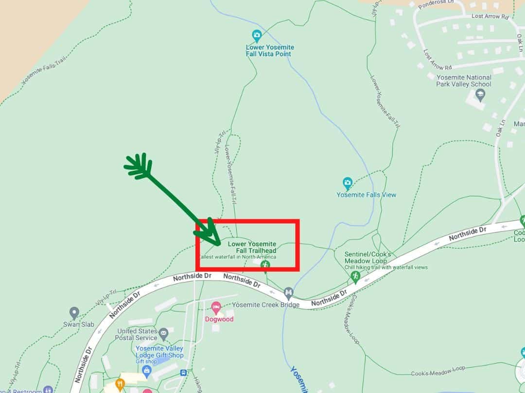
Easy Hikes in Yosemite / Map of Lower Yosemite Falls Trail
- Distance: 1 mile (1.6 km) loop
- Time: 30 minutes – 1 hour
- Elevation Change: 50 feet
- Trailhead: Lower Yosemite Falls Trailhead (shuttle stop #6)
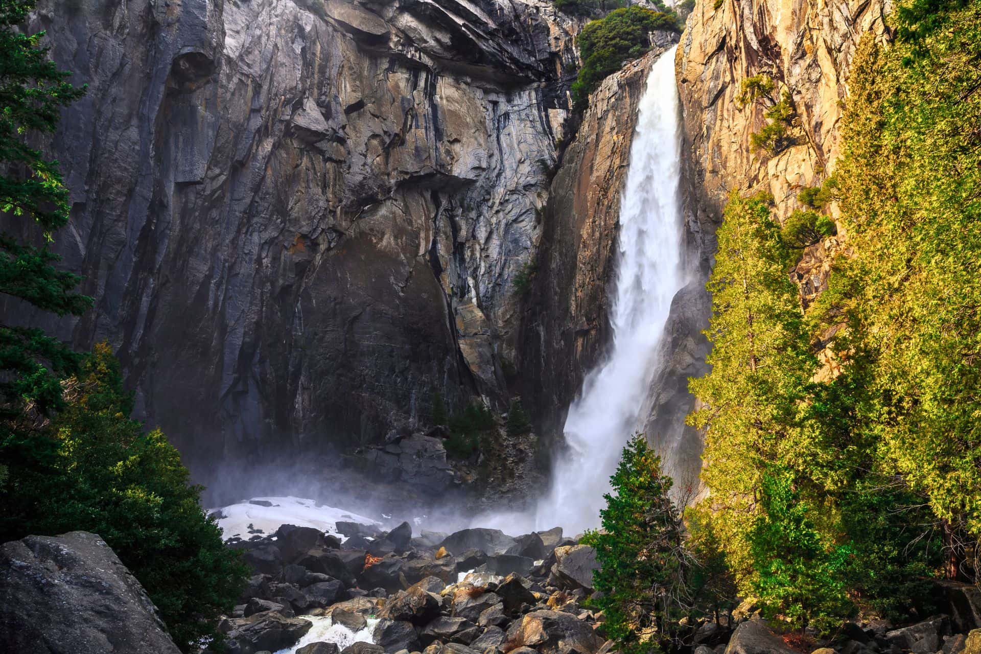
This iconic trail is perfect for a leisurely stroll, offering breathtaking views of the towering Lower Yosemite Falls. The paved pathway meanders through a lush forest, leading to a viewpoint where you can feel the mist from the falls on your face.
The trail is especially spectacular in spring when the snowmelt swells the falls to their fullest.
Lower Yosemite Falls is one of the tallest waterfalls in North America, with a total drop of 320 feet. The falls are fed by Yosemite Creek and flow year-round.
GOOD TO KNOW: Arrive early to avoid crowds, as this trail can get busy during peak hours.
PRO TIP: For a unique experience, visit the falls at sunset when the golden hues cast a warm glow on the cascades.
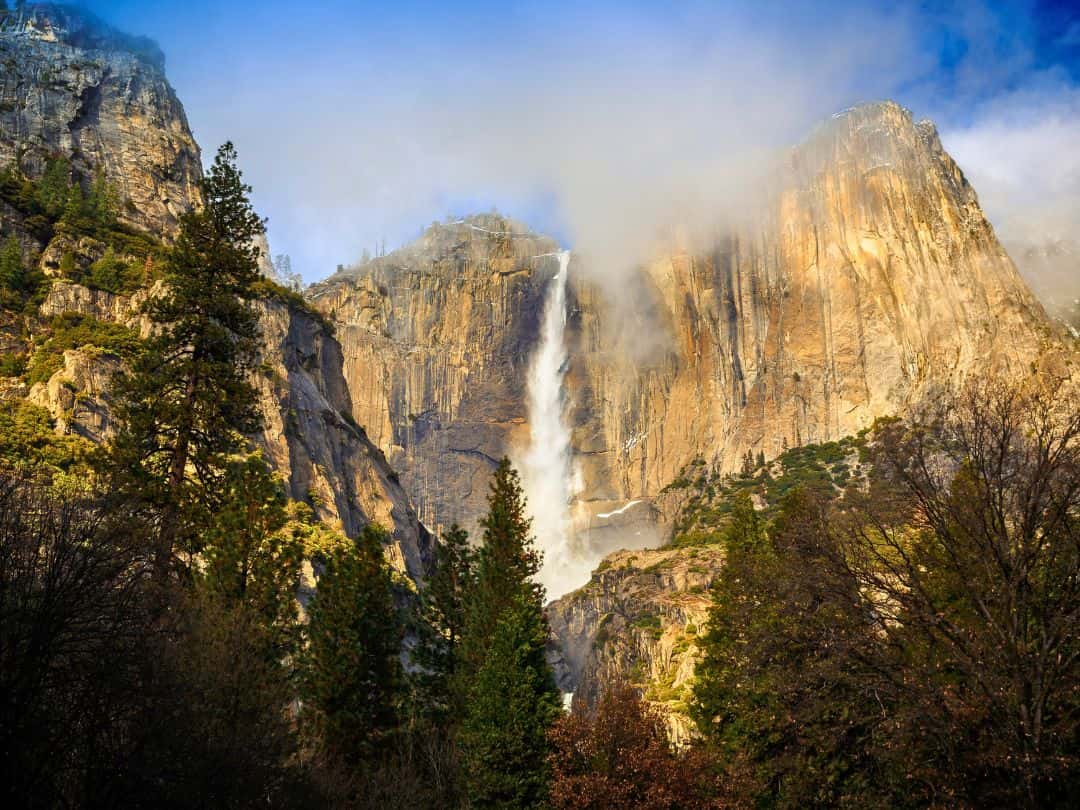
Easy Hikes in Yosemite / Lower Yosemite Falls
Easy Hikes in Yosemite / Lower Yosemite Falls
Cook's Meadow Loop Trail
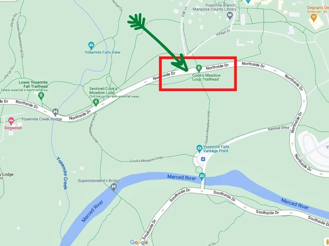
Easy Hikes in Yosemite / Map of Cook’s Meadow Loop Trail
- Distance: 1 mile (1.6 km) loop
- Time: 30 minutes – 1 hour
- Elevation Change: None
- Trailhead: Lower Yosemite Falls Trailhead (shuttle stop #6)
This easy loop trail offers a leisurely walk through Cook’s Meadow, with stunning views of Yosemite Falls, Sentinel Rock, and Half Dome in the background. It is a particularly scenic spot for photography, especially during sunrise or sunset.
GOOD TO KNOW: Cook’s Meadow was named after James Mason Hutchings’ photographer, George Fiske Cook. It is a prime location to capture the changing colors of the landscape as the sun moves across the sky.
PRO TIP: Bring binoculars to catch a glimpse of Yosemite’s diverse birdlife, including Steller’s jays and black-headed grosbeaks.
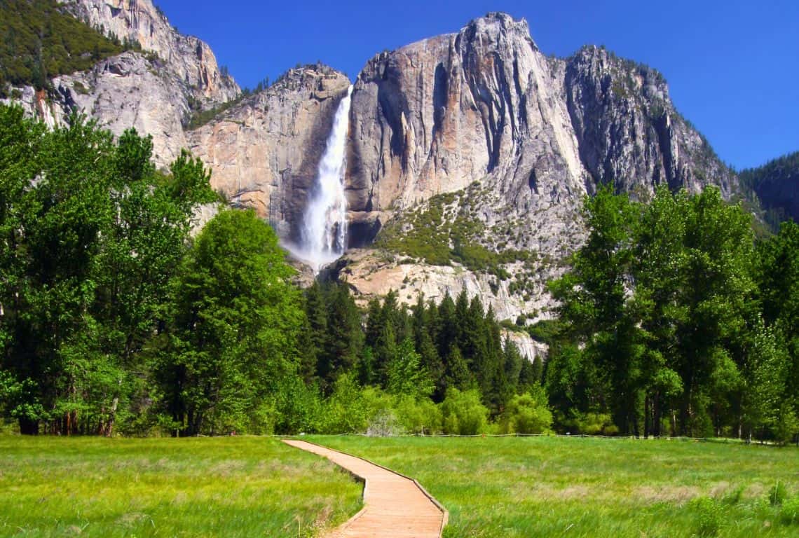
Easy Hikes in Yosemite / View of Lower Yosemite Falls from Cook’s Meadow Loop Trail
Mirror Lake Loop Trail
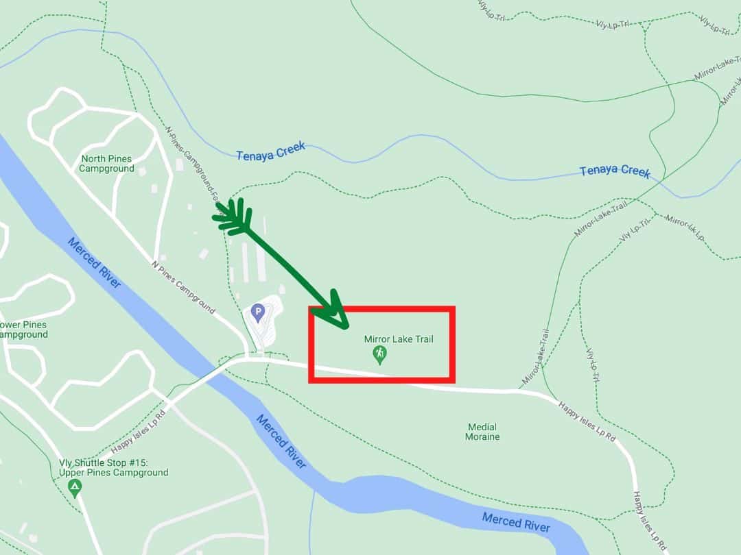
Easy Hikes in Yosemite / Map of Mirror Lake Loop Trail
- Distance: 2 miles (3.2 km) loop
- Time: 1 – 2 hours
- Elevation Change: 100 feet
- Trailhead: Mirror Lake Trailhead (shuttle stop #17)
This tranquil loop trail takes you to the shores of Mirror Lake, a seasonal body of water that offers stunning reflections of the surrounding granite cliffs. During the summer, the water can be low, creating a mirror-like surface perfect for capturing photos.
GOOD TO KNOW: Mirror Lake is not a year-round lake; it is more like a large pond that forms in the spring and early summer due to the melting snow.
PRO TIPS: The trail can get busy, so consider visiting early in the morning for a more peaceful experience. Pack a picnic and enjoy the serene beauty of the lake and its surroundings.
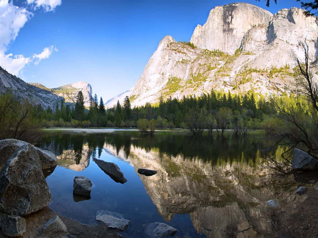
Easy Hikes in Yosemite / Mirror Lake
Bridalveil Falls Trail
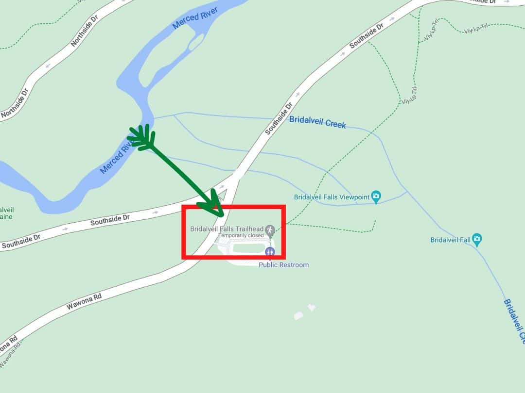
Easy Hikes in Yosemite / Map of Bridalveil Falls Trail
- Distance: 0.5 miles (0.8 km) round trip
- Time: 15 – 30 minutes
- Elevation Change: 80 feet
- Trailhead: Bridalveil Falls Parking Area (shuttle stop #2)
A short and sweet trail leads to the base of Bridalveil Falls, where you will feel the mist and hear the roar of the cascading water. The paved pathway offers stunning views of the waterfall framed by towering granite cliffs.
GOOD TO KNOW: Bridalveil Falls got its name due to the way the water droplets resemble a bridal veil blowing in the wind.
PRO TIP: Wear a rain jacket to stay dry from the waterfall’s mist.
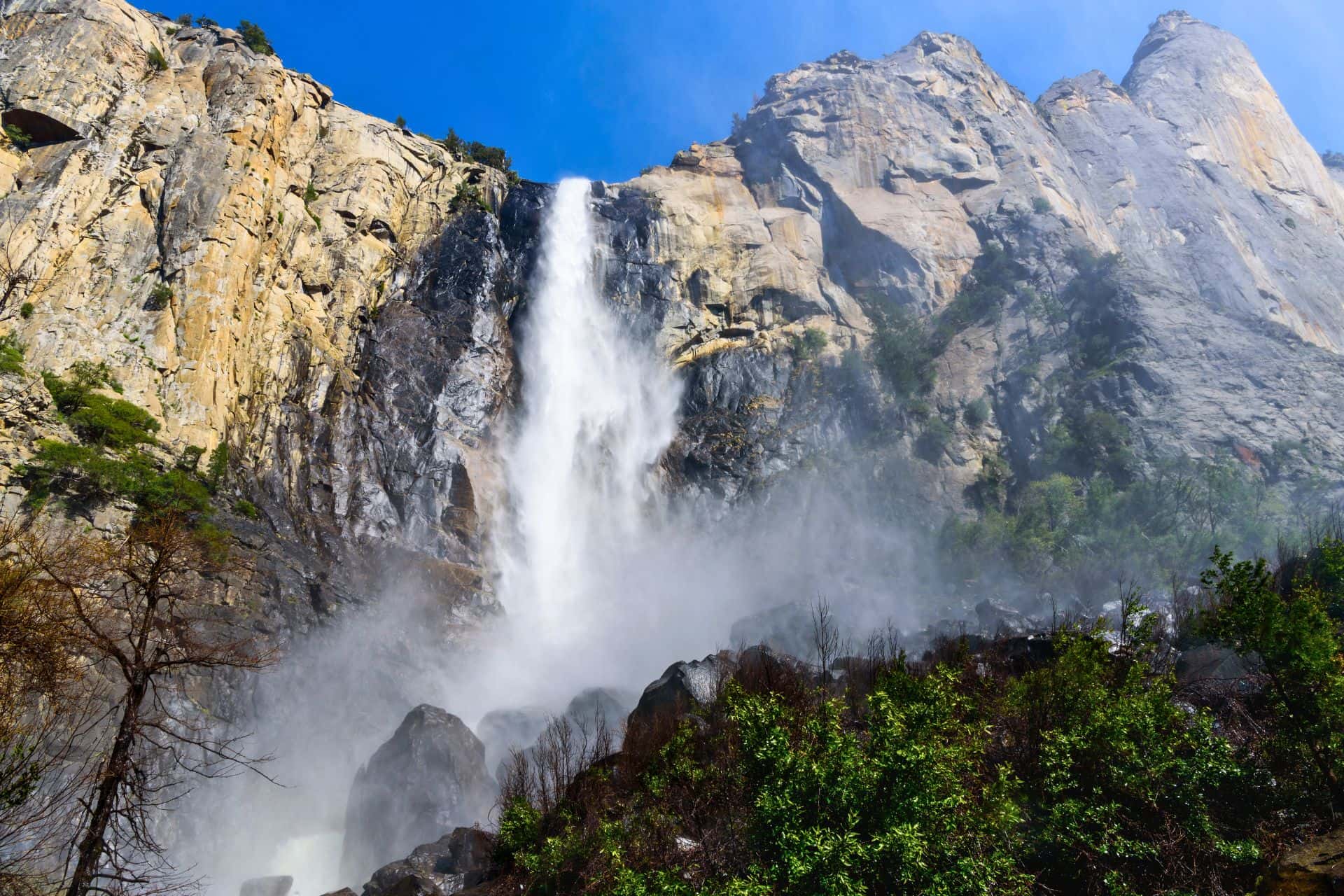
Easy Hikes in Yosemite / Bridalveil Falls
Mist Trail to Vernal Falls Footbridge
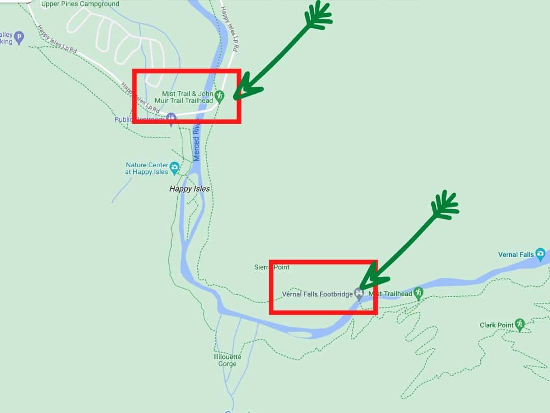
Easy Hikes in Yosemite / Map of Mist Trail to Vernal Falls Footbridge
- Distance: 1.5 miles round trip
- Time: 1 – 1.5 hours
- Elevation Change: Approximately 400 feet
- Trailhead: Mist Trailhead
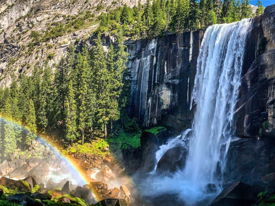
The Mist Trail offers a chance to experience the power and beauty of Vernal Fall up close. This trail will lead you through lush forested sections and take you to a bridge where you can feel the spray from the waterfall.
GOOD TO KNOW: Vernal Fall is named for the mist that surrounds it, creating an ethereal and enchanting spectacle for all who venture here. This trail is particularly popular during spring and early summer when the snowmelt feeds the waterfall, resulting in an impressive cascade.
PRO TIP: The trail’s incline can be moderate at times. Also, be prepared for some slippery sections due to the mist.
Easy Hikes in Yosemite / Vernal Falls
Easy Hikes on Scenic Tioga Road
Tuolumne Grove Trail
Easy Hikes in Yosemite / Map of Tuolumne Grove Trail
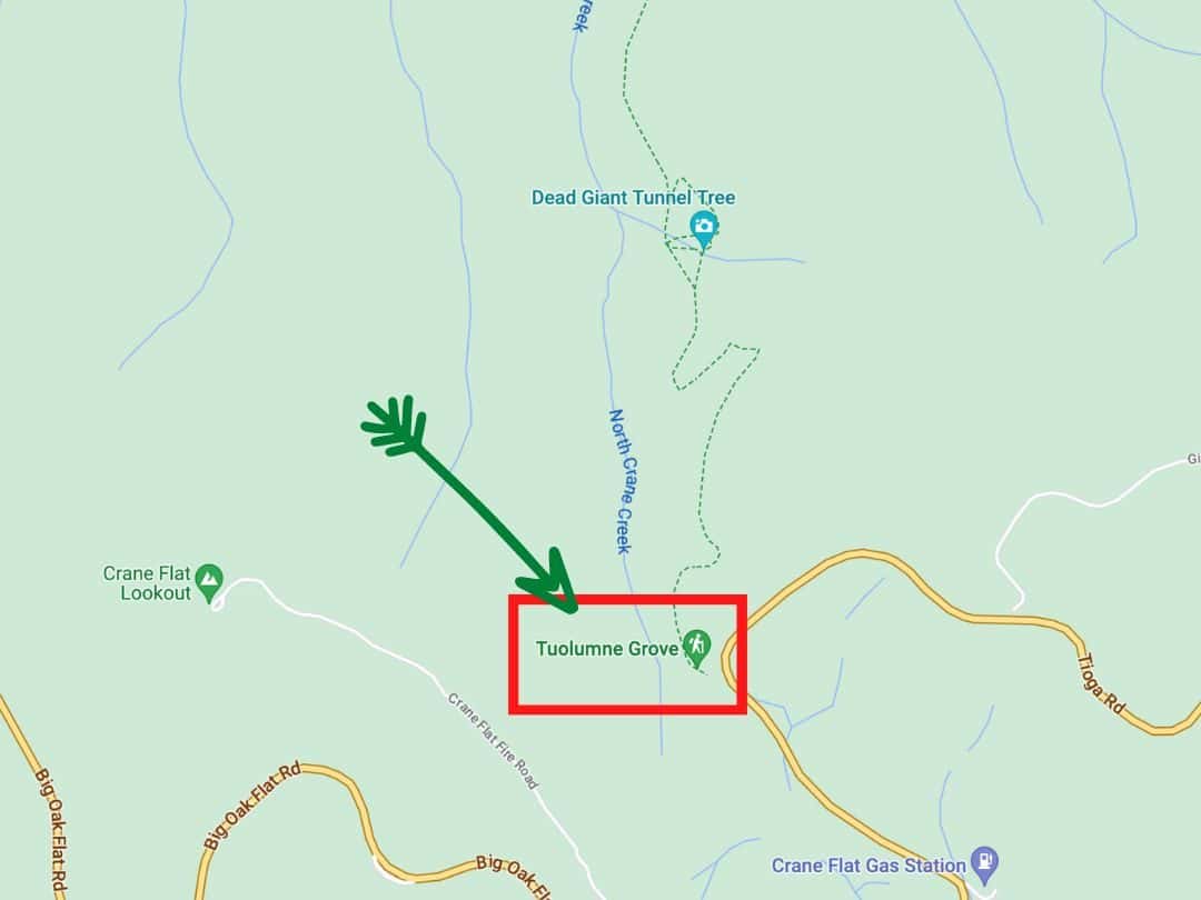
- Distance: 2.5 miles round trip
- Time: 1.5 – 2 hours
- Elevation Change: Approximately 500 feet
- Trailhead: Tuolumne Grove Trailhead
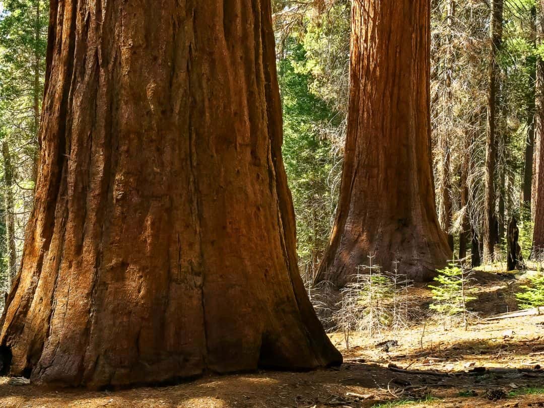
The Tuolumne Grove Trail will lead you into the heart of a majestic sequoia forest, where trees that have stood for centuries inspire a sense of awe. The trail takes you downhill through a shaded forest, leading you to the impressive base of a giant sequoia known as the Dead Giant.
GOOD TO KNOW: The Tuolumne Grove is home to several giant sequoias, each with its own story to tell. The Dead Giant, named so due to a fire that affected it, highlights the natural cycles of life and decay within the forest ecosystem.
PRO TIP: While the hike down to the grove is enjoyable, remember that the return hike is uphill, so pace yourself accordingly.
Easy Hikes in Yosemite / Giant Sequoias on Tuolumne Grove Trail
Tenaya Lake Loop Trail
Easy Hikes in Yosemite / Map of Tenaya Lake Loop Trail
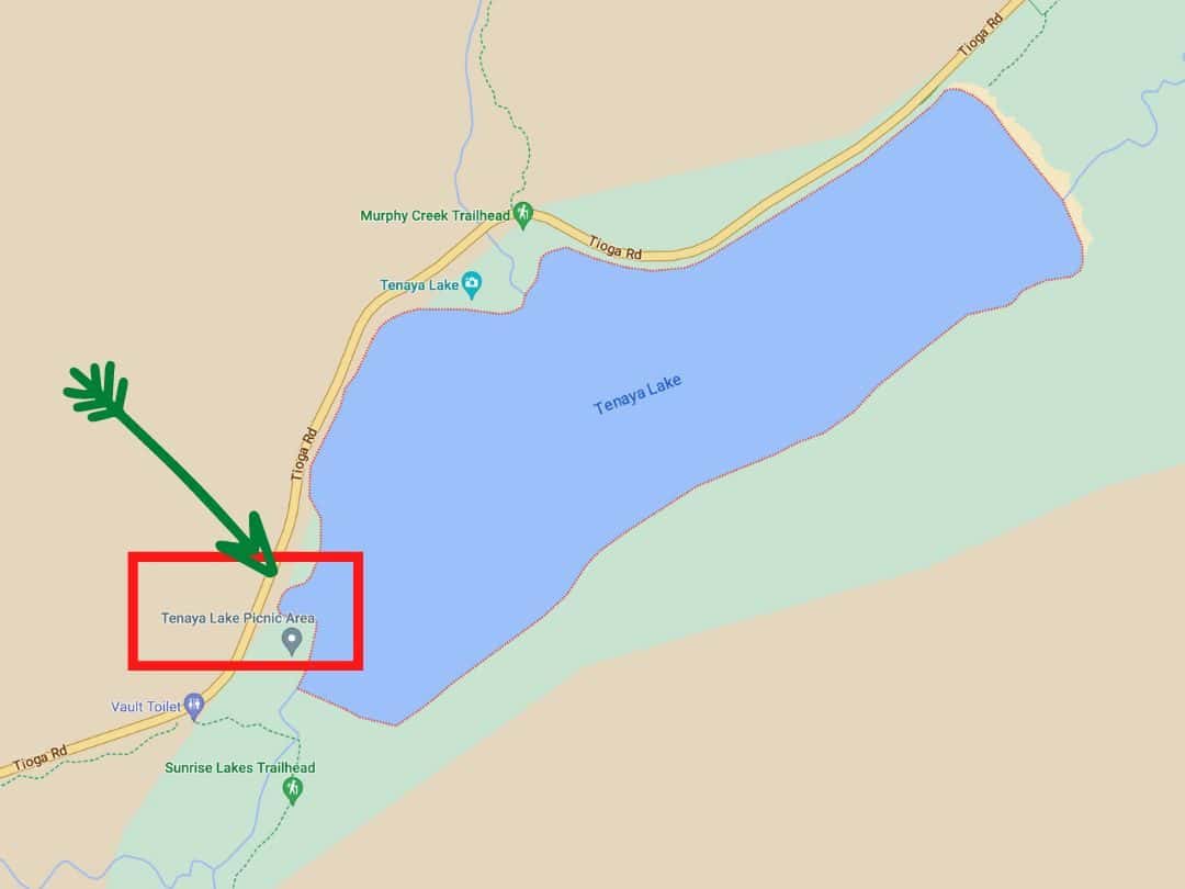
- Distance: 2.5 miles loop
- Time: 1 – 1.5 hours
- Elevation Change: Minimal
- Trailhead: Tenaya Lake Parking Area (off Tioga Road)
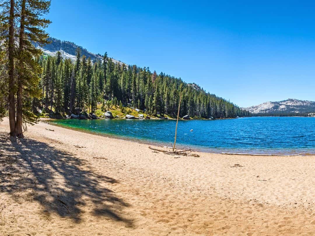
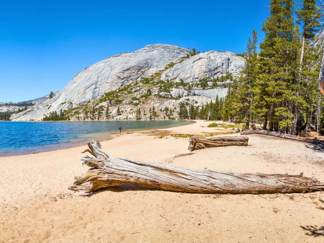
The Tenaya Lake Loop Trail will lead you around the pristine shores of Tenaya Lake, where the crystal-clear waters reflect the surrounding granite peaks and lush forests.
If you decide to do the full loop then you will need to cross the lake’s inlet and outlet which are pretty easy to do in the summer, but it might involve getting your feet wet in the earlier part of the summer.
GOOD TO KNOW: Tenaya Lake is named after Chief Tenaya, the leader of the Ahwahneechee people who once inhabited the Yosemite Valley. This natural lake was formed by glacial action, leaving behind the stunning landscape you see today.
PRO TIP: Pack a picnic and spend some time by the lake’s shores after your hike. The scenic surroundings create the perfect backdrop for a leisurely meal.
Easy Hikes in Yosemite / Tenaya Lake
Easy Hikes in Yosemite / Tenaya Lake
Lukens Lake Trail
Easy Hikes in Yosemite / Map of Luken Lake Trail
- Distance: 2.8 miles round trip
- Time: 1.5 – 2 hours
- Elevation Change: Approximately 300 feet
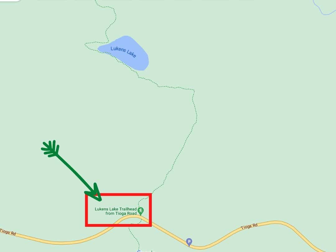
- Trailhead: Lukens Lake Trailhead (off Tioga Road)
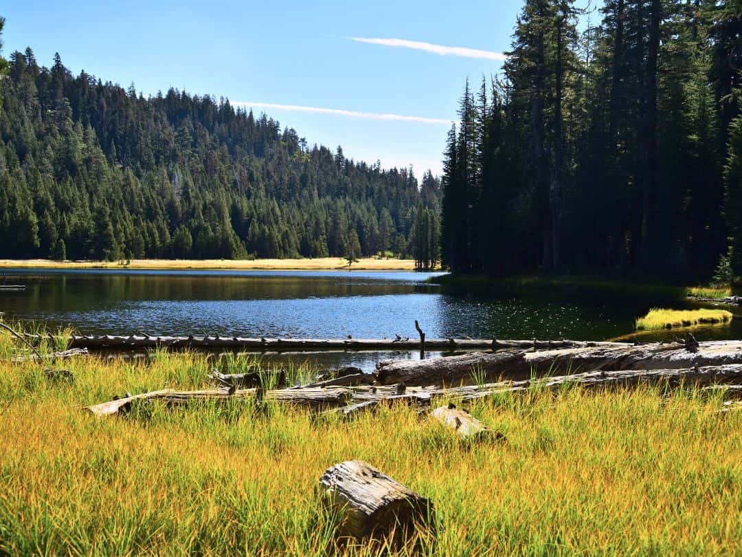
The Lukens Lake Trail will take you through pine-scented forests and open meadows to the peaceful shores of Lukens Lake. The mirrored waters of the lake reflect beautiful forests, creating a serene vista that feels like a hidden gem within Yosemite’s grandeur.
GOOD TO KNOW: Lukens Lake was named after Albert Lukens, a pioneer who helped construct the Big Oak Flat Road in the 1870s.
PRO TIP: Pack a blanket and some light snacks to enjoy a lakeside picnic, surrounded by the serene ambiance of Lukens Lake.
Easy Hikes in Yosemite / Lukens Lake
Soda Springs and Parsons Memorial Lodge Trail
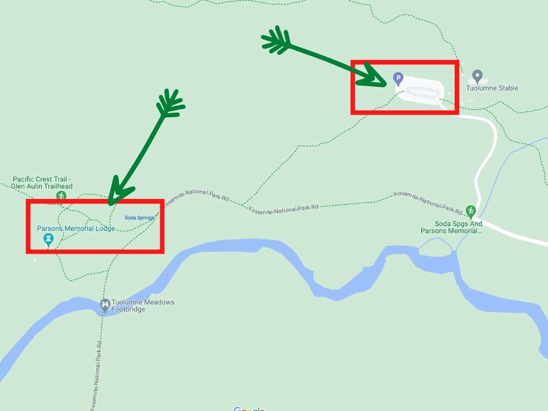
Easy Hikes in Yosemite / Map of Soda Springs and Parsons Memorial Lodge Trail
- Distance: 1.5 miles round trip
- Time: 1 – 1.5 hours
- Elevation Change: Minimal
- Trailhead: Lembert Dome Parking Area (off Tioga Road)
The Soda Springs and Parsons Memorial Lodge Trail take to Soda Springs. This natural attraction has drawn visitors for decades with its carbonated water. The trail culminates at the Parsons Memorial Lodge, an early 20th-century stone structure that provides insight into Yosemite’s past.
GOOD TO KNOW: Soda Springs is a carbonated spring, which means it contains naturally occurring carbon dioxide gas dissolved in the water, resulting in effervescence similar to carbonated beverages. Parsons Memorial Lodge was constructed in the early 20th century, and completed in 1915. It was built in memory of Edward Taylor Parsons, a nature enthusiast and conservationist who played a role in the early efforts to protect and preserve Yosemite.
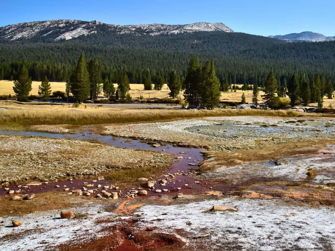
Easy Hikes in Yosemite / Soda Springs
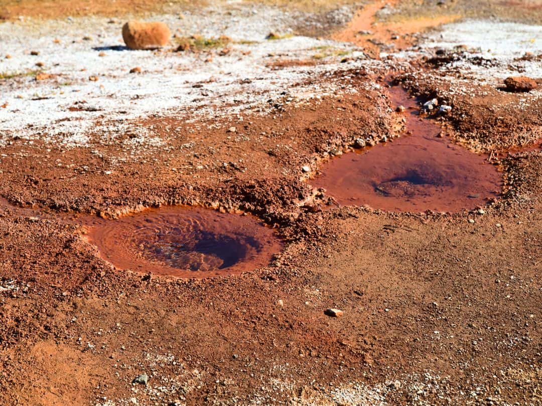
Easy Hikes in Yosemite / Soda Springs
Olmsted Point Trail
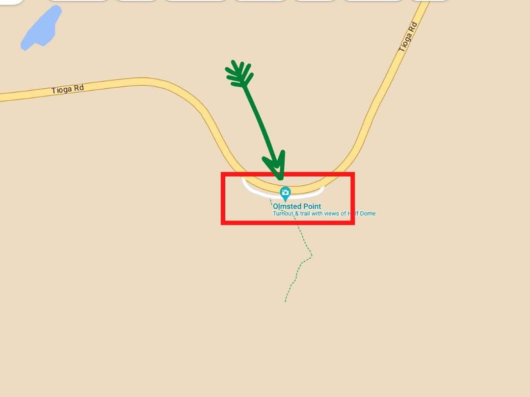
Easy Hikes in Yosemite / Map of Olmsted Point Trail
- Distance: Short walk from the parking area
- Time: 30 minutes to an hour
- Elevation Change: Minimal
- Trailhead: Olmsted Point Parking Area (off Tioga Road)
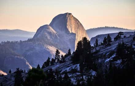
The Olmsted Point Trail doesn’t require a long hike – just a short walk from the parking area. Yet, the rewards are immense. As you stand atop the granite expanse, you will be treated to panoramic views that encompass the iconic Half Dome, the rugged terrain of Tenaya Canyon, and the expansive Sierra Nevada wilderness.
GOOD TO KNOW: Olmsted Point is named after Frederick Law Olmsted, a landscape architect who played a crucial role in the early development of Yosemite National Park.
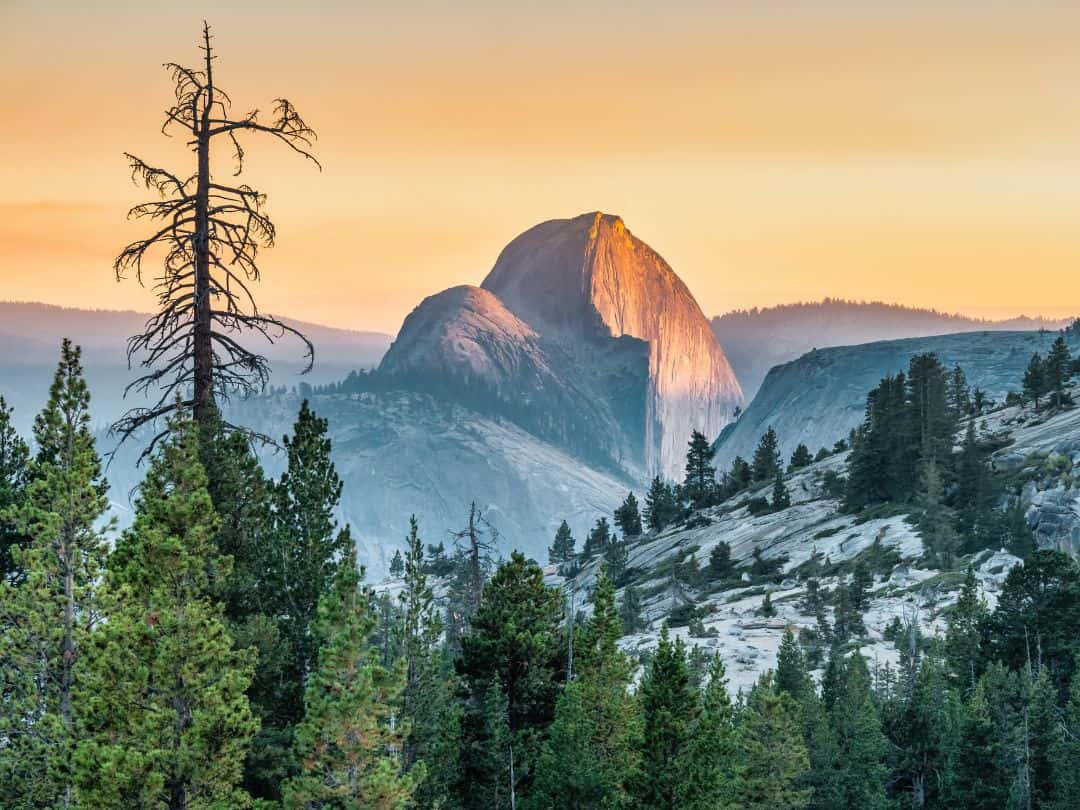
Easy Hikes in Yosemite / View from Olmsted Pont at Sunset
Tuolumne Meadows Trail
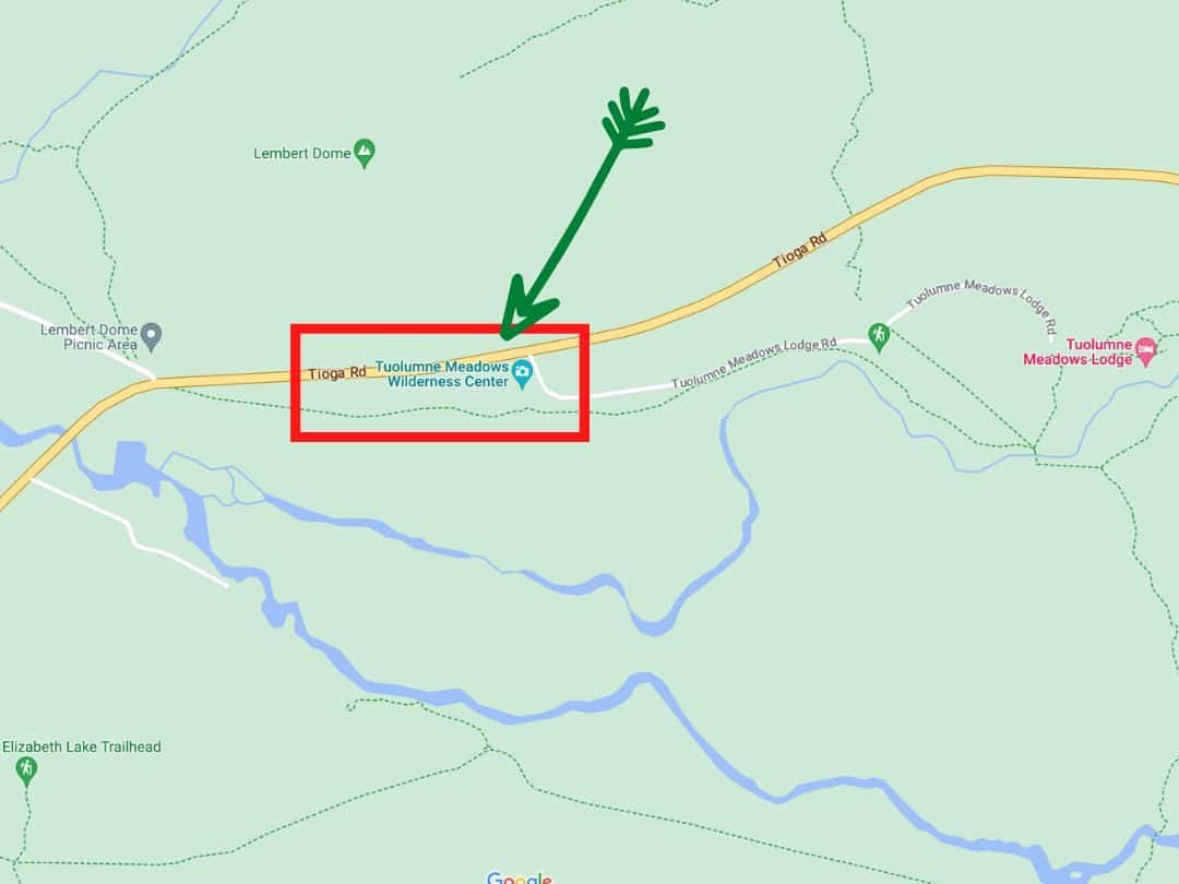
Easy Hikes in Yosemite / Map of Tuolumne Meadows Trail
- Distance: Approximately 2 miles (or however much wondering you want to do)
- Time: 30 min – 1 hour
- Elevation Change: Minimal
- Trailhead: Tuolumne Meadows Wilderness Center
The Tuolumne Meadows Trail leads you through the heart of one of Yosemite’s most iconic landscapes. As you walk, you’ll be surrounded by sprawling meadows, vibrant wildflowers, and the gentle flow of the Tuolumne River.
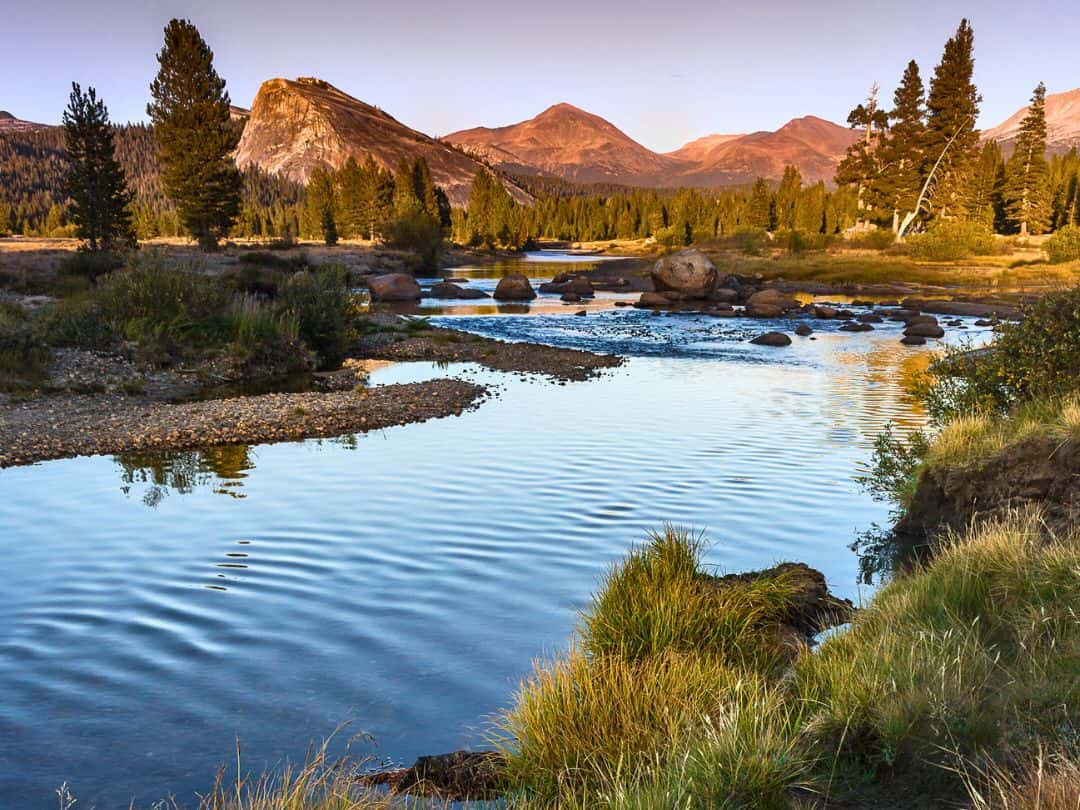
Easy Hikes in Yosemite / Tuolumne Meadows
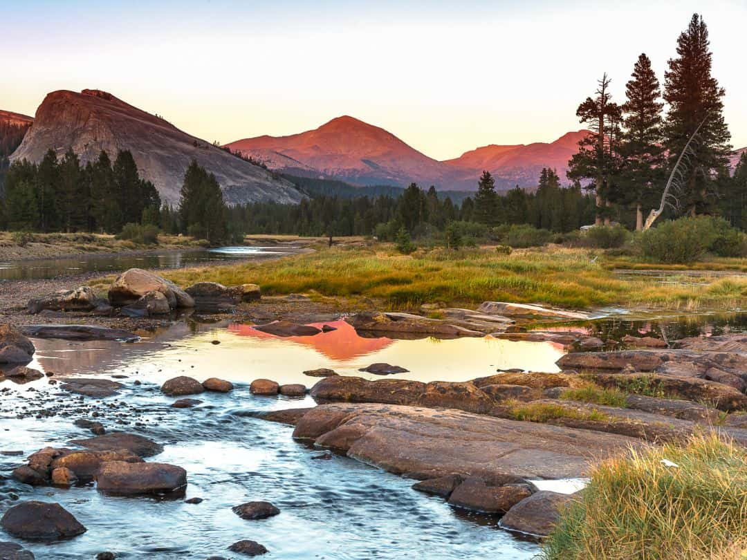
Easy Hikes in Yosemite / Tuolumne Meadows at Sunset
Easy Hikes in Glacier Point Area
Glacier Point Trail
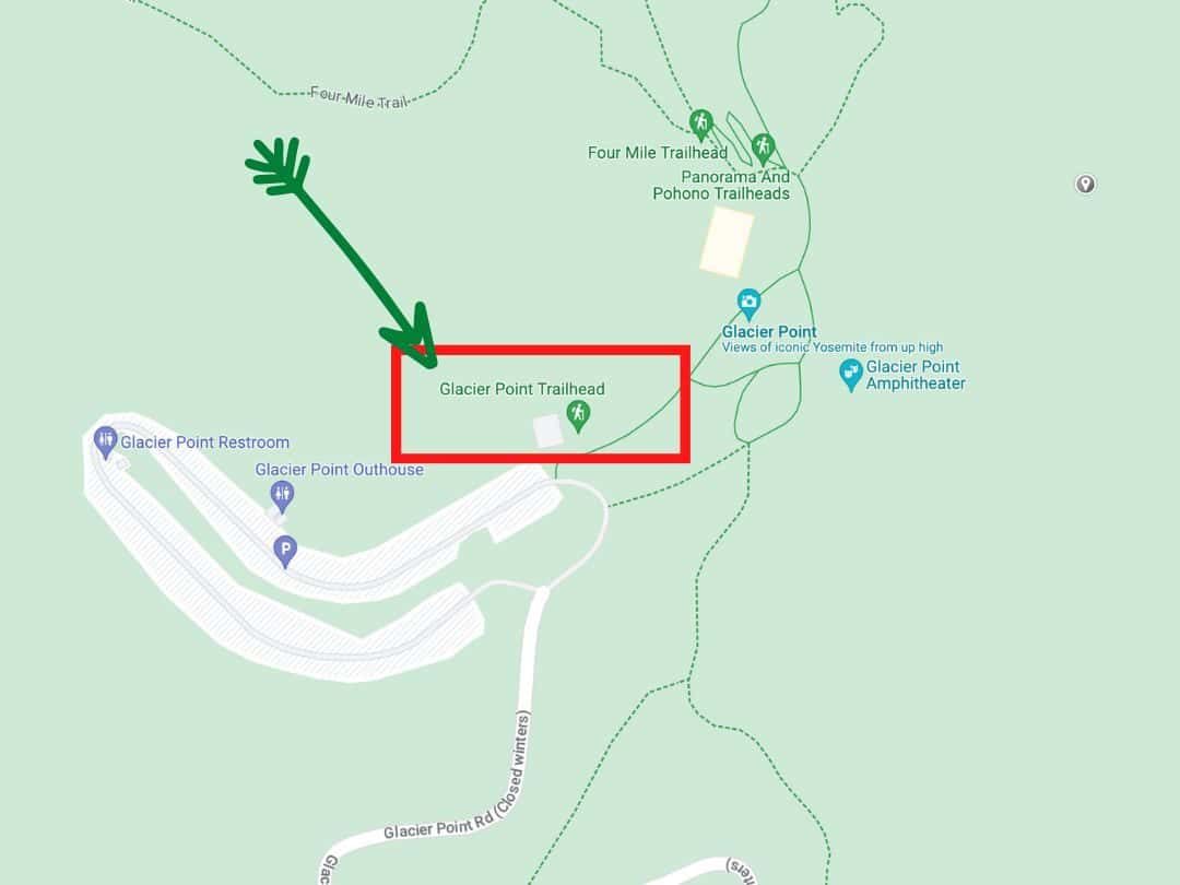
Easy Hikes in Yosemite / Map of Glacier Point Trail
- Distance: 300 Yards
- Time: 5 minutes
- Elevation Change: None
- Trailhead: Glacier Point Parking Area
Start at the Glacier Point parking area and enjoy a leisurely wheelchair-accessible stroll to the Glacier Point railing, where you look down on Yosemite Valley (3,200 below!) and east toward Half Dome and the High Sierra.
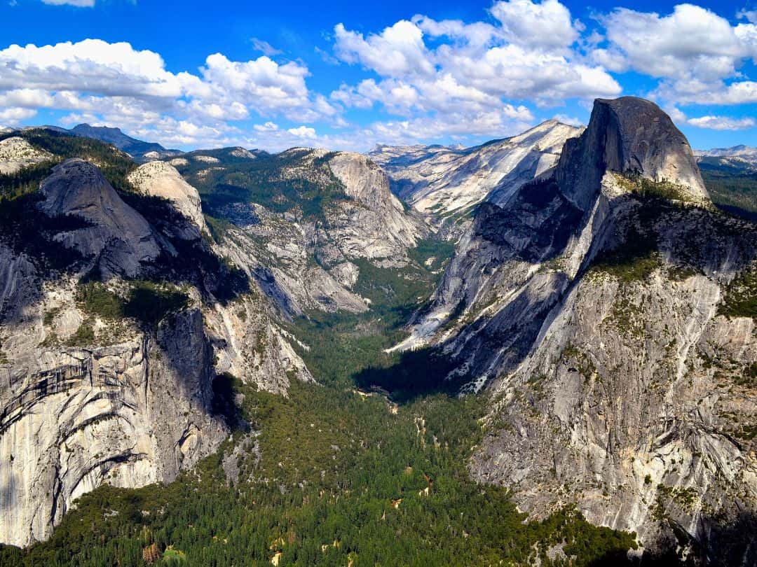
Easy Hikes in Yosemite / View from Glacier Point
Sentinel Dome Trail
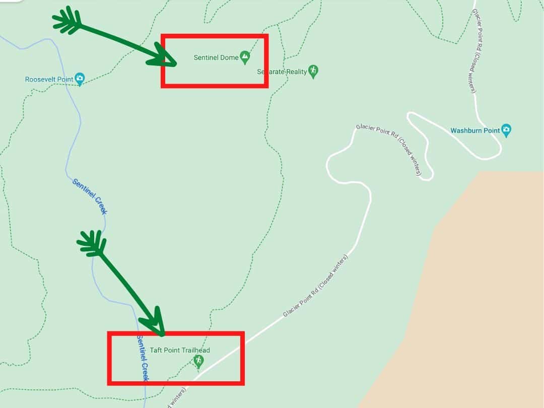
Easy Hikes in Yosemite / Map of Sentinel Dome Trail
- Distance: Approximately 2.2 miles (3.5 km) round trip
- Time: 1.5 – 2 hours
- Elevation Change: Minimal
- Trailhead: Sentinel Dome Trailhead
The Sentinel Dome Trail gets you to a vantage point and lets you gaze upon the iconic granite peaks of El Capitan and Half Dome, while the verdant expanse of Yosemite Valley spreads out beneath you, seemingly endless. The dome’s elevation of over 8,100 feet elevates your perspective to new heights of appreciation.
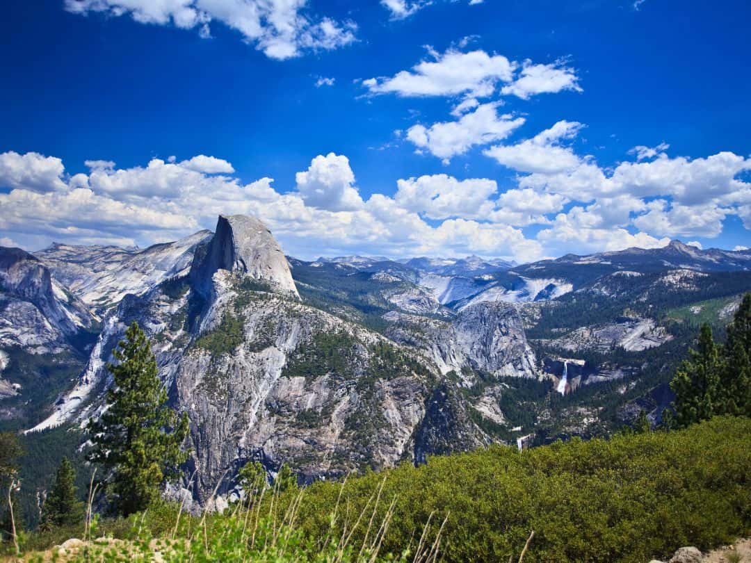
Easy Hikes in Yosemite / View from Sentinel Dome
Taft Point Trail
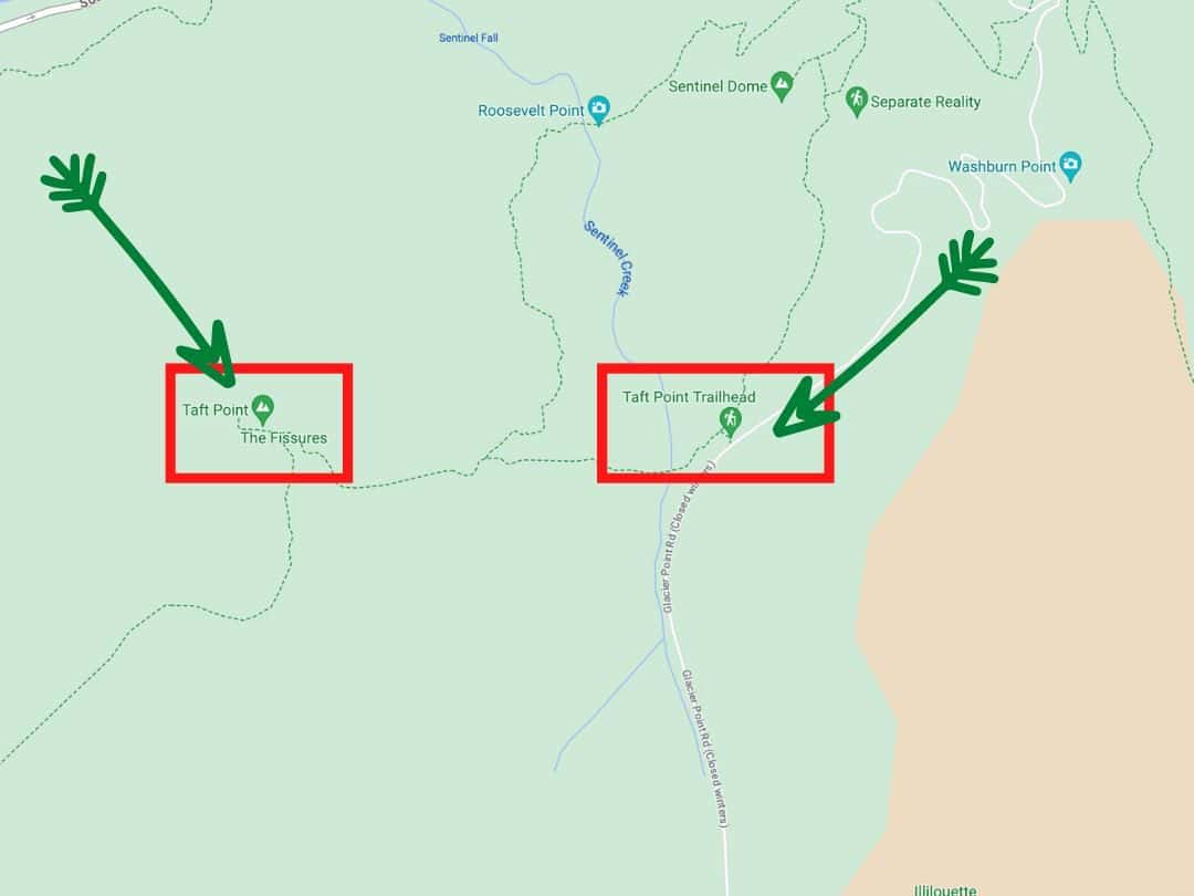
Easy Hikes in Yosemite / Map of Taft Point Trail
- Distance: Approximately 2.2 miles (3.5 km) round trip
- Time: 2 – 3 hours
- Elevation Change: Minimal
- Trailhead: Taft Point Trailhead
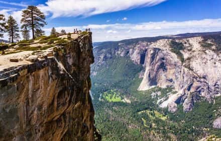
The Taft Point Trail begins with a gentle walk through a pine forest. Upon arriving at Taft Point, you will be standing on the edge of a vertigo-inducing precipice, gazing across the vastness of Yosemite Valley. The iconic El Capitan and the cascading Bridalveil Fall create a dramatic backdrop, while the distant Half Dome stands as a testament to nature’s artistry.
GOOD TO KNOW: The point itself has sheer drop-offs. Exercise caution, especially if you are bringing children or are uneasy with heights.
PRO TIP: Bring a pair of binoculars to marvel at the rock climbers on El Capitan’s vertical face, and remember that the sunset views are nothing short of breathtaking.
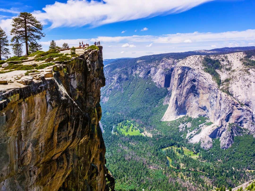
Easy Hikes in Yosemite / Taft Point and the View of Yosemite Valley
Easy Hikes Along Wawona Road
Mariposa Grove Big Trees Loop Trail
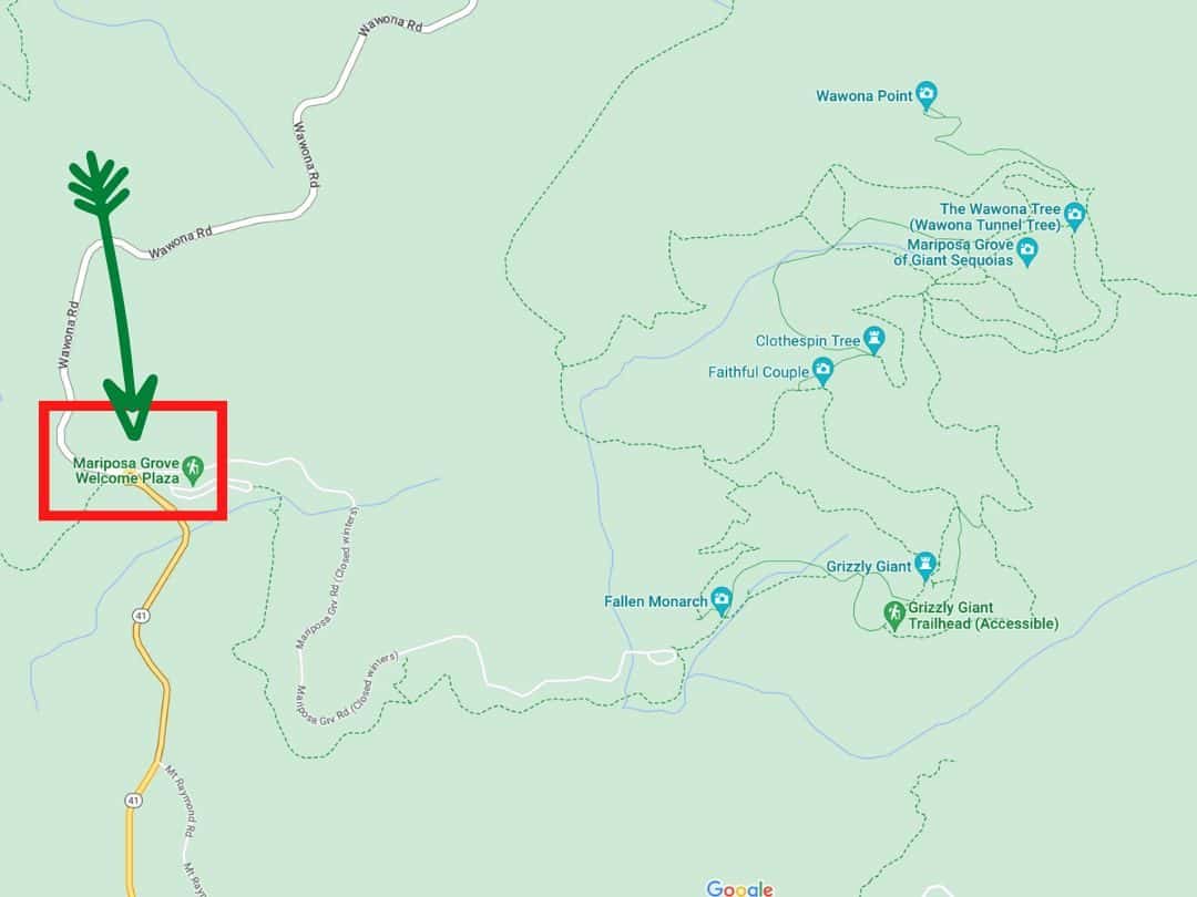
Easy Hikes in Yosemite / Map of Mariposa Grove Trails
- Distance: Approximately 2.3 miles (3.7 km) loop
- Time: 1.5 – 2.5 hours
- Elevation Change: Minimal
- Trailhead: Mariposa Grove Arrival Area (off Wawona Road)
The Mariposa Grove Big Trees Loop Trail guides will introduce you to some of the largest living organisms on Earth – the giant sequoias. As you walk amidst these towering sentinels, you will be astounded by their immense size and the serene aura they emanate.
GOOD TO KNOW: Mariposa Grove is home to over 500 mature giant sequoias, making it one of the most significant groves in the park. Among these giants is the Grizzly Giant, estimated to be over 1,800 years old.
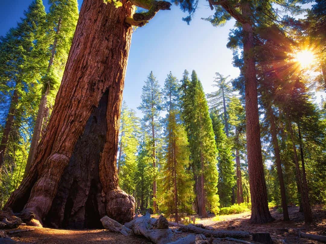
Easy Hikes in Yosemite / Mariposa Grove (Grizzy Giant)
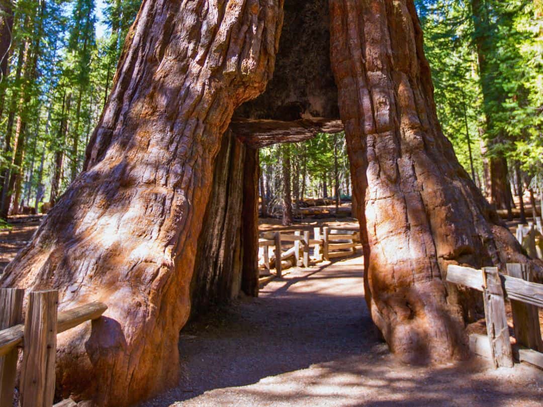
Easy Hikes in Yosemite / Mariposa Grove (Tunnel Tree)
Wawona Meadow Loop Trail
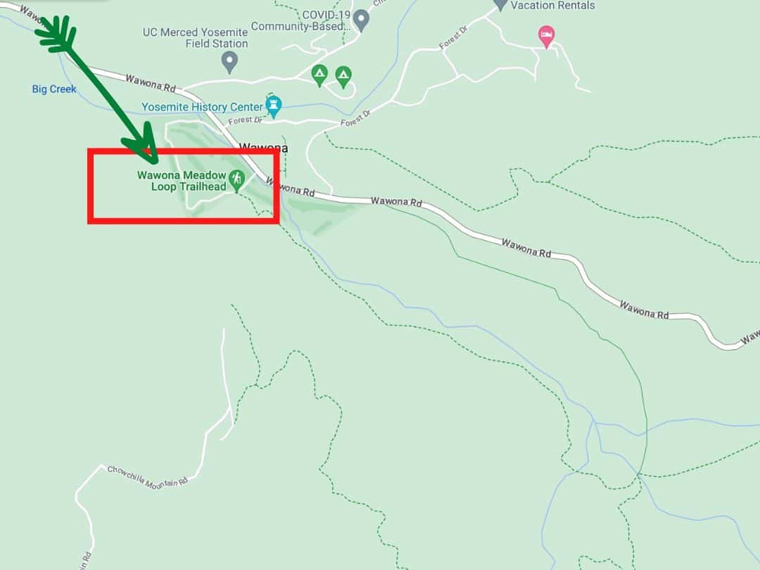
Easy Hikes in Yosemite / Map of Wawona Meadow Loop Trail
- Distance: Approximately 3.5 miles (5.6 km) loop
- Time: 1.5 – 2 hours
- Elevation Change: Minimal
- Trailhead: Wawona Meadow Loop Trailhead
Description: The Wawona Meadow Loop Trail meanders through the open meadows of Wawona, treating you to sweeping vistas of the surrounding landscape. As you walk, you’ll be captivated by the gentle rhythm of nature, the song of birds, and the breathtaking backdrop of the Sierra Nevada mountains.
Good to Know: With its flat terrain and pleasant length, this trail is perfect for families, casual walkers, and those seeking a peaceful connection with nature. Bring along a pair of binoculars to enhance your birdwatching experience.
Pro Tip: Enjoy a leisurely picnic amidst the meadows or near the serene Mariposa Grove of Giant Sequoias. Capture the changing colors of the meadow and the play of light on the Sierra Nevada peaks with your camera.
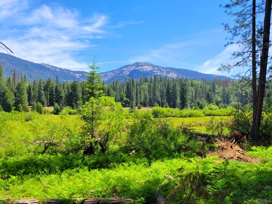
Easy Hikes in Yosemite / Wawona Meadow
Easy Hikes in Hetch Hetchy Area
Wapama Falls Trail
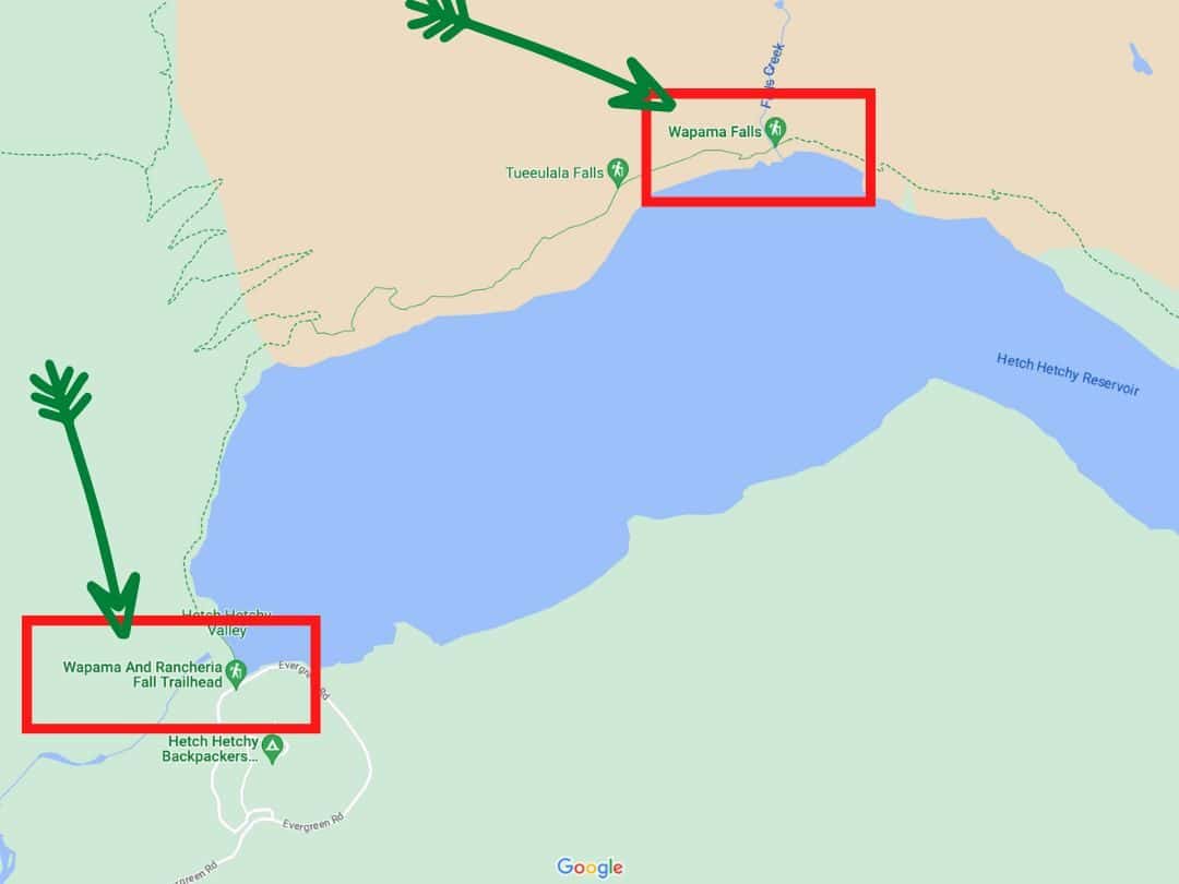
Easy Hikes in Yosemite / Map of Wapama Falls Trail
- Distance: Approximately 5 miles round trip
- Time: 3 – 4 hours
- Elevation Change: Minimal
- Trailhead: O’Shaughnessy Dam Area
The Wapama Falls Trail will take you on a journey alongside the striking Hetch Hetchy Reservoir. As you progress, a series of sturdy footbridges will lead you right to the foot of the mighty Wapama Falls.
With a cumulative drop of over 1,000 feet, the falls present an awe-inspiring spectacle as the Merced River crashes down the granite cliffs.
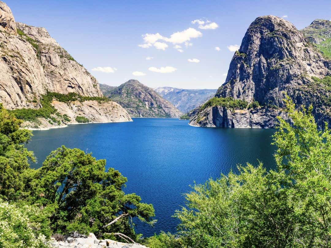
Easy Hikes in Yosemite / Hetch Hetchy Reservoir
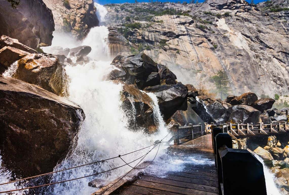
Easy Hikes in Yosemite / Wapama Falls
You Might Also Like:
5 Towns Near Yosemite (with Best Places to Stay and Eat)
9 Spectacular Yosemite Sunset Spots (No Hiking Needed)
5 Amazing Scenic Drives in Yosemite (with Best Stops+Maps)
15 Best Stops on Tioga Road: Yosemite’s Scenic Highway (Useful Tips and Map)
Explore 9 Majestic National Parks in California (Tips+Top Experiences)
What Is California Known For: 29 Things That Make California Famous and Unique
Did You Find This Useful?
Why Not Save Easy Hikes in Yosemite to Your Pinterest Board!
Now, It Is Your Turn, I Would Like to Hear Back from You!
Are you planning a trip to Yosemite?
Please let me know! Drop me a quick comment right below!
Click on any of the images below to get inspired and to help you with the planning process for your trip to Yosemite!
