This site uses affiliate links, meaning that if you make a purchase through our links, we may earn an affiliate commission.
Grand Teton National Park is a hiker’s paradise. Here are 11 easy hikes in Grand Teton National Park where you are guaranteed to see wildlife and breathtaking scenery.
These hikes boast gentle terrain, ensuring minimal elevation changes, with no steep hills or inclines. Tailored for the whole family, these trails, while some may be longer, can easily be adjusted to accommodate everyone’s enjoyment.
There are other things to do besides hiking in Grand Teton. For a break from the hiking trails, make sure to put Grand Teton Scenic Drive on your Grand Teton itinerary. This scenic drive will take you to some of the best viewpoints in Grand Teton National Park.
- 1. Grand Teton National Park At-A-Glance
- 2. Essential Hiking Gear for Grand Teton National Park
- 3. 11 Fun and Easy Hikes in Grand Teton National Park
-
- 3.1. Jenny Lake Loop Trail
- 3.2. Hidden Falls and Inspiration Point Trail
- 3.3. Phelps Lake Overlook Trail
- 3.4. String Lake Loop Trail
- 3.5. Beaver Creek and Taggart Lake Loop Trail
- 3.6. String Lake and Leigh Lake Trail
- 3.7. Phelps Lake Loop Trail
- 3.8. Jackson Lake Lakeshore Trail
- 3.9. Hermitage Point Trail
- 3.10. Two Ocean Lake Loop Trail
- 3.11. Schwabacher Landing Trail
- 4. Intrepid Scout's Tips for Easy Hikes in Grand Teton National Park
Grand Teton National Park At-A-Glance
Before diving in, here are a few highlights to help you plan your trip:
- Best Time to Visit Grand Teton National Park
Hands down, summer is the best (and most popular) time to visit Grand Teton National Park. The weather is warm and all park facilities are open. However, my favorite time to visit is early to mid-September. The weather can be awesome in the fall and it is a great time to avoid the crowds and find some solitude on the trails.
- Where to Stay In or Near Grand Teton
Nothing beats staying inside the park! There are several great lodges inside the park. However, you need to make reservations well in advance. If all the lodges are booked, then there are a few places that I stayed at, and I highly recommend them. In addition, there are great campsites inside the park as well. To sum up, before you make any reservations, make sure to check out my post Where to Stay in Grand Teton: 7 Amazing Places to Stay.
- How to Get to Grand Teton National Park
Grand Teton National Park is located in northwestern Wyoming and the closest airports to Grand Teton National Park are Jackson Hole Airport (JAC) – 8 min, Idaho Falls Regional Airport (IDA) – 2 hours, and 11 min, Salt Lake City International Airport (SLC) – 5 hours. Now, Salt Lake City International Airport is a major airport and all major airlines fly into this area from large cities all over the U.S. and internationally. Use Skyscanner to browse flights and find the best price.
- How to Get Around in Grand Teton National Park
There is no shuttle service in the park and the best way to get around is by having your car. I use dicovercars.com to browse deals on rental cars or rent an RV or campervan with Outdoorsy!
- Intrepid Scout’s Tip:
It costs $30 to enter the park. The entrance pass is good for 7 consecutive days. If you are visiting several national parks then make sure to get America the Beautiful National Park Pass. This $80 pass is valid for 12 months and gets you into all 400+ national park sites!
Essential Hiking Gear for Grand Teton National Park
- Footwear: Opt for sturdy hiking boots or trail shoes for solid traction. Don’t forget to break them in before your trip, and consider using merino wool socks for dry and blister-free feet.
- Hydration: Stay well-hydrated with a reliable water bottle; I recommend the Yeti Rumbler 26 oz insulated, stainless steel bottle for its efficiency.
- Nutrition: Keep your energy up with snacks like RXBAR. Their high-protein, gluten-free bars are both nutritious and delicious.
- Weather Preparedness: Dress in layers to adjust to changing weather, and avoid cotton. Consider essentials like the North Face Women’s Osito Triclimate Jacket, Patagonia moisture-wicking hiking shirts, and warm fleece pullovers.
- Safety Kit: Pack a prepackaged first-aid kit, a versatile multi-purpose tool or knife, and insect repellent with 25 to 30% DEET concentration.
- Sun Protection: Shield yourself from the sun with sunscreen, a lightweight long-sleeve shirt, long pants, sunglasses with UV protection, and a wide-brimmed hat.
- Daypack: Choose a comfortable backpack with features like the Osprey Daylite Daypack, and ensure it has a rain cover.
- Photography Gear: Capture the breathtaking scenery with a camera like the Nikon COOLPIX P1000 Super Telephoto Camera, a spare battery, a tripod (Manfrotto Befree Live Carbon Fiber Tripod with Fluid Head), and binoculars for close-ups.
- Trail Cleanliness: Carry a trash bag or zip-lock bag to keep the trail beautiful, and consider investing in a bear spray for safety, readily available in Grand Teton National Park.
11 Fun and Easy Hikes in Grand Teton National Park
Jenny Lake Loop Trail
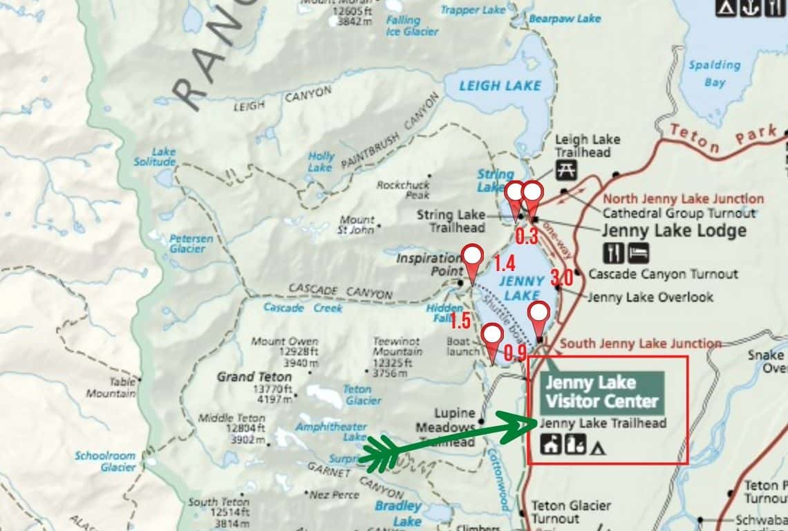
Map of Jenny Lake Loop Trail in Grand Teton National Park. Image Source: National Park Service / Easy Hikes in Grand Teton
- Roundtrip Distance: 7.1 miles
- Trail Location: Jenny Lake Trailhead
- Time: 3.5 hours
- Difficulty: Easy
Jenny Lake is the iconic spot in Grand Teton National Park and the Jenny Lake Loop Trail which goes around the perimeter of the lake is a classic hike that needs to be on your list.
The entire loop that goes around Jenny Lake is 7.1 miles, however, you do not need to hike all the way around, you can shorten this hike any way you like. What’s nice about this hike is that it is pretty much flat and it is perfect for all levels of hikers!
How to Get to Jenny Lake Loop Trail
Jenny Lake Loop Trail starts at Jenny Lake Trailhead. To reach the trailhead turn west off Teton Park Road at the South Jenny Lake Junction.
The South Jenny Lake Junction is located about 7.7 miles north of Moose Junction.
Once you get to the junction, proceed for no more than 0.5 miles until you reach a parking area. It is located next to Jenny Lake Visitor Center. From Jenny Lake Visitor Center follow the paved path leading to the East Boat Dock. Jenny Lake Trailhead starts at the East Boat Dock.
Moreover, my recommendation is to hike Jenny Lake Loop Trail in a counter-clockwise direction for the best views of the mountains. So, you will be going north, along the eastern shore of Jenny Lake.
What You Need to Know About Jenny Lake Loop Trail
Jenny Lake Loop Trail is a very popular hike, so, unfortunately, do not expect any solitude on this hike. So, my recommendation is to start the Jenny Lake Loop hike as early in the morning as possible to avoid crowds. Also, keep in mind that Jenny Lake Scenic Road passes close to the eastern shore of the lake, and traffic and noise will increase during the day.
Make sure to have your camera ready, because the scenery right from the start is pretty awesome! You will get to catch some spectacular views of Teewinot Mountain, Mount Owen, Cascade Canyon, and Mount Moran, just to name a few.
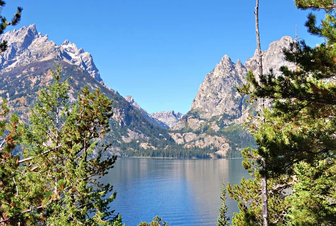
Jenny Lake in Grand Teton National Park
- Jenny Lake was named after Shoshone Indian woman, who married an Englishman, Richard ‘Beaver Dick’ Leigh.
- They married in 1863. Jenny was 16 years old at the time and came from Eastern Shoshone Chief Washakie’s band. The ceremony was performed by a minister, but with no existing records, the bride’s Shoshone name is not known. Dick gave her the English name Jenny.
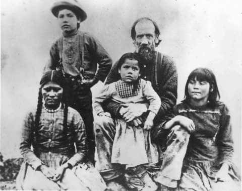
Image Credit: Wyoming History
- In the winter of 1876, an Indian woman seeking food visited the Leighs. They did not know that she had been infected with smallpox. All of the Leigh family as well as another hunter caught the disease. Between Christmas Eve and Dec. 28, 1876, all of Beaver Dick’s family (six children and Jenny) died; he and the hunter barely survived.
As you are hiking the perimeter of Jenny Lake, enjoy the spectator views of the Tetons!
At about 2.6 miles from the trailhead, you will reach the String Lake Outlet that connects String Lake with Jenny Lake.
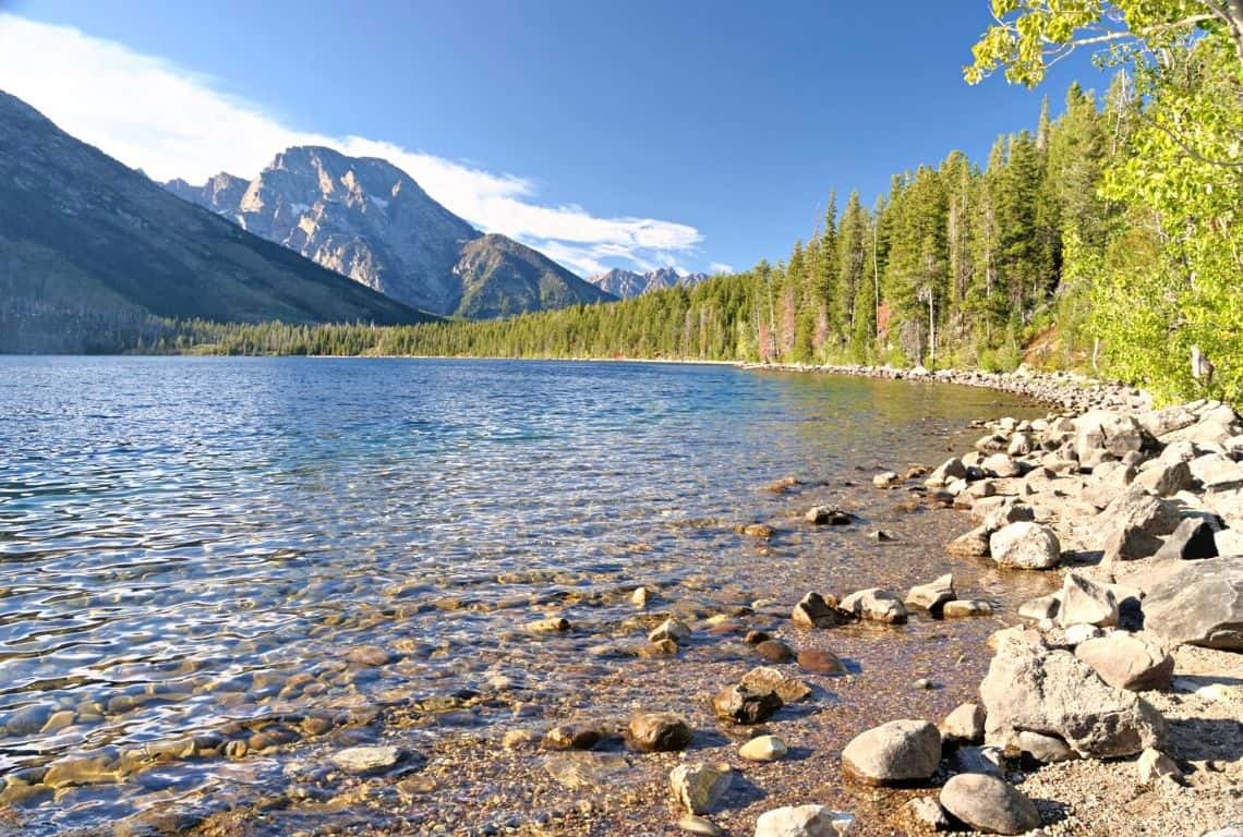
As you are hiking along Jenny Lake enjoy the spectacular views of the Tetons / Easy Hikes in Grand Teton
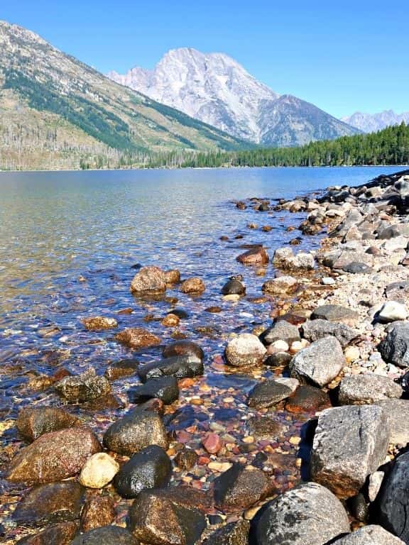
The scenery right from the start is pretty awesome!
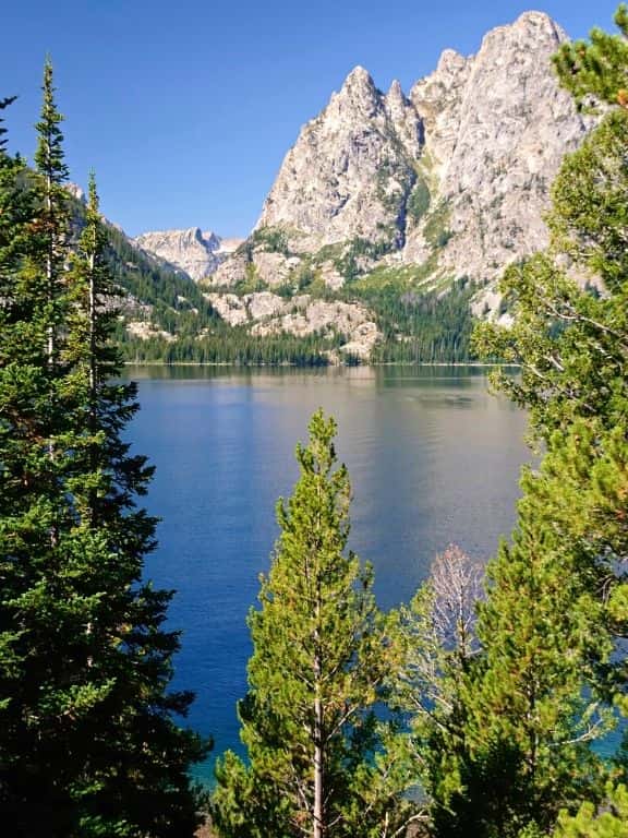
Catch some spectacular views of Teewinot Mountain, Mount Owen, Cascade Canyon, and Mount Moran.
Next, go on for about 0.4 miles, until you reach a footbridge that goes over the outlet. Cross the footbridge and continue your hike.
At about 3.4 miles from the trailhead, you will get to the Jenny Lake Trail Junction. Bear left and continue your hike. Gradually, the trail will start going south along the western side of the lake.
Pretty soon, you will reach the West Shore Boat Dock area.
At about 4.7 miles from the trailhead, you will pass by the trail that leads to Hidden Falls and Inspiration Point. This is a perfect opportunity to make a small detour and see Hidden Falls and then hike to Inspiration Point. My recommendation is to save this detour for another day and combine it with a shuttle ride across Jenny Lake (another perfect easy hike in Grand Teton that I described below. So, keep reading!)
Next, continue your hike and soon you will reach another footbridge that goes over Cascade Canyon Creek. Cross the footbridge and continue along the shore of Jenny Lake.
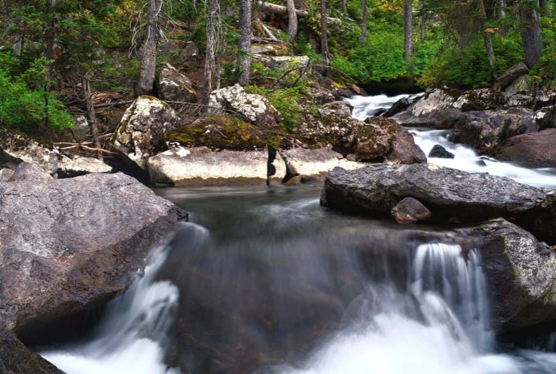
Cascade Canyon Creek at Jenny Lake
At about 7.1 miles, you will pass the boat launch area. And, at 7.3 miles, you will reach a footbridge to the East Boat Dock. Congratulations! You completed the loop and you are back where you started.
Hidden Falls and Inspiration Point Trail
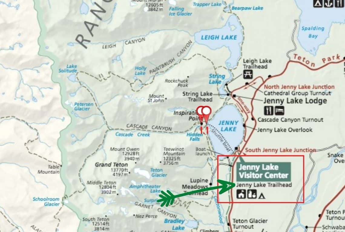
Map of Hidden Falls and Inspiration Point Trail in Grand Teton National Park. Image Source: National Park Service / Easy Hikes in Grand Teton
- Roundtrip Distance: 2.2 miles
- Trail Location: Jenny Lake Trailhead
- Time: 1-2 hours
- Difficulty: Easy
Hidden Falls and Inspiration Point Trail is one of the easy hikes in Grand Teton National Park that needs to be on everyone’s list! All in all, it is just a fun experience for the entire family, where you get to take the shuttle across Jenny Lake and then hike.
Taking the shuttle is optional. If you would rather hike, then you just need to take Jenny Lake Loop Trail in either direction and it will get you to Hidden Falls and Inspiration Point Trailhead.
How to Get to Hidden Falls and Inspiration Point Trail
So, you can hike to Hidden Falls and Inspiration Point Trailhead or you can take the shuttle across Jenny Lake, both ways or just one way.
The shuttle is located at Jenny Lake East Boat Dock. It is right next to Jenny Lake Visitor Center. To get to Jenny Lake Visitor Center turn west off Teton Park Road at the South Jenny Lake Junction. The junction is located about 7.7 miles north of Moose Junction. Once you get to the junction, proceed for no more than 0.5 miles to a large parking lot located next to Jenny Lake Visitor Center.
GOOD TO KNOW: Shuttles run every 10-15 minutes. A round-trip ticket costs $18 and a one-way ticket is $10. You can purchase the tickets right at the Jenny Lake East Boat Dock. It takes no more than 10-15 minutes to get across the lake and reach Jenny Lake West Boat Dock.
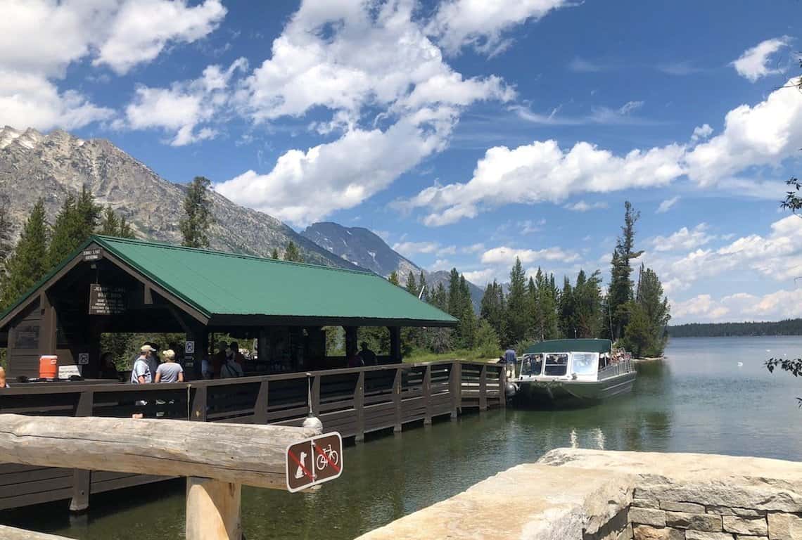
Jenny Lake West Boat Dock
What You Need to Know About Hidden Falls and Inspiration Point Trail
Once you get to the Jenny Lake West Boat Dock follow the signs for the Cascade Canyon Trailhead.
Next, start your hike along Cascade Canyon Trail. First, you will be hiking through a forested area, however, pretty soon, you will cross over Cascade Canyon Creek and the area will open up.
At about 0.5 miles from the Cascade Canyon Trailhead, you will reach the short trail leading to Hidden Falls. At this point, turn left and proceed to Hidden Falls. It is a beautiful waterfall that drops 100 feet in a series of cascades.
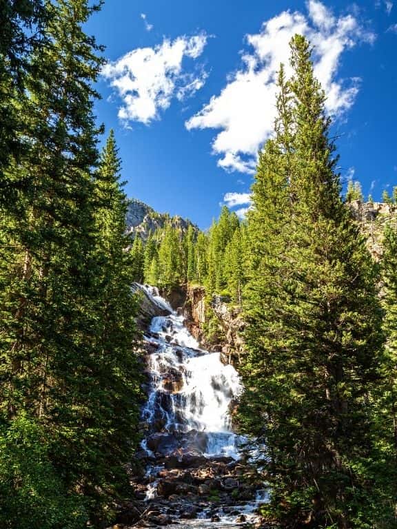
Hidden Falls
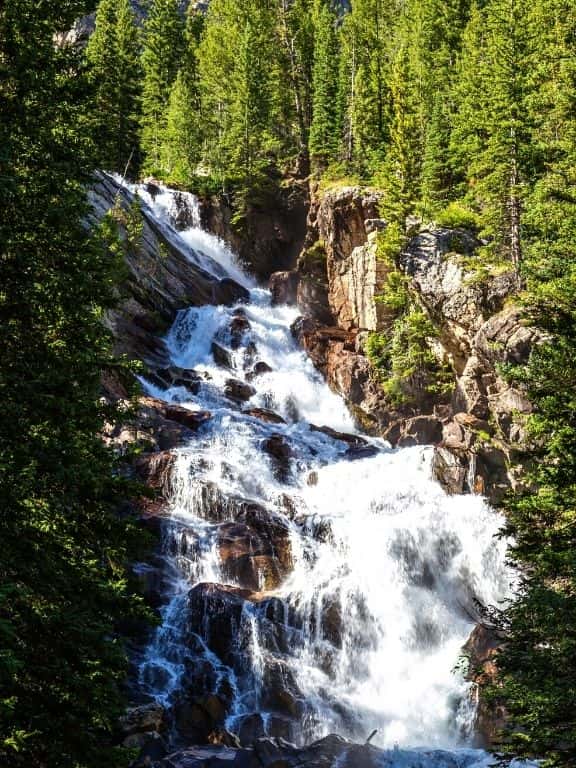
Hidden Falls drops 100 feet in a series of cascades
When you are ready, turn around and retrace your steps back to Cascade Canyon Trail. Once you are back on the trail, turn right and continue your hike to Inspiration Point. This section of the hike goes at a sharp ascent over a rugged, rocky trail. However, it is a short section and it is all worth the extra effort!
As you gradually gain elevation, the famous Cathedral Group will come into your view.
At 1.1 miles from the Cascade Canyon Trailhead, you will reach Inspiration Point. The views are awesome! Right in front of you will be Jenny Lake and Jackson Hole, and to the east, you will see the Gros Ventre Range.
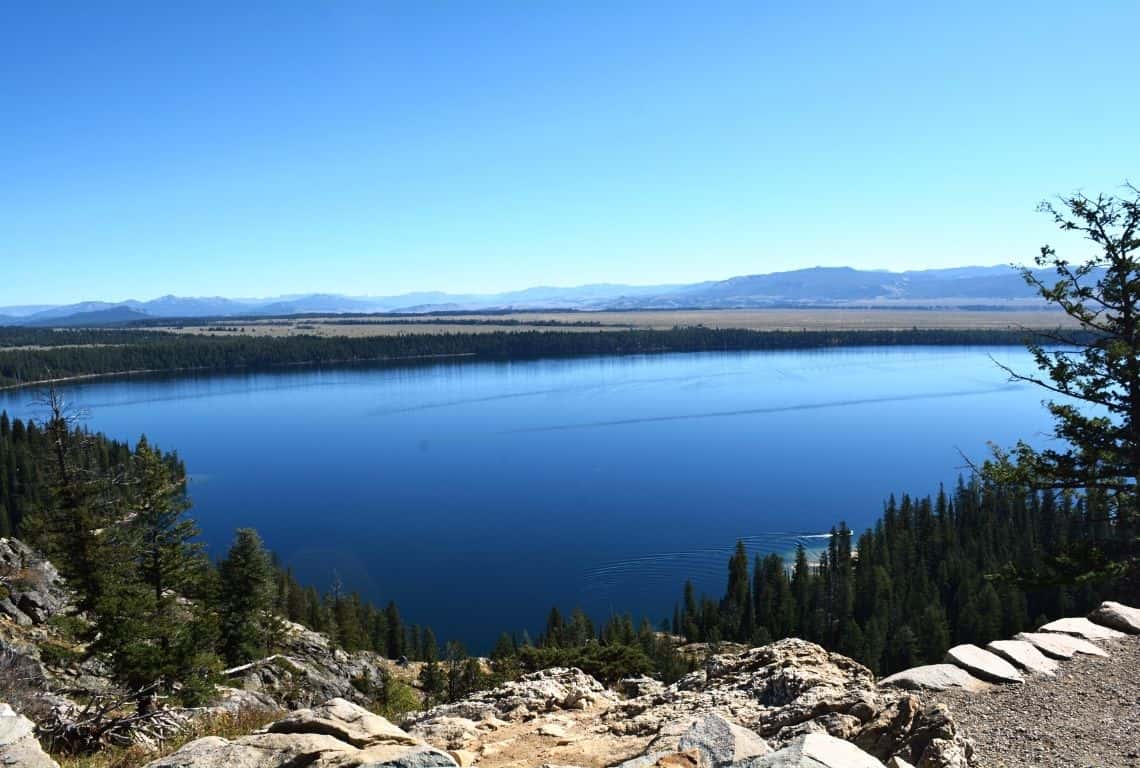
The view from Inspiration Point in Grand Teton National Park / Easy Hikes in Grand Teton
Did you know that Jenny Lake was formed approximately 12,000 years ago by glaciers pushing rock debris that carved Cascade Canyon? Jenny Lake is estimated to be 256 feet deep and it encompasses 1,191 acres. Source: Wikipedia
When you are ready to head back, simply retrace your steps. Again, you have a few options for how to get back to the Jenny Lake Trailhead where you started. You can hike back or you can take the boat shuttle.
Phelps Lake Overlook Trail
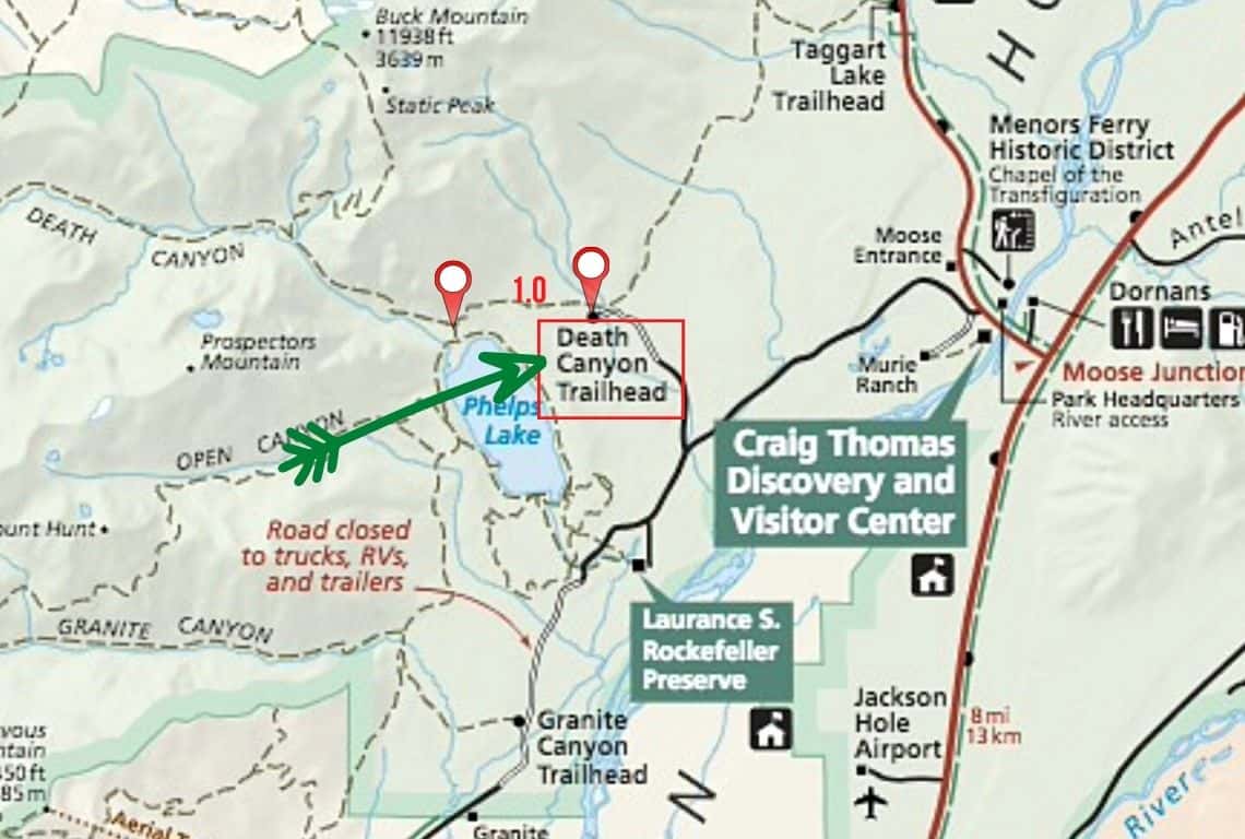
Map of Phelps Lake Overlook Trail in Grand Teton National Park. Image Source: National Park Service / Easy Hikes in Grand Teton
- Roundtrip Distance: 2.0 miles
- Trail Location: Death Canyon Trailhead
- Time: 1 hour
- Difficulty: Easy
The hike to Phelps Lake Overlook will give you the best views in all of Grand Teton National Park! Don’t miss this hike! It is one of the best easy hikes in Grand Teton National Park.
How to Get to Phelps Lake Overlook Trail
The hike to Phelps Lake Overlook starts at the Death Canyon Trailhead. Make a note that the Death Canyon Trailhead is sometimes called the Whitegrass Trailhead.
To reach the trailhead from Moose Junction, you need to turn left onto Moose-Wilson Road and drive for about 3 miles south until you reach the turn-off for the Death Valley Trailhead.
INTREPID’S PRO TIP: The first part of Moose-Wilson Road is paved and in pretty good condition. However, the last section of the road is a rough gravel road with lots of potholes.
A 4×4 vehicle is highly recommended at this point. However, if you do not have a 4×4 then, my recommendation is to park your vehicle at the end of the paved section of the road (there is a small parking area) and then walk to the trailhead. You will need to walk no more than a mile to reach the trailhead.
What You Need to Know About Phelps Lake Overlook Trail
Once you reach the Death Valley Trailhead, take a short path (no more than 0.1 miles) that will lead you to Valley Trail Junction. Bear left at the junction and follow Valley Trail as it goes westward through the wooded area dominated by lodgepole pines.
Pretty soon, the trees will thin out and you will start hiking through beautiful meadows. However, the hike becomes slightly more challenging here and starts to ascent, but by no means, it is a strenuous ascent.
At about 0.9 miles from the trailhead, you will start getting a few glimpses of Phelps Lake.
At 1.0 miles from the trailhead, you will reach Phelps Lake Overlook. The overlook stands at 567 feet above Phelps Lake and offers stunning views of the lake.
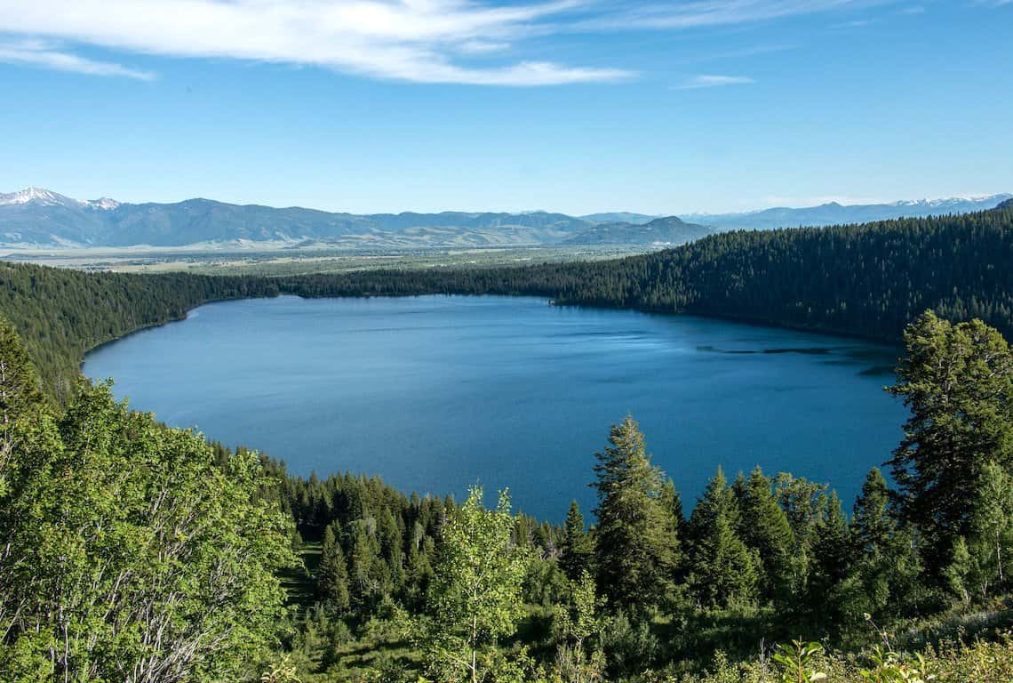
Phelps Lake Overlook
INTREPID’S PRO TIP: I want to encourage you to hike another 0.7 miles and reach the Death Canyon Junction! You will get even better views of the lake and the mountain scenery.
Also, another suggestion is to hike towards the shores of the lake. It is no more than 0.3 miles to reach the shore of the lake and take a relaxing break.
When you are ready to head back, simply retrace your steps. Start by going back to Valley Trail and continue back along Valley Trail to the Death Valley Trailhead.
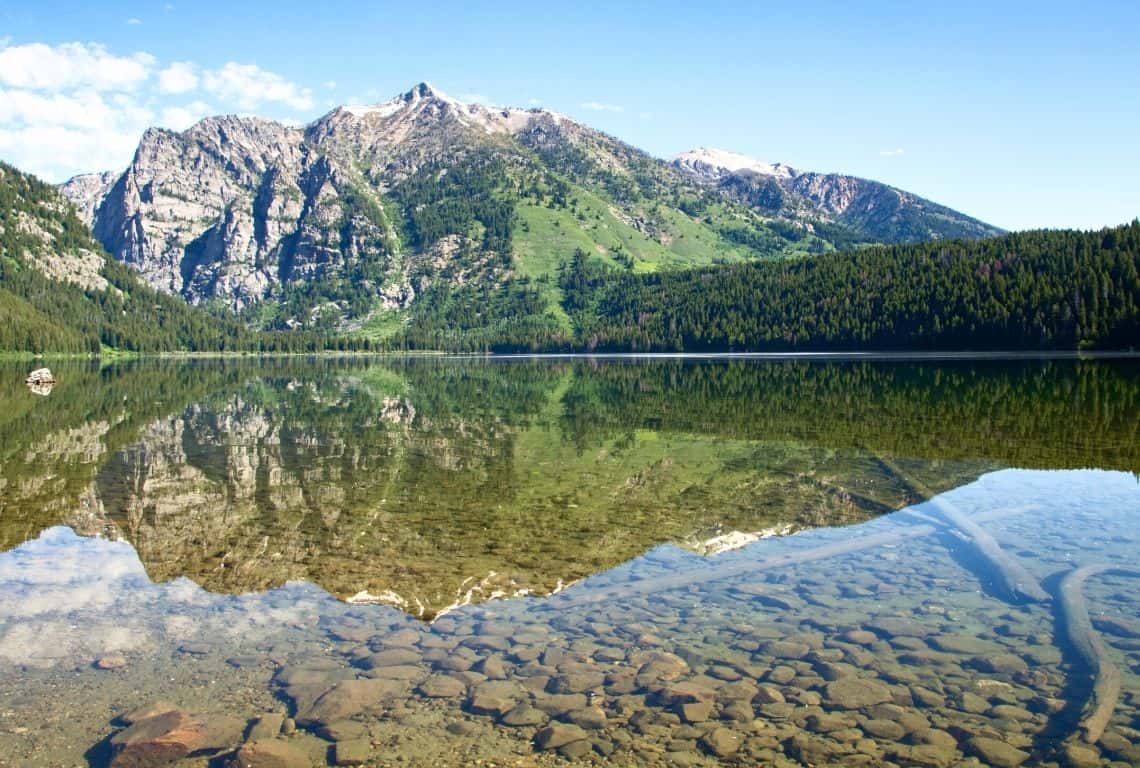
Hike towards the shores of the lake and take a relaxing break / Easy Hikes in Grand Teton
String Lake Loop Trail
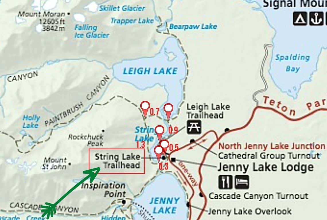
Map of String Lake Loop Trail in Grand Teton National Park. Image Source: National Park Service / Easy Hikes in Grand Teton
- Roundtrip Distance: 3.7 miles
- Trail Location: String Lake Trailhead
- Time: 1.5 hours
- Difficulty: Easy
String Lake Loop Trail is one of my favorite hikes in Grand Teton National Park. It is an easy hike with little elevation change that offers breathtaking scenery.
My recommendation is that you start early in the morning so that you can see the stunning Grand Tetons reflecting in String Lake.
In addition, make sure to hike in a counter-clockwise direction so that you can get the best views of the mountains.
How to Get to String Lake Loop Trail
String Lake Loop Trail starts at the String Lake Trailhead. The trailhead is located north of Jenny Lake.
To get there, turn west off Teton Park Road at the North Jenny Lake Junction. Next, continue on for 1.4 miles until you get to the parking lot located right at String Lake Trailhead.
What You Need to Know About String Lake Loop Trail
The trail starts along the eastern shore of the lake and heads up north.
Right from the start, you will get to enjoy the stunning views! On your left-hand side will be the famous Cathedral Group.
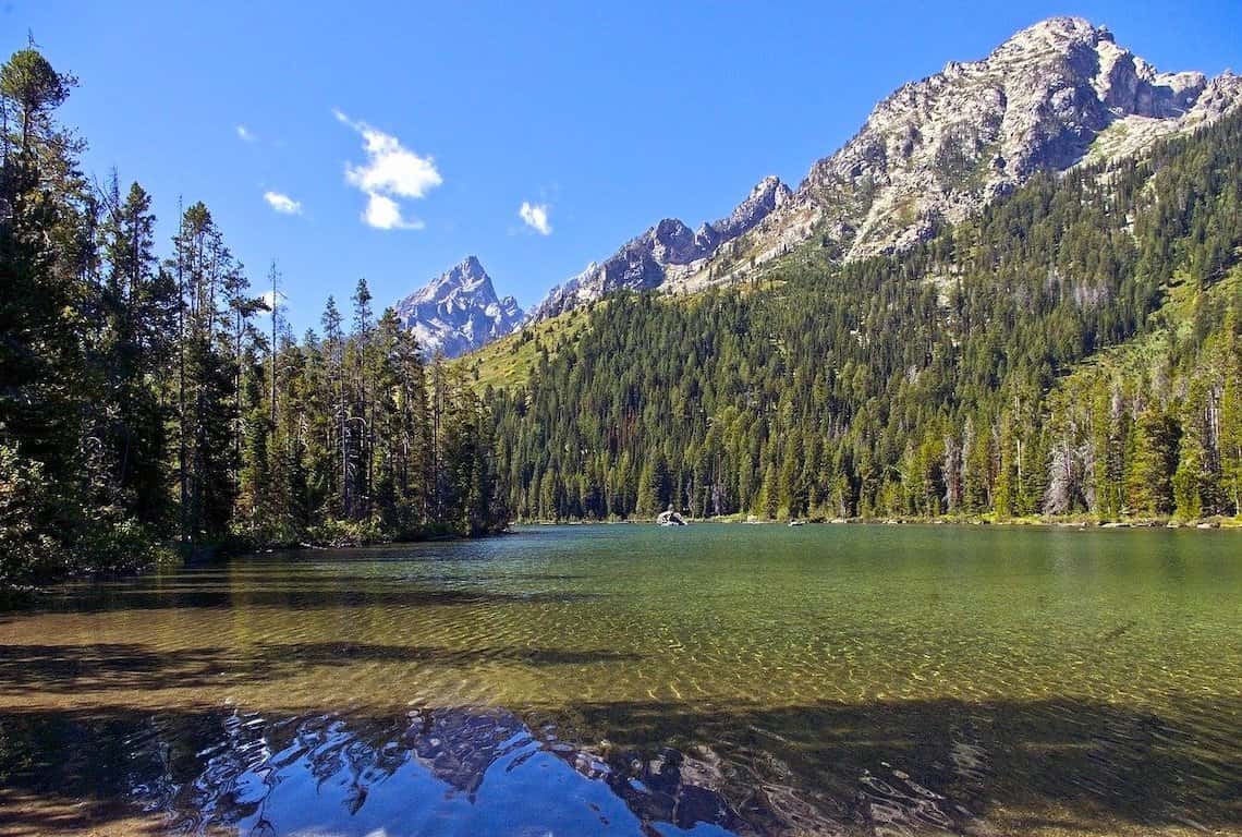
String Lake Loop Trail in Grand Teton National Park starts along the eastern shore of the lake and heads up north. The views are awesome right from the start / Easy Hikes in Grand Teton
What is Cathedral Group on Grand Teton National Park? The Cathedral Group is a group of classic alpine peaks, with pyramidal shapes caused by glacial motion. The group comprises eight out of ten tallest peaks in the Teton Range and it includes:
- Grand Teton (13,770)
- Mount Owen (12, 928)
- Middle Teton (12,804)
- South Teton (12, 514)
- Teewinot Mountain (12,325)
- Teepee Pillar (12,266)
- Cloudveil Dome (12,026)
- and Buck Mountain (11,938)
Now, if you look to the right you will be able to Mount Moran standing at 12,605 feet.
I need to mention, that there are a few interpretative signs along the way that are fun to read and worth checking out. You can find out how glaciation created the chain of lakes below the Teton Range.
At 0.5 miles, you will come to the Leigh Lake Trailhead.
At 1.4 miles, you will get to the Bearpaw Lake Trail Junction and the footbridge. Cross the footbridge and continue on String Lake Trail. At this point, the trail veers away from the lake and goes through the forest.
Next, at 2.1 miles, you will get to the Paintbrush Canyon Trail Junction. Make sure to stay on String Lake Trail.
Finally, at 3.7 miles, you will arrive at the footbridge over the String Lake Outlet. Just a few more steps and you are back at the parking lot where you started.
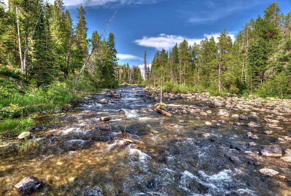
Stream at String Lake Loop Trail in Grand Teton National Park / Easy Hikes in Grand Teton
Beaver Creek and Taggart Lake Loop Trail
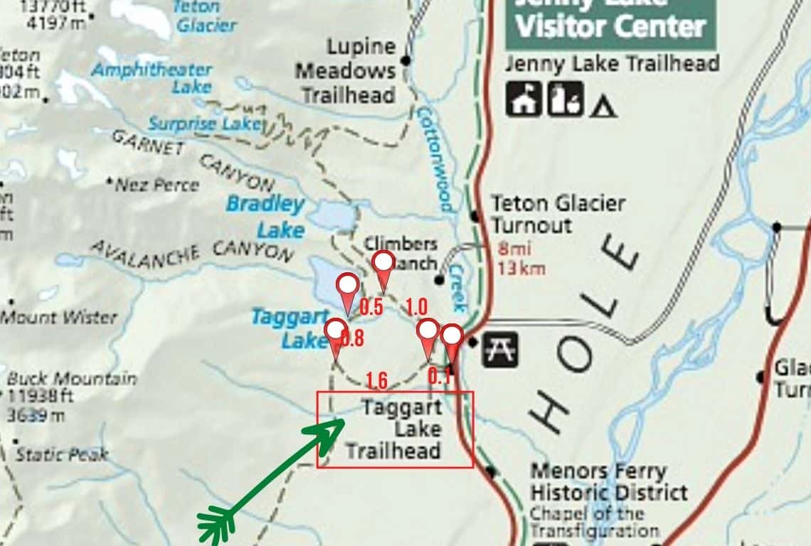
Map of Beaver Creek and Taggart Lake Loop Trail. Image Source: National Park Service / Easy Hikes in Grand Teton
- Roundtrip Distance: 4 miles
- Trail Location: Taggart Lake Trailhead
- Time: 2 hours
- Difficulty: Easy
Beaver Creek and Taggart Lake Loop Trail is an easy hike with one of the best views in Grand Teton National Park.
My recommendation is to start early since the parking lot located at the Taggart Lake Trailhead fills up by pretty much mid-morning.
Also, for the best views, I suggest that you hike counter clock-wise.
How to Get to Beaver Creek and Taggart Lake Loop Trail
Beaver Creek and Taggart Lake Loop Trail start at the Taggart Lake Trailhead.
The Taggart Lake Trailhead is located about 2.3 miles north of the Moose Entrance Station.
What You Need to Know About Beaver Creek and Taggart Lake Loop Trail
First, when you get to the trailhead proceed for about 0.1 miles until you reach Beaver Creek Trail. Make a note that you will be hiking north.
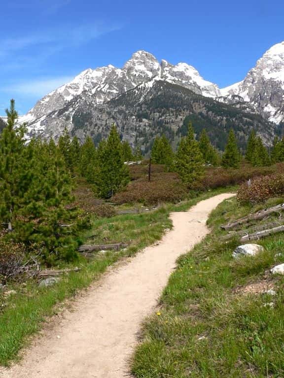
The trail to Taggart Lake in Grand Teton National Park
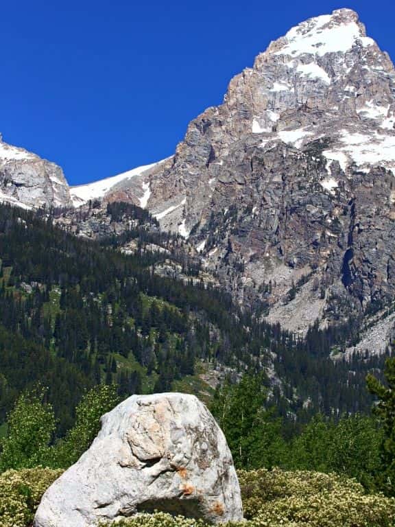
Views on Taggart Lake Trail in Grand Teton National Park
Continue on Beaver Creek Trail until you reach Taggart Creek. There will be a footbridge over Taggart Creek. This is a perfect photo opportunity. Take your time at this spot to capture some cool photos! If you are into photography, then Grand Tetons are a photographer’s dream. Check out my post: Best Photography Locations in Grand Teton National Park. It has some useful photography tips as well.
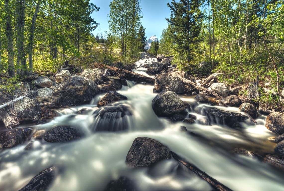
Continue on Beaver Creek Trail until you reach Taggart Creek. It is a perfect photo spot!
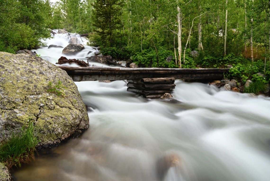
There will be a footbridge over Taggart Creek. And, it is another great photo opportunity!
After you cross the footbridge, you will be hiking on Taggart Lake Trail. The trail runs pretty much along Taggart Creek.
At 1.1 miles, you will reach Bradley Lake Trail Junction. Bradley Lake Trail will be on your right. Do not turn right, if you do you will end up hiking to Bradley Lake. Make sure to turn left, and continue on Taggart Lake Trail.
Continue hiking for about 0.5 miles and you will reach Taggart Lake. Here, you will get to enjoy the views of spectacular mountain scenery. There are a few spots close to the shore where you can rest, refuel your body (perfect time for a snack or lunch) and soak in the views.
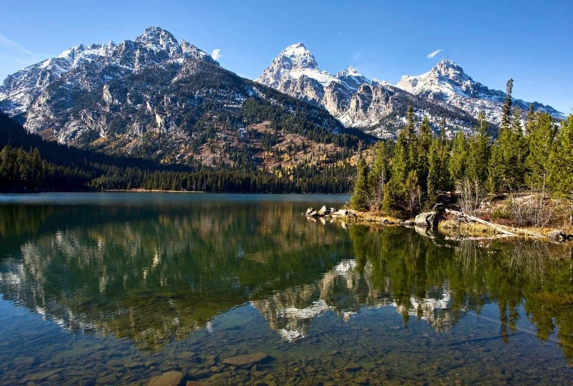
Once you reach Taggart Lake, you will get to enjoy the views of spectacular mountain scenery /Easy Hikes in Grand Teton
When you are ready to continue your hike, follow Taggart Lake Trail. You will start hiking south.
In about 0.1 miles you will reach a footbridge over an inlet. Cross the footbridge and continue heading south. At this point, you will be hiking on Beaver Creek Trail.
The views of Taggart Lake and the Cathedral Group will be replaced by sweeping views over meadows and Jackson Hole. It is a great stretch of the hike and you should be on the lookout for wildlife.
Continue for about 1.6 miles until you reach the Taggart Lake Trailhead where you started.
String Lake and Leigh Lake Trail
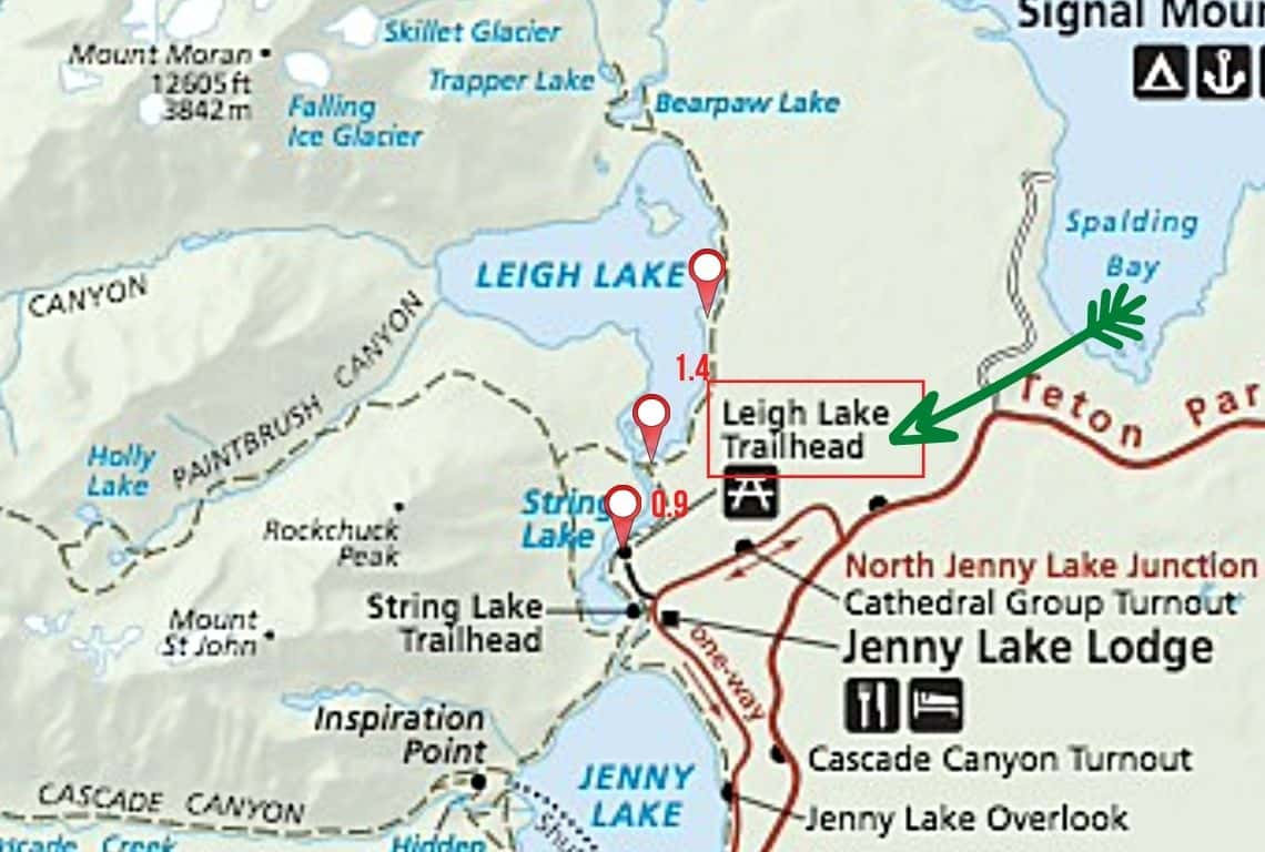
Map of String Lake and Leigh Lake Trail. Image Source: National Park Service / Easy Hikes in Grand Teton
- Roundtrip Distance: 5 miles
- Trail Location: Leigh Lake Trailhead
- Time: 2-3 hours
- Difficulty: Easy
String Lake and Leigh Lake Trail is, hands down, one of the most picturesque hikes in Grand Teton National Park. It is an easy hike with little elevation change.
Make sure to start early in the morning for the best views of the mountains reflected in the still waters of String and Leigh Lakes.
How to Get to String Lake and Leigh Lake Trail
String Lake and Leigh Lake Trail starts at the Leigh Lake Trailhead. The trailhead is located north of Jenny Lake.
To get there, turn west off Teton Park Road at the North Jenny Lake Junction. Next, continue for 1.4 miles until you get to the String Lake Trailhead. Next, turn right and continue 0.5 miles to Leigh Lake Trailhead, which is located at the end of the road.
What You Need to Know About String Lake and Leigh Lake Trail
The trail starts along the eastern shore of String Lake and heads up north.
For the first 0.9 miles, you will be hiking along String Lake. To your left, you will see the famous Cathedral Group, and to your right will be Mount Moran.
At about 1 mile, you will reach a junction.
Next, continue straight (do not turn left, if you do, you will be on Lake String Loop Trail). So continue straight.
Now, you are hiking along the eastern shore of Lake Leigh. The views of the Tetons are simply stunning!
Leigh Lake is the third largest lake in Grand Teton National Park and it is one of the deepest lakes, with a depth of 250 feet.
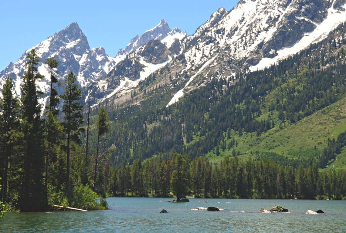
When you are hiking along the eastern shore of Lake Leigh, the views of the Tetons are simply stunning!
Did you know that Leigh Lake was named after ‘Beaver Dick’ Leigh? Richard ‘Beaver Dick’ was an English-American trapper, scout, and guide at the end of the 19th Century. He has been called “possibly the West’s last mountain man”. Leigh Lake was named for Richard Leigh and Jenny Lake for his first wife, by Hayden’s expedition in 1872. Source: Wyoming State Historical Society
Now, keep in mind that you can stop and turn around at any point. However, my recommendation is to hike for about 1.4 miles until you reach a rocky beach that offers possibly the best views of the middle Tetons.
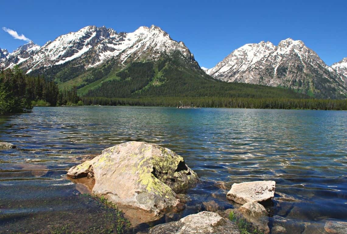
If you hike for another 1.4 miles you will reach a rocky beach that offers possibly the best views of the middle Tetons / Easy Hikes in Grand Teton
If you are ready to turn around and start going back, then simply retrace your steps. After about 1.4 miles, you will be back at the junction. Next, continue for about 1 mile until you reach the Leigh Lake Trailhead and the parking lot.
Phelps Lake Loop Trail
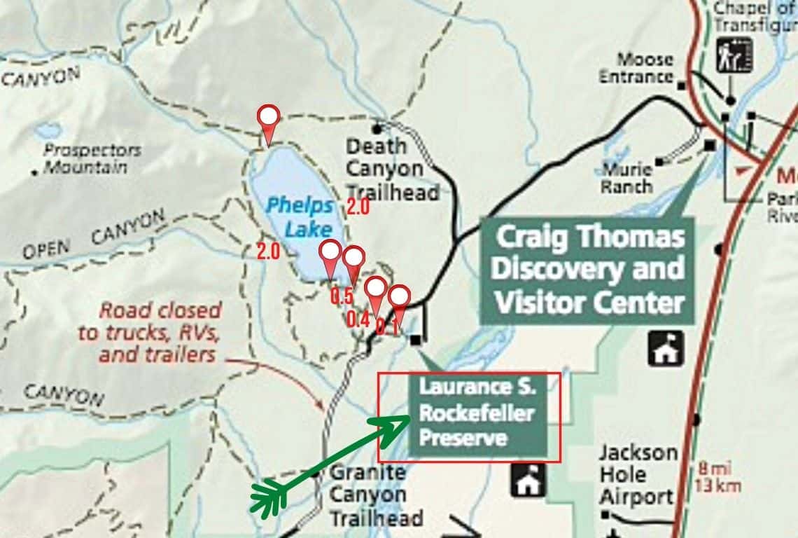
Map of Phelps Lake Loop Trail. Image Source: National Park Service / Easy Hikes in Grand Teton
- Roundtrip Distance: 6.9
- Trail Location: Laurance S. Rockefeller Preserve
- Time: 4 hours
- Difficulty: Easy
Phelps Lake Loop Trail is one of the best easy hikes In Grand Teton National Park. It is a beautiful hike with scenic lake views and meadows dotted with flowers.
What makes this hike special is the fact that part of it goes through the Laurance S. Rockefeller Preserve.
Make a note that the parking at the Preserve is limited. So, start your day early and get to the parking area no later than 9-10 am to secure a parking spot.
My recommendation is to hike in a counterclockwise direction for the best views of the mountains.
How to Get to Phelps Lake Loop Trail
The trailhead for Phelps Lake Loop is located in the Laurance S. Rockefeller Preserve off Moose-Wilson Road.
To reach the trailhead from Moose Junction, turn left onto Moose-Wilson Road and drive for about 3.6 miles south until you reach the Preserve, which will be located on the left.
What is Laurance S. Rockefeller Preserve?
- The Laurence S. Rockefeller Preserve is a 1,106 acres refuge within Grand Teton National Park on the southern end of Phelps Lake
- Starting in 1927, John D. Rockefeller, Jr purchased much of the land in Jackson Hole for the creation of the Jackson Hole National Monument and the expansion of Grand Teton National Park. He retained the 3,100-acre JY Ranch as a family retreat. Over the years, the family gave most of the ranch to the national park
- Laurance S. Rockefeller donated the final parcel in 2001.
What You Need to Know About Phelps Lake Loop Trail
Start your hike at the Laurance S. Rockefeller Visitor Center.
Take Woodland Trail to the lake. It is no more than a 1.3-mile hike and you will reach Phelps Lake.
Right from the start, you will get to enjoy the views of the lake and the surrounding mountains. Make sure to locate Death Canyon in the distance and Albright Peak standing at 10,552 feet. To the left of the canyon is 11,241-foot Prospectors Mountain.
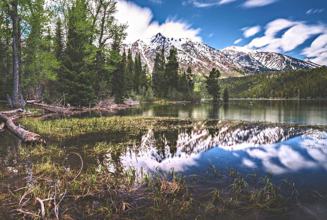
Right from the start, you will get to enjoy the views of Phelps Lake and the surrounding mountains / Easy Hikes in Grand Teton
Now, you will be hiking counter clock-wise along the eastern shore of the lake. You will be going north.
At about 2.5 miles from the trailhead, you will reach a huge boulder sitting on the edge of the lake. Here, you can get even better views of Death Canyon.
At about 3.1 miles you will reach the north shore of Phelps Lake and a nice sandy beach. If you are ready for a break, then this might be a good spot.
There is a sign at the beach indicating the direction to the Valley Trail Junction. Follow the path leading to the Valley Trail Junction.
INTREPID’S PRO TIP: Now, if you feel like it, then you can make a little detour and follow the sign to Phelps Lake Overlook. The views from the overlook are off the charts! It is not more than 0.7 miles from the beach to the overlook. So worth it!
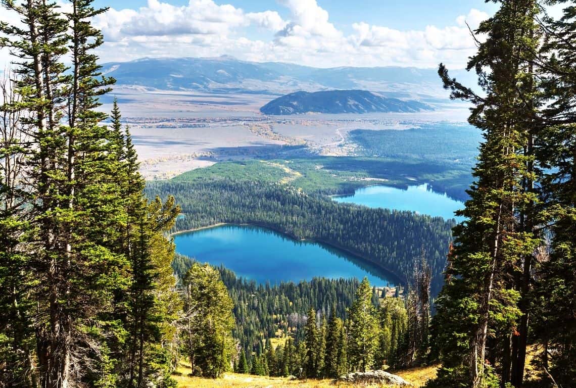
Make a little detour and follow the sign to Phelps Lake Overlook. The views from the overlook are off the charts!
At about 3.8 miles from the trailhead, Valley Trail goes off to the right. Follow the trail and continue your loop around Phelps Lake. Now, you will be hiking along the western shores of the lake and going south. It is a beautiful section of the hike and the trail meanders through lovely meadows. You will be passing by Huckleberry Point. Make sure to stop by and soak in some spectacular views of Death Valley and Albright Peak.
Next, at about 5.5 miles, you will get to the Lake Creek Trail Junction. Continue on Lake Creek Trail to the LSR Visitor Center.
Jackson Lake Lakeshore Trail
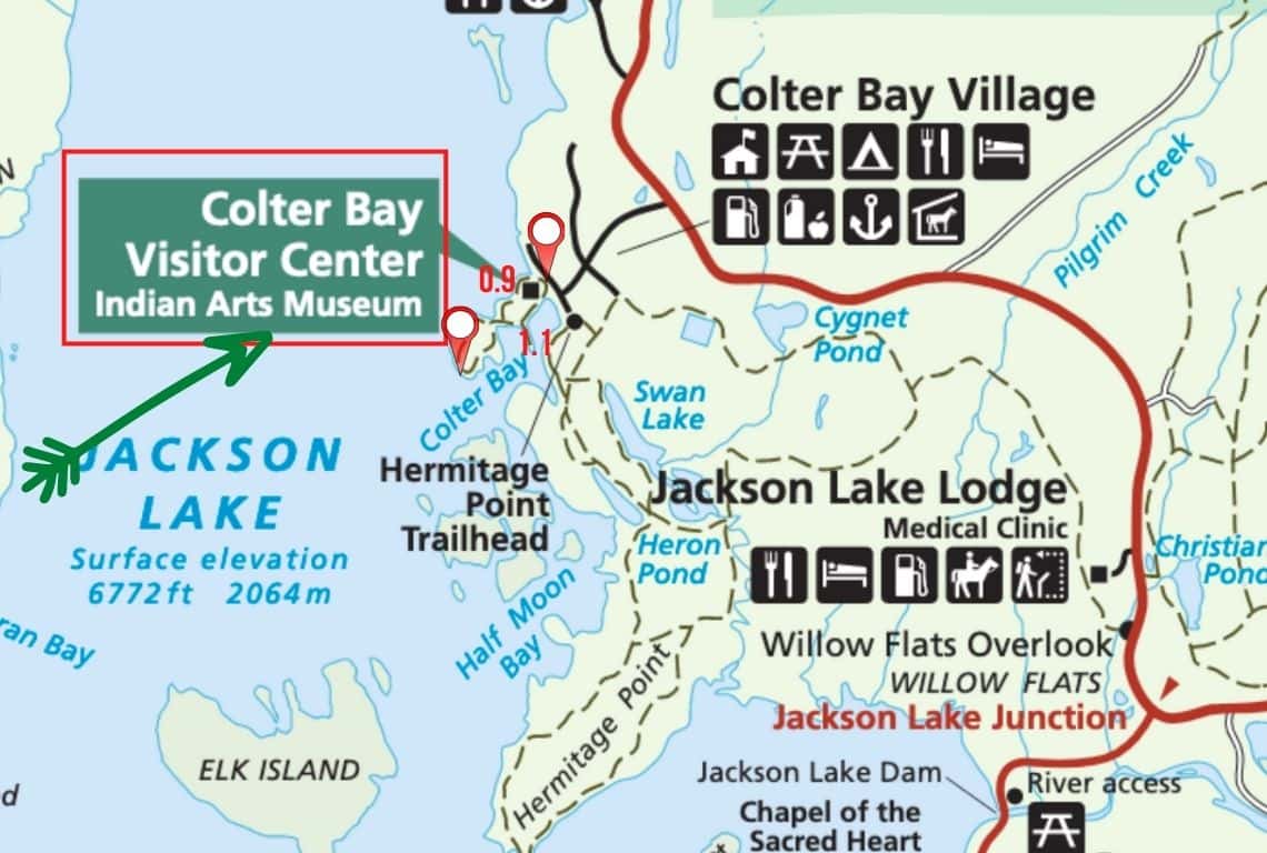
Map of Jackson Lake Lakeshore Trail. Image Source: National Park Service / Easy Hikes in Grand Teton
- Roundtrip Distance: 2 miles
- Trail Location: Colter Bay Visitor Center
- Time: 1 hour
- Difficulty: Easy
Jackson Lake Lakeshore Trail offers the most incredible views of the Teton Mountains across Jackson Lake.
The trail consists of two connecting loops: the inner loop and the outer loop. The inner loop and outer loop are located on the peninsula that forms Colter Bay.
How to Get to Jackson Lake Lakeshore Trail
Jackson Lake Lakeshore Trail begins from the backside of the Colter Bay Visitor Center.
To get to the Colter Bay Visitor Center drive about 5.4 miles north from the Jackson Lake Junction. Next, turn left at the junction and continue for about 1 mile. You will be driving through Colter Bay Village until you reach the Colter bay Visitor Center.
The trailhead is located in the back of the visitor center.
What You Need to Know About Jackson Lake Lakeshore Trail
Jackson Lake Lakeshore Trail starts in the back of the Colter Bay Visitor Center.
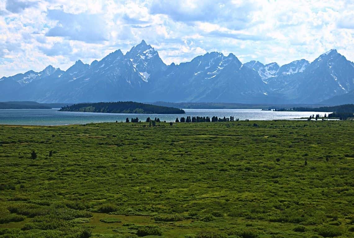
Jackson Lake Lakeshore Trail in Grand Teton National Park / Easy Hikes in Grand Teton
First, you will start your hike on the inner loop portion of Jackson Lake Lakeshore Trail. At about 0.4 miles, you will reach a path that connects the two loops. Bear right and continue on the outer loop portion of the Jackson Lake Lakeshore Trail.
At about 0.9 miles, the trail will take you to the end of the peninsula with a rocky beach and stunning views of the Tetons towering over Jackson Lake.
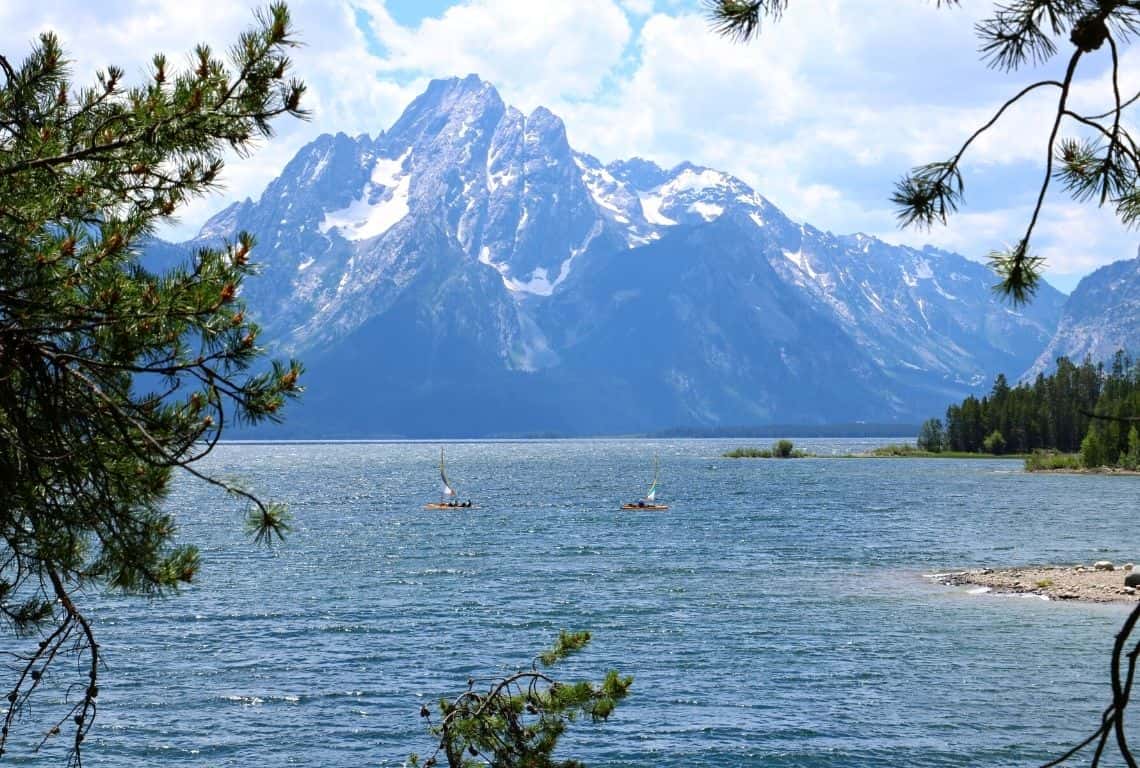
Jackson Lake Lakeshore Trail / Easy Hikes in Grand Teton
When you are ready to head back, continue on your outer loop portion of the trail. At about 1.5 miles you will reach the end of the outer loop. Bear right and start hiking on the inner loop portion of the trail.
At about 2 miles, you will reach the Colter Bay Visitor Center where you originally started your hike.
Hermitage Point Trail
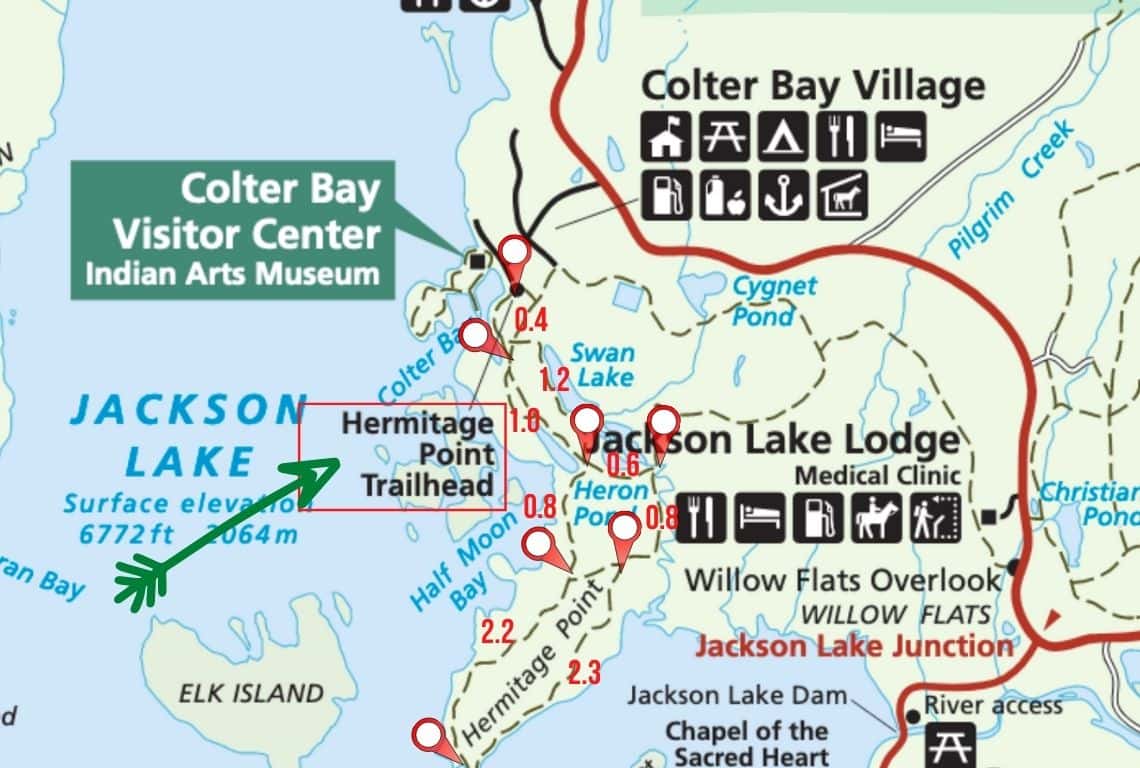
Map of Hermitage Point Trail. Image Source: National Park Service / Easy Hikes in Grand Teton
- Roundtrip Distance: 10.0 miles
- Trail Location: Colter Bay – Hermitage Point Trailhead
- Time: 5 hours
- Difficulty: Easy/Moderate
Hermitage Point Trail is one of my favorite easy hikes in Grand Teton National Park. It offers unsurpassed views of the Grand Tetons.
The hike to Hermitage Point is mostly flat, except for a few short sections with a relatively sharp ascent.
How to Get to Hermitage Point Trail
The hike to Hermitage Point begins from the Hermitage Point Trailhead.
The Hermitage Point Trailhead is located at the south end of the Colter Bay Visitor Center. To get to the trailhead, drive about 5.4 miles from the Jackson Lake Junction to the Colter Bay Visitor Center.
What You Need to Know About Hermitage Point Trail
Once you get to the Colter Bay Visitor Center take s short road to the boat landing area.
Next, continue south for no more than 0.4 miles until you will get to a junction. Bear right and continue along the shore of Jackson Lake. You will be heading towards Heron Pond.
At about 0.7 miles from the trailhead, you will reach a side trail leading to Jackson Lake Overlook.
Have your camera ready, because the views of the Teton Mountain Range are breathtaking at the overlook.
Next, continue on the side trail, until you connect to the main trail.
At about 1.4 miles, you will reach another junction. Bear right and continue south along the shore of Jackson Lake. You will be passing by Heron Pond.
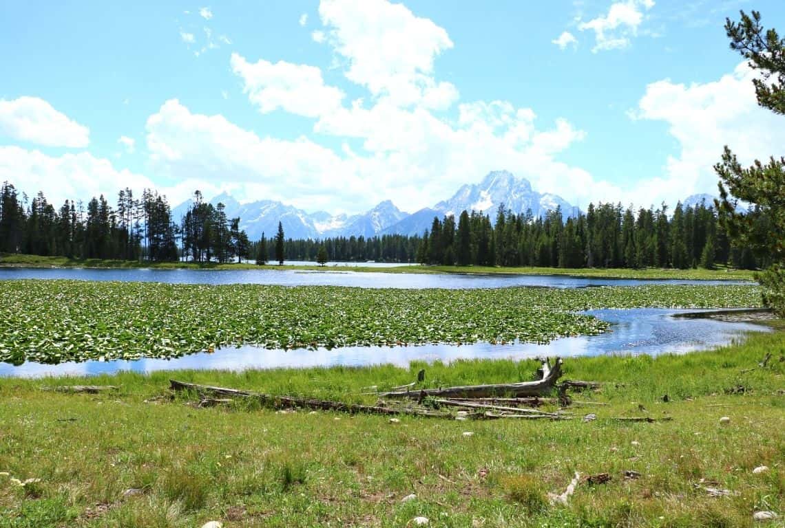
Views of the Teton Range from the Heron Pond in Grand Teton National Park / Easy Hikes in Grand Teton
Heron Pond is quite a sight when it is covered with lilies. Moreover, be on the lookout for wildlife. And, yes, have your camera ready! The views are awesome!
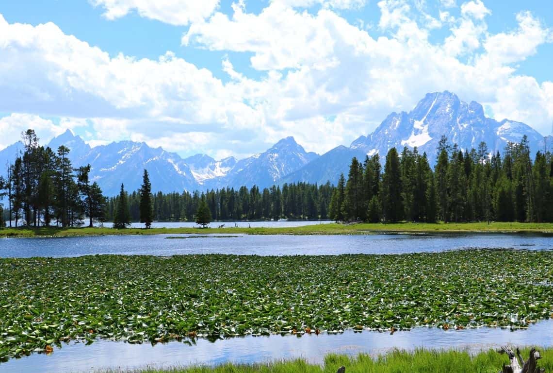
Views of the Teton Range from the Heron Pond in Grand Teton National Park / Easy Hikes in Grand Teton
Next, continue your hike until you reach Half Moon Bay Overlook. Take your time here and soak in the views!
From this point, the trail goes through the forested area but gradually the trees thin out and at about 4.4 miles from the trailhead, you will reach the southernmost tip of the peninsula. It is known as Hermitage Point.
Go to the very end. There is a rocky beach which is perfect for taking a break here. In my opinion, at this point, you will get some of the best views of the Grand Tetons.
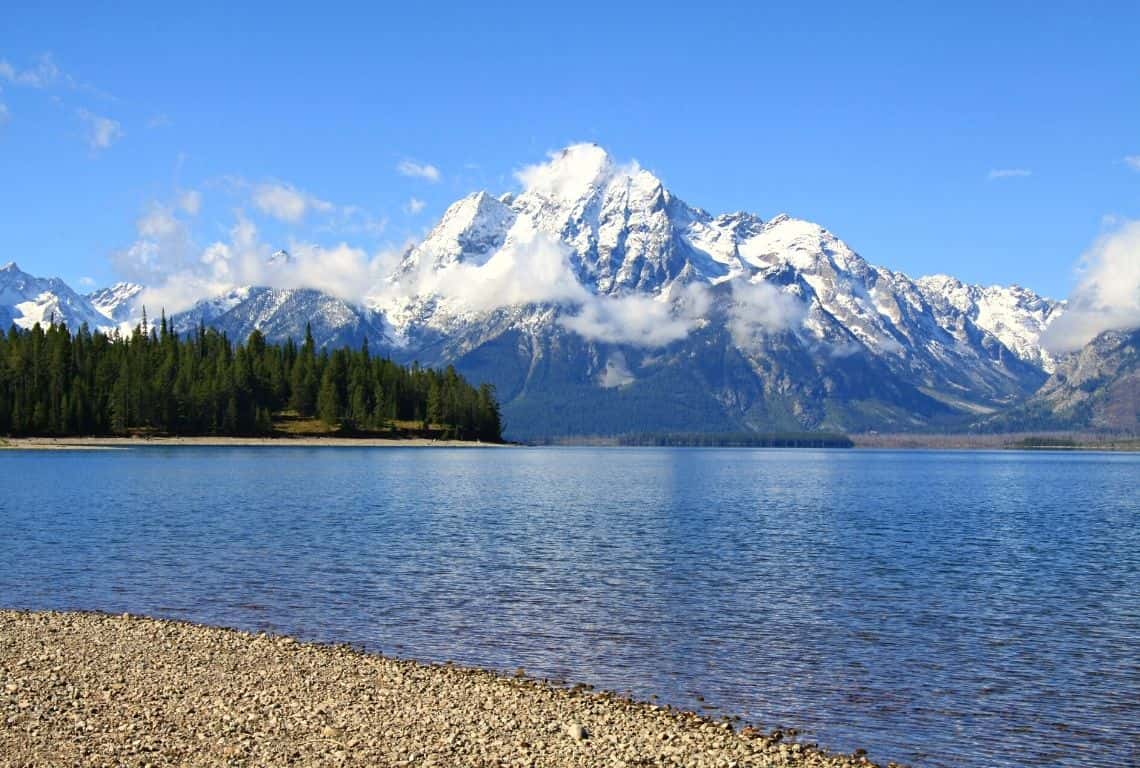
Views of the Teton Range from the Heron Pond in Grand Teton National Park / Easy Hikes in Grand Teton
When you are ready to continue your hike, walk back to the main trail and proceed along the southeastern side of the peninsula until you reach a bit of the incline. Just hang in there, it is all worth it! By the way, as you brave the incline, check out the great views of the southeastern corner of Jackson Lake.
At about 6.7 miles from the trailhead, you will get to a junction, continue straight at the junction. Ahead of you will be a swampy area overgrown with willows. Be on the lookout for moose!
Next, at about 7.5 miles from the trailhead, you will get to a junction. Here, turn left and start heading towards Swan Lake.
Swan Lake is beautiful when it is covered with blooming lilies. Take your time here and try to spot a trumpeter swan!
- Trumpeter Swans are impressively large—males average over 26 pounds, making them North America’s heaviest flying bird. To get that much mass aloft the swans need at least a 100 meter-long “runway” of open water: running hard across the surface, they almost sound like galloping horses as they generate speed for take-off.
- Trumpeter Swans take an unusual approach to incubation: they warm the eggs by covering them with their webbed feet.
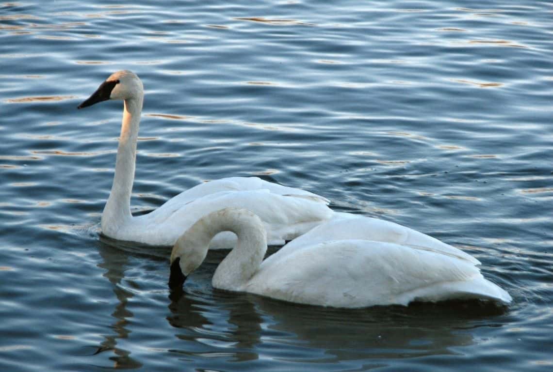
Swan Lake is beautiful when it is covered with blooming lilies. Take your time here and try to spot a trumpeter swan / Easy Hikes in Grand Teton
Next, continue along the shore of Swan Lake until you reach a junction. At this point, head straight towards the Colter Bay Visitor Center where you started your hike.
Two Ocean Lake Loop Trail
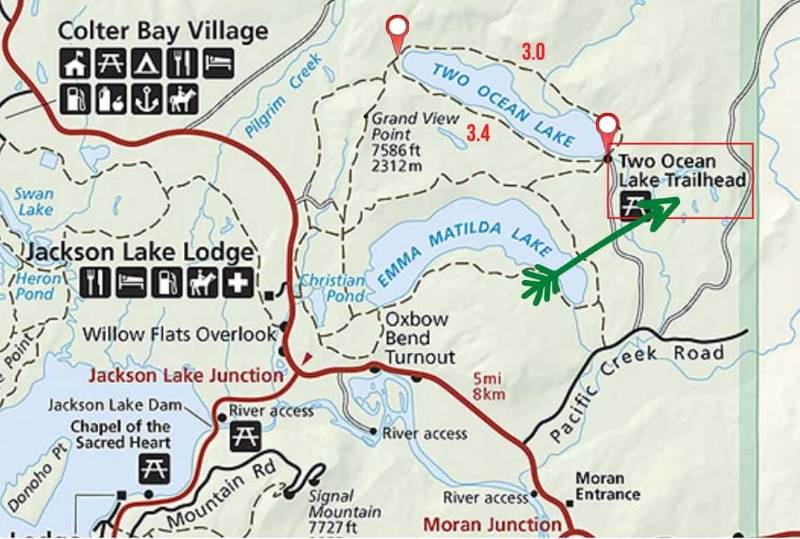
Map of Two Ocean Loop Trail. Image Source: National Park Service / Easy Hikes in Grand Teton
- Roundtrip Distance: 6.4
- Trail Location: Two Ocean Lake Trailhead
- Time: 3.5 hours
- Difficulty: Easy
I really like Two Ocean Lake Loop Trail. It is a peaceful and easy trail that loops around Two Ocean Lake. It goes through forested areas and meadows. The scenery is constantly changing on this trail and in the distance, you can see the Grand Teton Mountain Range.
How to Get to Two Ocean Lake Loop Trail
Two Ocean Lake Loop Trail starts at the Two Ocean Lake Trailhead. To get to the trailhead turn right on Pacific Creek Road, which is located less than a mile from the Moran Entrance.
Once you turn into Pacific Creek Road, continue for about 2 miles until you get to Two Ocean Road.
Turn right onto Two Ocean Road and continue for about 2.4 miles. Make sure to slow down, since the road is just a dirt road, and be on the lookout for potholes. When you reach the end of the road, park your vehicle and the trailhead will be right in front of you.
What You Need to Know About Two Ocean Lake Loop Trail
You can hike this loop in any direction you want. However, I think, doing the loop counter-clockwise is a better option since you will have the views of the Tetons on your left across Two Ocean Lake.
So, start on the east side of the lake and proceed west along the northern shore of the lake.
The trail goes through meadows and forested areas. The scenery constantly changes on this trail. It goes close to the shore and then it wanders off away from the lake.
At about 3 miles, you will reach the west end of the lake and the South Two Ocean Lake Trail Junction.
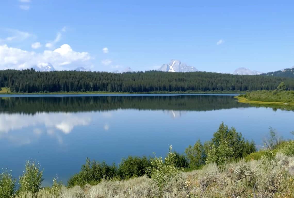
Two Ocean Loop Trail in Grand Teton National Park / Easy Hikes in Grand Teton
If you feel like it, you can extend your hike by about 1.1 miles and hike to Grand View Point. It is a fairly strenuous hike, however, it is all worth it! You will be rewarded with some pretty stunning views of the Tetons.
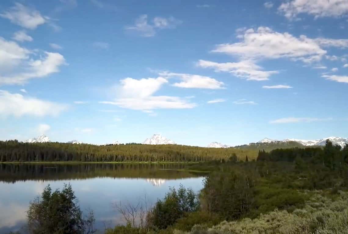
Two Ocean Loop Trail in Grand Teton National Park / Easy Hikes in Grand Teton
If you do not feel like it, then continue your loop on the southern side of Two Ocean Lake going east. You will be passing through beautiful open meadows and through some forested areas.
At about 6.4 miles, you will complete the loop and be back at the trailhead.
Schwabacher Landing Trail
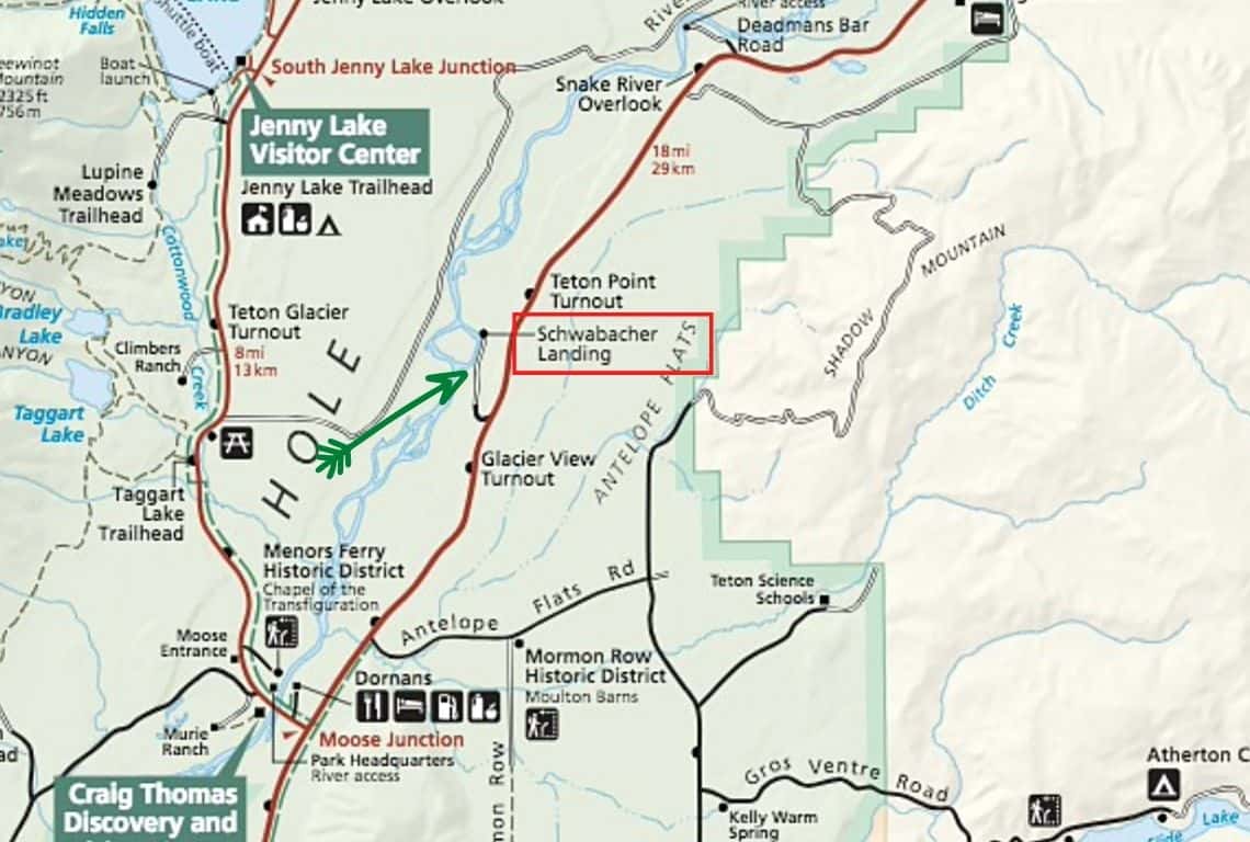
Map of Schwabacher Landing Trail. Image Source: National Park Service / Easy Hikes in Grand Teton
- Roundtrip Distance: 1.3 miles
- Trail Location: Schwabacher Landing
- Time: 30 min – 1 hour
- Difficulty: Easy
Schwabacher Landing Trail is one of my favorite easy hikes in Grand Teton National Park.
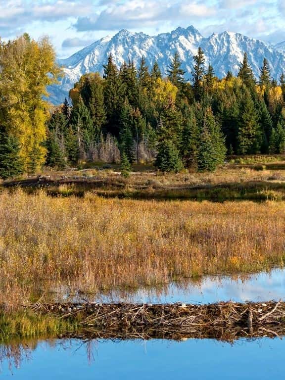
Here, you will see a picture-perfect reflection of the Tetons in the still waters of the Snake River. My recommendation is to be at Schwabacher Landing at sunrise to get the most stunning pictures (weather permitting!).
How to Get to Schwabacher Landing Trail
Schwabacher Landing Trailhead is located about 4 miles north of Moose Junction on HWY 191/89/26.
It is easy to miss the turn-off HWY 191/89/26 that leads to the trailhead. So, make sure to slow down and be on the lookout for the sign pointing to Schwabacher Landing.
Once you make the turn, continue for about 1 mile. Unfortunately, it will be just a dirt road, so slow down and watch out for potholes.
The parking area is a good size, so you should have no problems finding a spot to park your vehicle.
What You Need to Know About Schwabacher Landing Trail
Schwabacher Landing Trail starts right at the parking lot. It will take you on a great hike along the Snake River with the Tetons reflected in the water. So have your camera ready, because you will get some great photo opportunities.
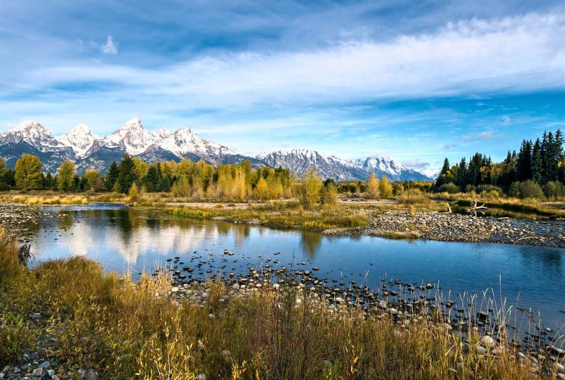
Schwabacher Landing Trail / Easy Hikes in Grand Teton
At about two-tenths of a mile from the trailhead, you will get to a beaver dam. This spot is the best place to see some wildlife. Be on the lookout for moose and elk.
At about four-tenths of a mile, the trail narrows and starts going through the sagebrush. You can end your hike at this point, or continue. At about two-thirds of a mile, the trail ends. It is time to retrace your steps and get back to the trailhead.
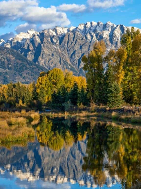
Schwabacher Landing Trail in Grand Teton / Easy Hikes in Grand Teton
Schwabacher Landing Trail in Grand Teton / Easy Hikes in Grand Teton
Intrepid Scout's Tips for Easy Hikes in Grand Teton National Park
That is quite a list of easy hikes in Grand Teton National Park, right? What if you only have time to do a couple of hikes? No problem! Here are my absolute must-do 4 easy hikes in Grand Teton National Park:
- Hands down, the number one must-do easy hike in Grand Teton National Park is Hidden Falls and Inspiration Point Trail. It is a classic that should not be missed!
- Second, my favorite easy hike in Grand Teton National Park is Hermitage Point Trail. It offers unsurpassed views of the Tetons!
- Third, do not miss Schwabacher Landing Trail at sunrise. It just doesn’t get any better than to see the Tetons reflected in the waters of the Snake River.
More Helpful Posts About Grand Teton National Park:
15 Things You Can’t-Miss on Your First Visit to Grand Teton National Park
7 Amazing Places to Stay in Grand Teton National Park
17 Most Scenic Hikes in Grand Teton National Park You Need to Explore
5 Best Places to See Wildlife in Grand Teton National Park (Maps +Tips)
6 Best Photography Locations in Grand Teton (+Useful Photo Tips)
Did You Find This Useful?
Why Not Save Easy Hikes in Grand Teton to Your Pinterest Board!
Now, It Is Your Turn, I Would Like to Hear Back from You!
Are you planning your trip to Grand Teton National Park?
Please let me know! Drop me a quick comment right below!
Click on any of the images below to get inspired and to help you with the planning process for your trip to Grand Teton National Park!

Comments:
2 thoughts on “11 EASY HIKES in GRAND TETON Perfect for Beginners (Maps+Tips)”
Anna,
We appreciate your rapid reply to our inquiry. e used Janet Chapple’s “Yellowstone Treasures” as our primary source in planning our detailed daily trip itineraries. It included pairs of mileage post (for use in either direction) of the distances between overlooks/pullouts for the main attractions. We had hoped that you might have compiled that information for your own visit or could perhaps recommend or suggest a reference source.
In planning all of our annual fall trips to the national parks of the US and Canada we start with the particular park(s) official website, TripAdvisor and Google articles.
Our small group (three senior couples) of retired teachers don’t hike as much or as far as we did in the past due to age and physical limitations. However, we will take the shuttle and hike to Hidden Falls and, perhaps Inspiration Point and around Mormon Row and Menor’s Ferry, to name two in GTNP.
Regards,
Jill & Les
Hi Jill and Les,
Sounds like you are great planners! I am the same way. I take time to plan and research each destination before I go. I truly enjoy the process. It makes the experience so much richer.
Good luck with everything!
Anna