This site uses affiliate links, meaning that if you make a purchase through our links, we may earn an affiliate commission.
Iceland – The Land of Ice and Fire, known for the Northern Lights, Blue Lagoon, volcanoes, glaciers, spectacular glacier caves, waterfalls, black-sand beaches, puffins, and the list goes on is a must-see destination.
Here is an amazing Iceland Ring Road itinerary that will take you to the most unforgettable places in Iceland. This itinerary can easily be adjusted from 7 to 10 days to accommodate your schedule.
- 1. Map of Iceland Ring Road Itinerary
- 2. Iceland Ring Road Itinerary - 7 to 10 Days (with 43 Best Stops)
-
- 2.1. DAY 1 of Iceland Road Ring Itinerary
-
- 2.1.1. Thingvellir National Park
- 2.1.2. Geysir Geothermal Area
- 2.1.3. Gullfoss (Golden Waterfall)
- 2.1.4. Kerid Crater
- 2.2. DAY 2 of Iceland Road Ring Itinerary
-
- 2.2.1. Seljalandsfoss Waterfall
- 2.2.2. Skogafoss Waterfall
- 2.2.3. Dyrholaey Lighthouse and Arch
- 2.2.4. Reynisfjara (Black Sand Beach) and Reynisdrangar
- 2.2.5. Fjadrargljufur Canyon
- 2.2.6. Svartifoss (Black Waterfall)
- 2.2.7. Hofskirkja Turf Church
- 2.3. DAY 3 of Iceland Ring Road itinerary
-
- 2.3.1. Diamond Beach
- 2.3.2. Jokulsarlon Glacier Lagoon
- 2.3.3. Stokksnes Peninsula
- 2.3.4. Seydisfjordur
- 2.4. DAY 4 of Iceland Ring Road itinerary
-
- 2.4.1. Studlagil Canyon
- 2.4.2. Dettifoss Waterfall
- 2.4.3. Krafla Volcanic Caldera
- 2.4.4. Hverir Geothermal Area
- 2.4.5. Grjotagja
- 2.4.6. Hverfjall Volcano
- 2.4.7. Dimmuborgir Lava Field
- 2.4.8. Skutustadir Pseudocraters
- 2.5. DAY 5 of Iceland Ring Road itinerary
-
- 2.5.1. Husavik Whale-Watching Tour
- 2.5.2. Godafoss Waterfall
- 2.5.3. Siglufjordur
- 2.5.4. Trollaskagi Lighthouse
- 2.6. DAY 6 of Iceland Ring Road Itinearay
-
- 2.6.1. Hofsos Village
- 2.6.2. Glaumbaer Farm and Museum
- 2.6.3. Vidimyrarkirkja Turf Church
- 2.6.4. Kolugljufur Canyon and Kolufossar Waterfalls
- 2.6.5. Hvitserkur
- 2.6.6. Viking Longhouse at Eiriksstadir
- 2.7. DAY 7 of Iceland Ring Road Itinerary
-
- 2.7.1. Mount Kirkjufell and Kirkjufellsfoss Waterfall
- 2.7.2. Svodufoss Waterfall
- 2.7.3. Skardsvik Beach
- 2.7.4. Ondverdarnes Cape and Ondverdarnesviti Lighthouse
- 2.7.5. Saxholl Crater
- 2.7.6. Djupalonssandur - Black Lava Pearl Beach
- 2.7.7. Arnarstapi
- 2.7.8. Raudfeldsgja Gorge
- 2.7.9. Gerduberg Cliffs
- 2.8. DAY 8 of Iceland Ring Road Itinerary
-
- 2.8.1. Blue Lagoon
Map of Iceland Ring Road Itinerary
Iceland Ring Road Itinerary – 7 to 10 Days (with 43 Best Stops)
Iceland Ring Road Itinerary - 7 to 10 Days (with 43 Best Stops)
DAY 1 of Iceland Road Ring Itinerary
- Driving Distance: 167 miles
- Driving Time: 3 hours, 51 minutes
- Stops:
1. Thingvellir National Park
2. The Geysir Geothermal Area
3. Gullfoss Waterfall
4. Kerid Crater
Thingvellir National Park
What you need to know is that Thingvellir, the Geysir Geothermal Area, and Gullfoss Waterfall are part of Iceland’s famous and very popular area known as the Golden Circle.
Needless to say, Thingvellir National Park is a fascinating place and I am excited to start your Iceland Ring Road itinerary in Thingvellir.
Thingvellir has an interesting historical heritage as well as some incredible geological traits.
First of all, the Althing, an open-air assembly representing the whole of Iceland, was established in Thingvellir in 930 and continued to meet until 1798.
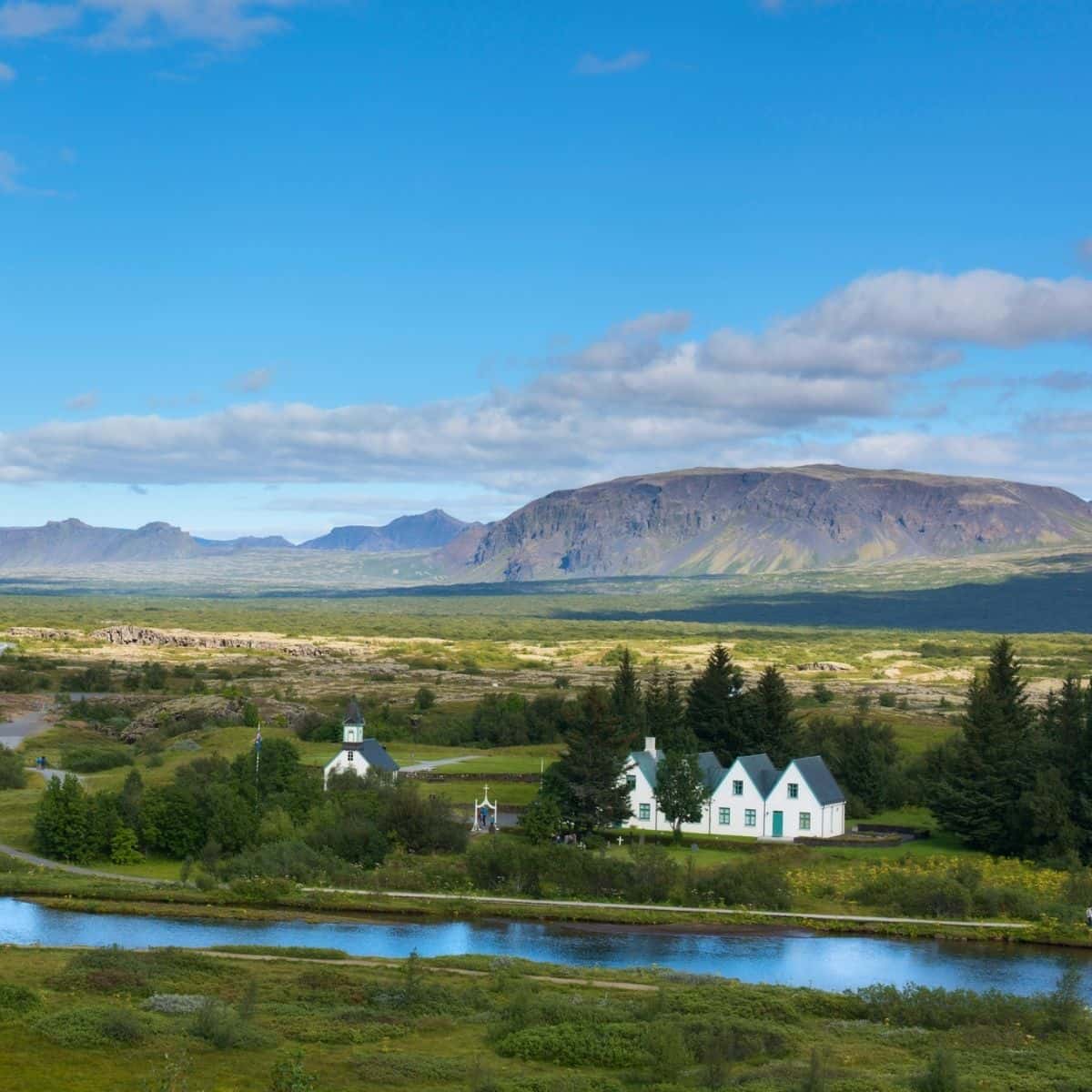
Thingvellir National Park / Iceland Ring Road Itinerary
Second, Thingvellir is the place where you can see the edges of North American and Euroasian plates known as the Mid-Atlantic Rift. The tectonic plates move apart at approximately 2.5 centimeters a year!
What is incredible is that you can snorkel or dive in between the continental plates in one of the ravines called Silfra. The water in the ravine is filled with the meltwater from Langjokull Glacier and it is famous for being crystal clear enabling visibility of over a hundred meters.
If snorkeling or diving in Silfra is something you want to add to your Iceland bucket list then check out DIVE.IS Silfra: Snorkeling Between Tectonic Plates. If they are totally booked then see if Silfra Fissure Arctic Adventures: Silfra Drysuit Snorkeling has any open spots.
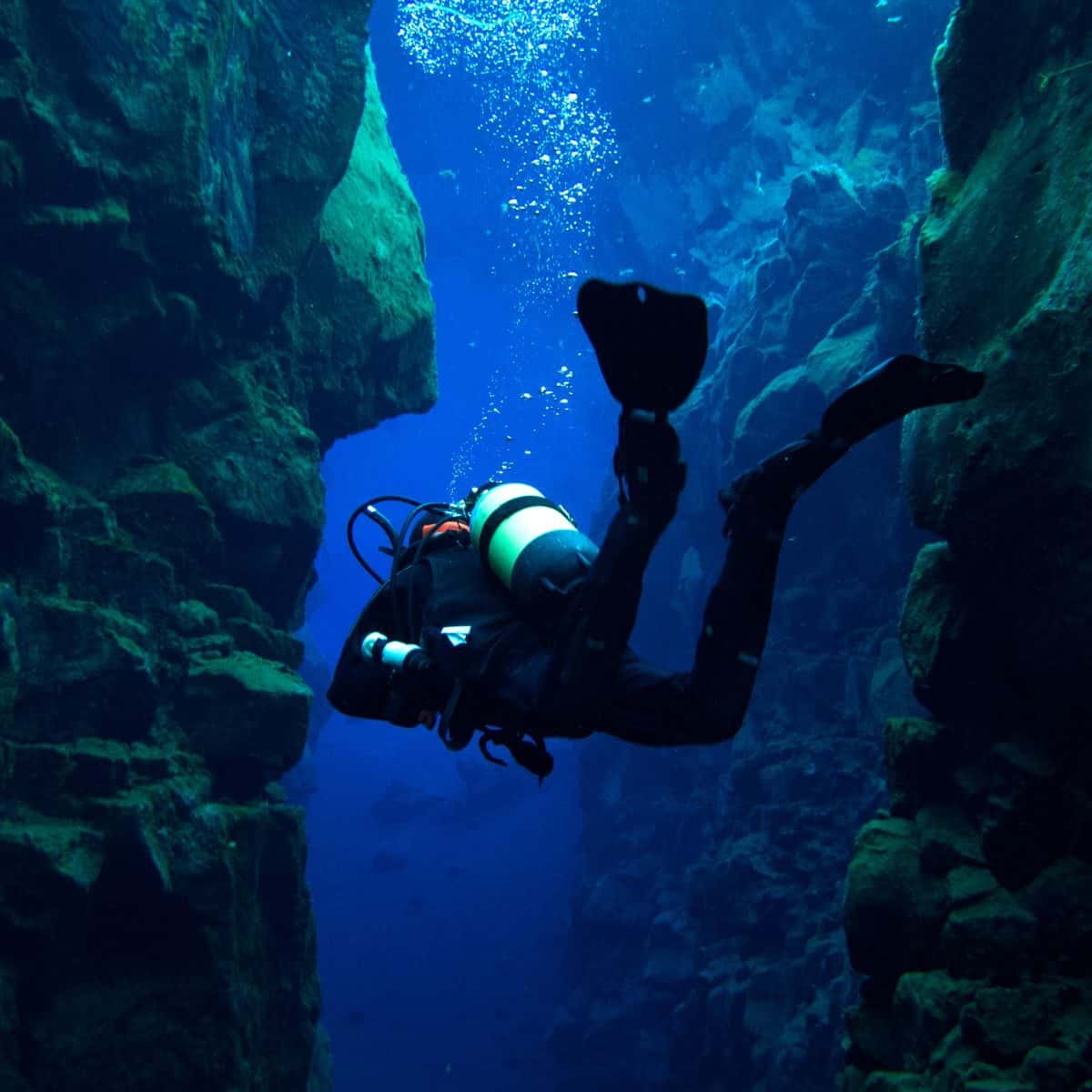
Silfra / Iceland Ring Road Itinerary
Geysir Geothermal Area
The next stop is the Geysir Geothermal Area.
The main feature of the Geysir Geothermal Area used to be the famous Geysir. However, currently, it is dormant. You can still stop by it and marvel at the colorful geyserite along the perimeter of Geysir.
Nowadays, the main attraction is Strokkur. It erupts approximately every 8 minutes and explodes 25-35 meters into the air.
Another spot you should not miss is Blesi, which are two hot springs that have an incredible blue color and are separated into two round shapes at look like two blue eyes.
Mt. Laugarfjall towers over the Geysir Geothermal Area and I want to encourage you to hike up to the top. It is a short hike and it is totally worth it. There are a couple of observation platforms and you will get to enjoy some stunning views of the area.
On the way out, make sure to stop at Litli-Geysir and Smidur which are small holes with boiling and bubbling water. You might get lucky and see them erupt!
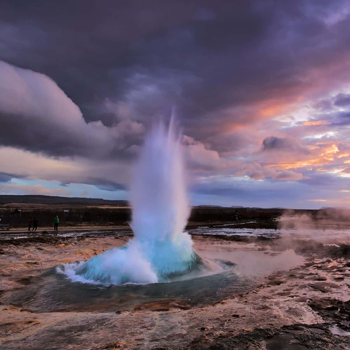
Strokkur in Geysir Geothermal Area / Iceland Ring Road Itinerary
Gullfoss (Golden Waterfall)
You are going to be in awe when you see Gullfoss (Golden Waterfall)! It cascades 32 meters in two spectacular stages. The canyon walls surrounding Gullfoss reach heights of up to 70 meters composing a dramatic scenery.
You can really see the power of Gullfoss during the summer months when approximately 140 cubic meters of water surge down every second.
There are several viewing platforms, so make your way up there for some spectacular views of the waterfall and Gullfossgjufur Canyon.
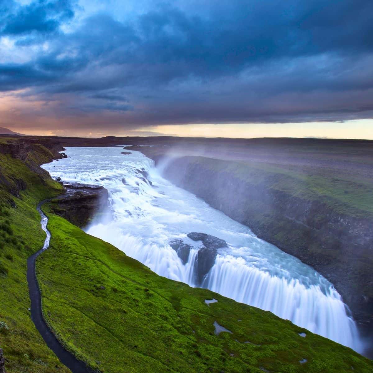
Gullfoss / Iceland Ring Road Itinerary
Stop for a bite to eat at Fridheimar Tomato Farm and Restaurant. It is definitely a unique dining experience. The farm harnesses geothermal energy and uses artificial lights and a climate-control system to grow tomatoes and other vegetables all year round. They serve all kinds of dishes all tomato-inspired right in their greenhouse. If you are visiting in the summertime, you might want to catch their horse show as well.
Kerid Crater
Kerid Crater is one of the most visually stunning places in Iceland. The vivid red caldera dotted with bright green vegetation surrounding the bright, sapphire-colored waters of the crater lake will take your breath away!
The reason why Kerid’s slopes are such a bright red color is due to the iron deposits. And, since Kerid is a youngster compared to other volcanic craters in Iceland the deposits have not turned black yet.
There is a path that goes around the crater’s perimeter and if you are to it, you can hike down to the lake.
Have some cash on hand, because there is an entrance fee of 450 ISK to see Kerid Crater (collected by the landowners as of February 2023).
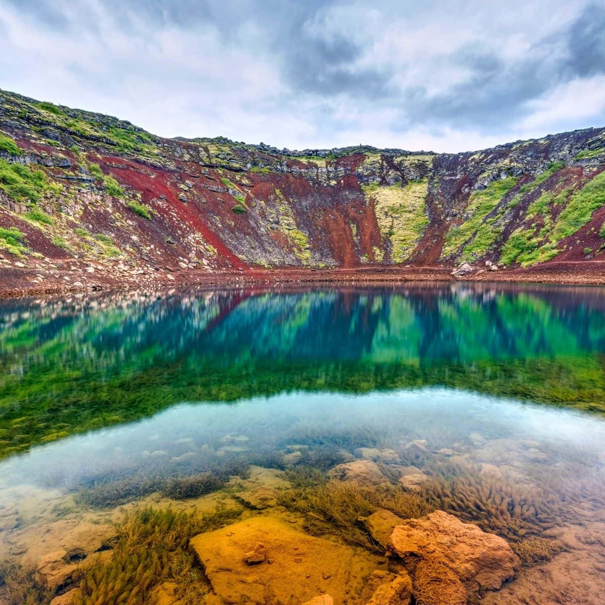
Kerid Crater / Iceland Ring Road Itinerary
My recommendation is to stay in Hella.
The two places that I stayed at are Stracta Hotel, which is mid-range (breakfast included), and Hotel Ranga, which is more expensive (breakfast included as well). Both of them have restaurants on-site, which makes it convenient.
DAY 2 of Iceland Road Ring Itinerary
- Driving Distance: 204 miles
- Driving Time: 4 hours, 40 minutes
- Stops:
1. Seljalandsfoss Waterfall
2. Skógafoss Waterfall
3. Dyrhólaey Lighthouse and Arch
4. Reynisfjara Beach
5. Fjaðrárgljúfur Canyon
6. Svartifoss
7. Hofskirkja
Seljalandsfoss Waterfall
Seljalandsfoss Waterfall is a stunning waterfall that is fed by the melting water from a famed glacier-capped Eyjafjallajokull Volcano (this is the same volcano that erupted in 2010).
Seljalandsfoss Waterfall cascades over steep cliffs some 60 meters down into a meadow dotted with pretty flowers (if you are visiting in the summertime!).
The main attraction here is a path that leads behind Seljalandsfoss Waterfall into a small cave. Once in the cave, you will get this iconic view of the curtain of water in front of you.
Make sure to protect your camera and wear a rain jacket or a poncho!
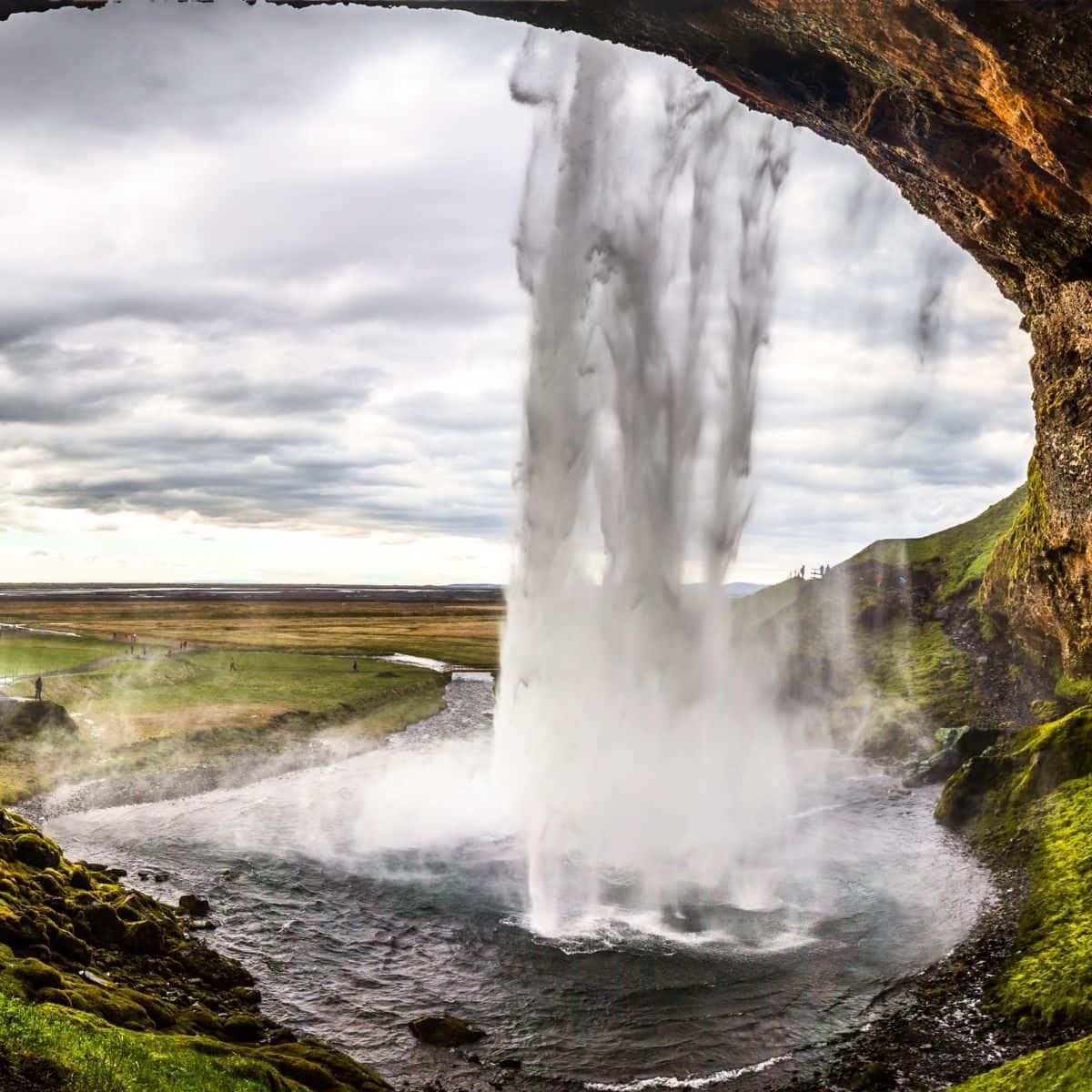
Seljalandsfoss Waterfall / Iceland Ring Road Itinerary
After you visit Seljalandsfoss Waterfall, continue hiking north for no more than 5-10 minutes. Soon, you will reach another stunning waterfall called Gljufrabui.
Glijufrabui Waterfall is hidden behind a rock face and as a result, it is often missed. However, it is unique because it falls from a concave cliff and you can photograph the cascading water from different angles. Hands down, you will be impressed by this waterfall!
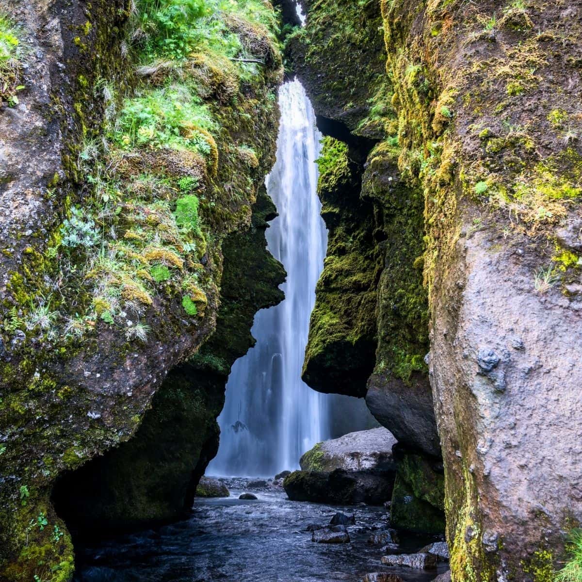
Gljufrabui Waterfall / Iceland Ring Road Itinerary
Skogafoss Waterfall
You will be able to see Skogafoss Waterfall right from the Ring Road and it is an absolutely picture-perfect view!
Skogafoss is one of Iceland’s biggest waterfalls with a width of 25 meters and a drop of 60 meters. It is a famous spot to see single or double rainbows on sunny days due to the amount of mist it produces.
You will be able to walk up quite close to it, however, a rain jacket or a poncho would be great. Also, protect your camera!
If you are up to it, then you should hike up to the observation platform to get an above view of the waterfall.
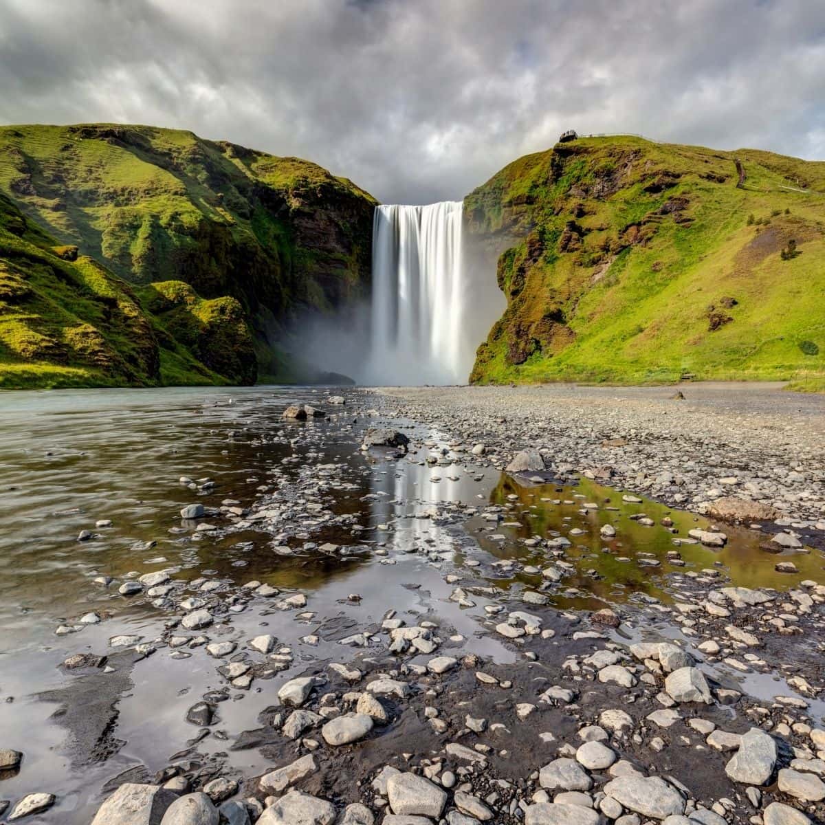
Skogafoss Waterfall / Iceland Ring Road Itinerary
Dyrholaey Lighthouse and Arch
Dyrholaey is a small peninsula famous for its picturesque Dyrholaey Lighthouse and Arch, and stunning views of the Black Sand Beach and black lava columns Reynisdrangar.
To get there, from the Ring Road turn right onto Road 218 and continue for no more than 10-15 minutes until you reach a junction. Turn right at the junction and continue for about 10 minutes until you reach the parking area.
Hands down, the views are breathtaking here!
To the north of you will be Myrdalsjokull Glacier, to the east will the black lava columns Reynisdrangar and to the west, you will be able to see the Black Sand Beach stretching for miles, and then right in front of you will be the famous Dyrholaey Arch.
What is really cool is that you can walk on the arch!
The name Dyrholaey means door hill island in Icelandic. The power of the ocean waves over the centuries has worn the black basalt rock into a 120-meter-high arch.
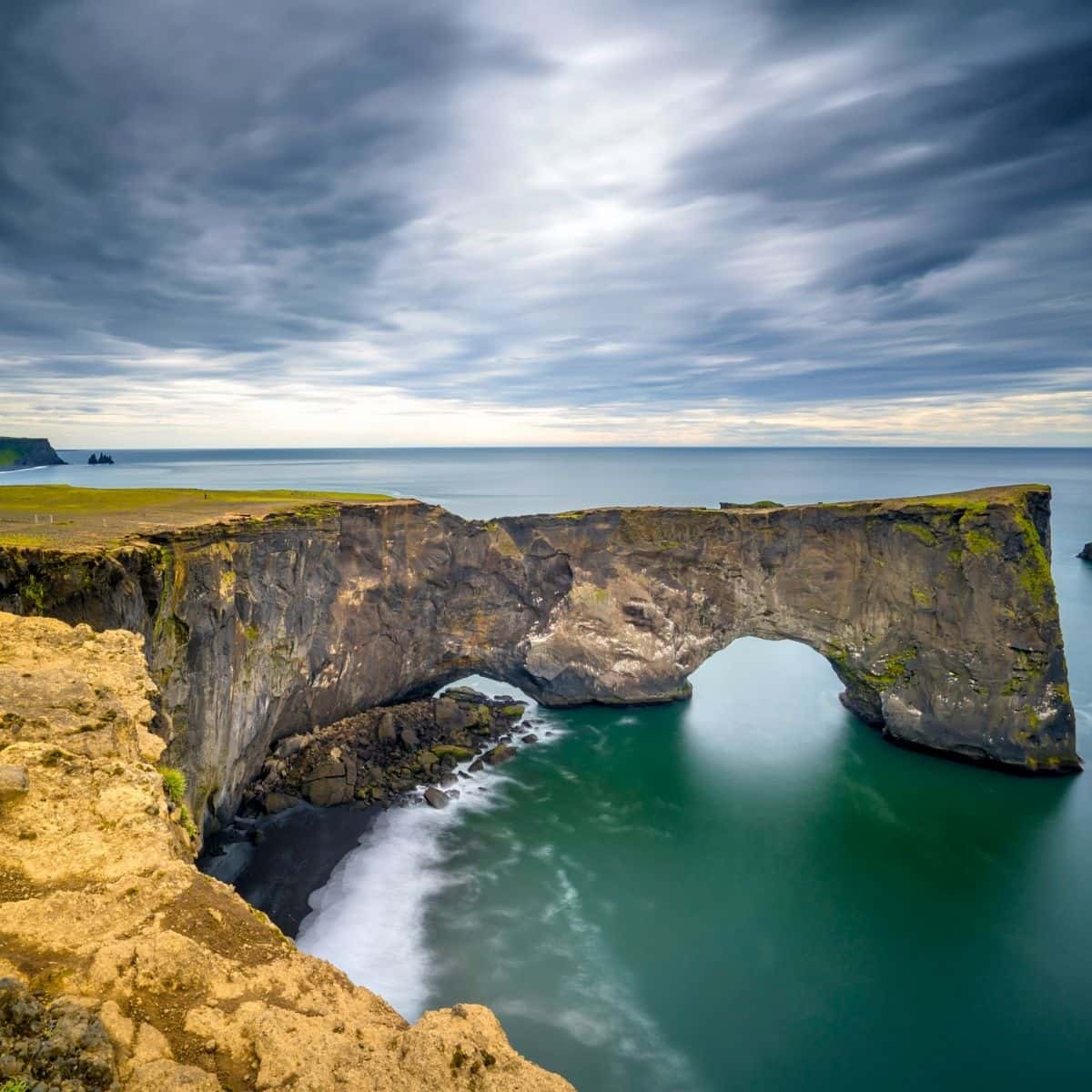
Dyrholaey Arch / Iceland Ring Road Itinerary
When you are ready drive back to the junction and then turn right and drive to the lower section of the peninsula. Here, you will be able to see a cool-looking sea stack called Arnardrangur Eagle Rock. There are many boardwalks that you can take and look for puffins.
If the tide is low then you can venture out to the black beach. However, be warned that the waves can be very strong and powerful!
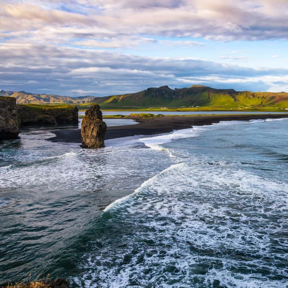
Arnardrangur Eagle Rock / Iceland Ring Road Itinerary
Dyrholaey is closed to the public during the nesting season (usually at the beginning of May and then limited access until the middle of June). The lower section should be open at all times. Make sure to check at a local information center.
Puffins make their nests in Dyrholaey’s grassy hills. Be on the lookout for arctic terns as well, however, a word of caution, they are very protective of their nests, so make sure to keep your distance.
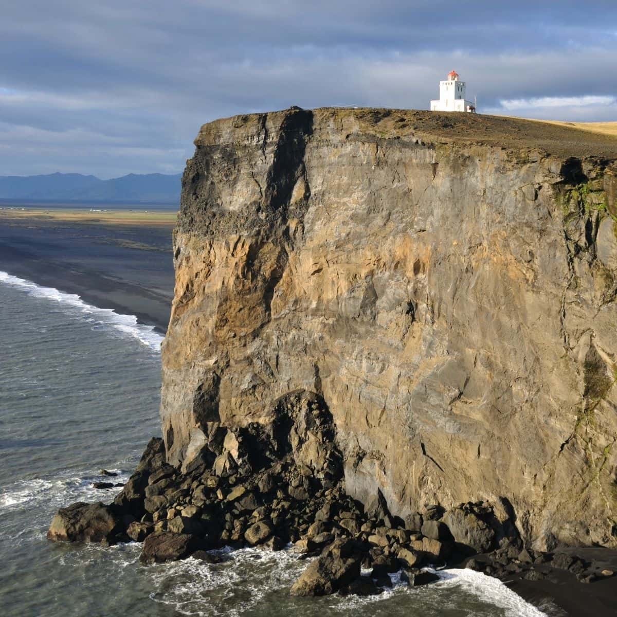
Dyrholaey Lighthouse / Iceland Ring Road Itinerary
Reynisfjara (Black Sand Beach) and Reynisdrangar
Reynisfjara is a beautiful black sand beach famous for, of course, the black sand, but also for stunning views of Reynisdrangar sea stacks near the shore of the beach, basalt columns, and Halsaneshellir Cave.
Reynisdrangar spiky basalt sea stacks jut from the ocean 66 meters into the air. And, a legend says that the stacks originated when two trolls dragged a three-masted ship to land unsuccessfully and when daylight broke they became needles of rock.
Another unique sight is the extraordinary basalt column formations and vaulted basalt column Halsaneshellir Cave.
Just a word of caution here! The waves could be very strong and dangerous. Make sure that you are venturing out to this area during the low tide and on a calm day.
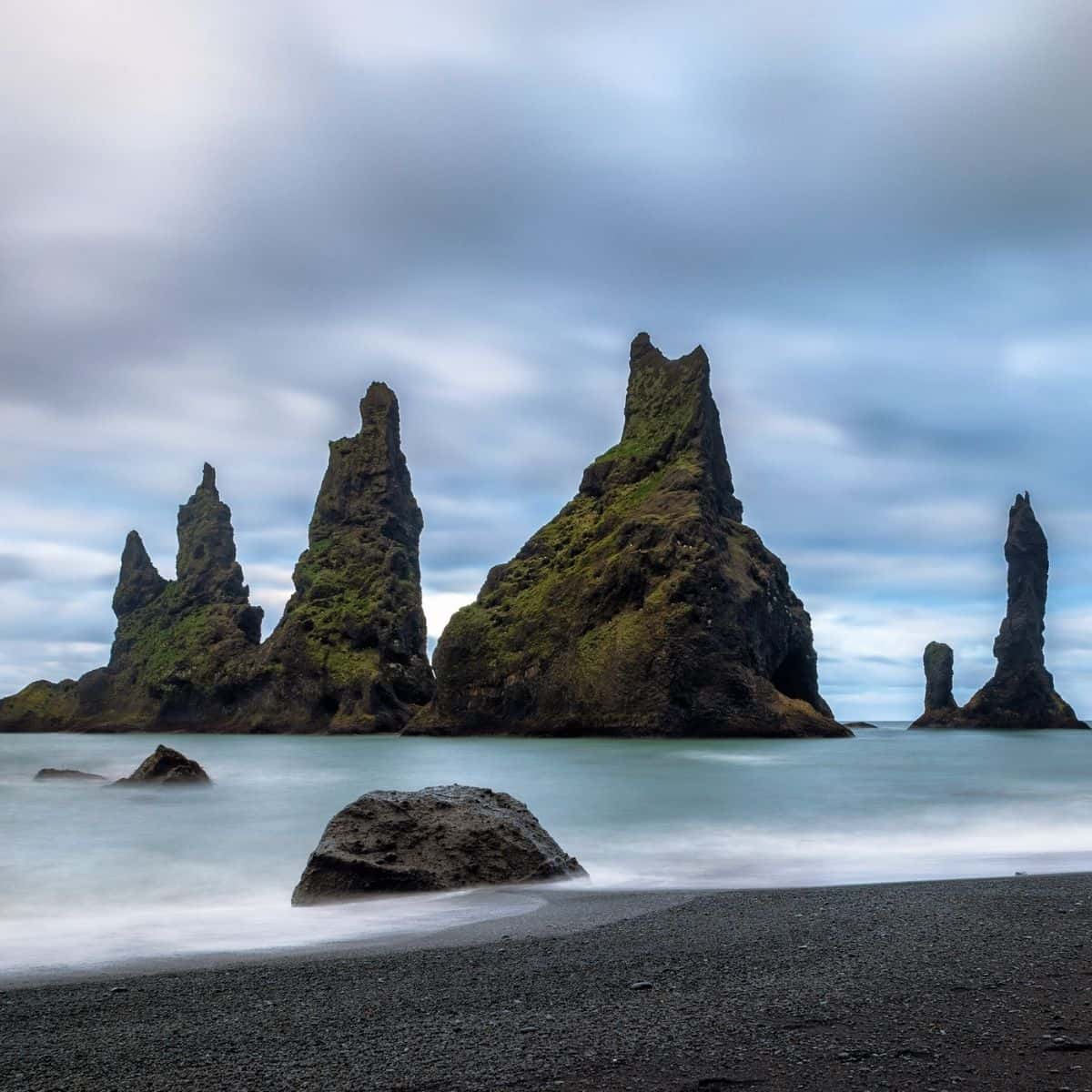
Reynisdrangar Sea Stacks / Iceland Ring Road Itinerary
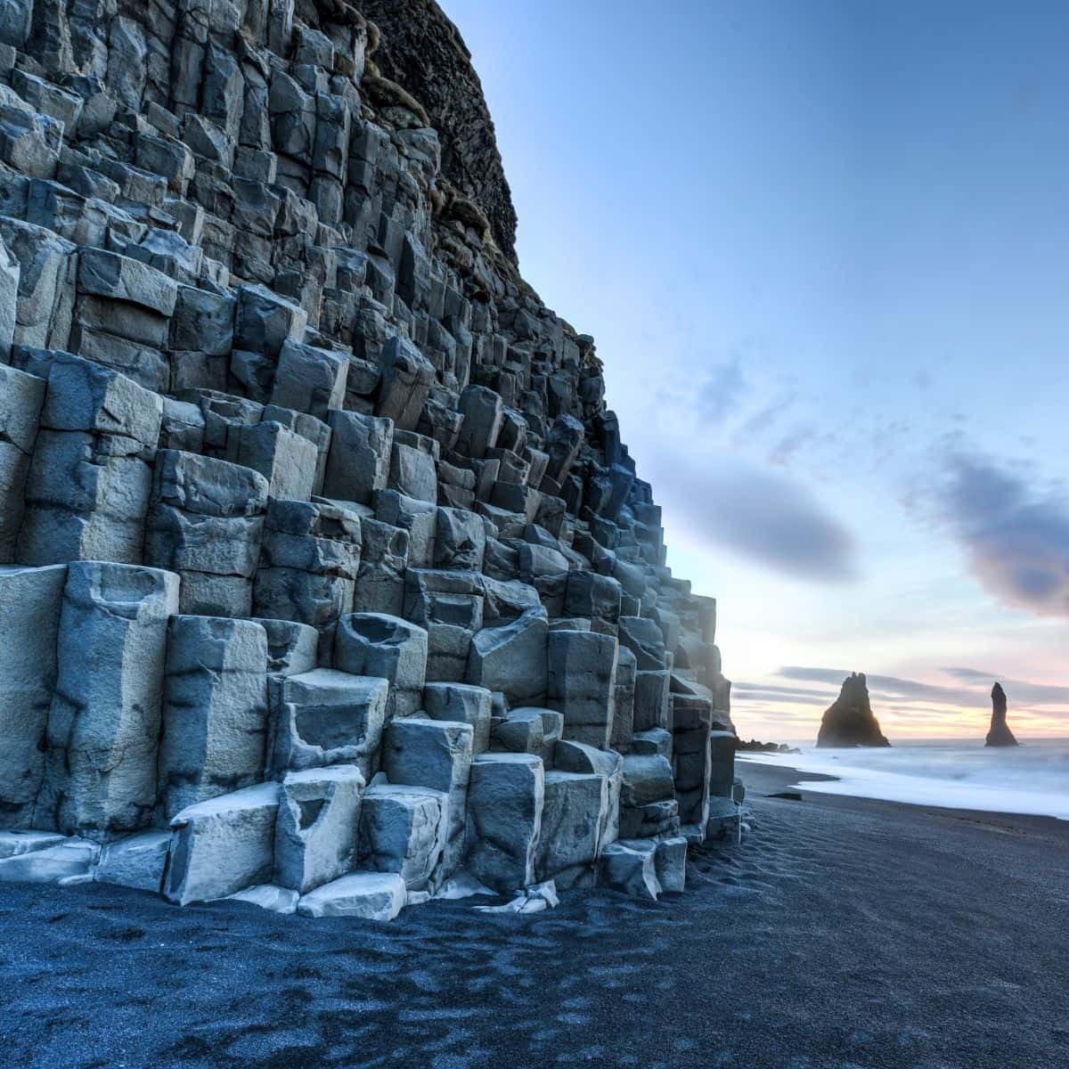
Reynisdrangar Basalt Column Formations / Iceland Ring Road Itinerary
Fjadrargljufur Canyon
Next is the grand Fjadrargljufur Canyon! In my opinion, it is one of the most stunning canyons that you will ever see.
When you reach Road 206 on Ring Road, turn left and continue for about 3 km until you reach a parking lot.
Fjadrargljufur Canyon or Feather River Canyon is truly an incredible sight. It is 100 m deep and 2 km long. It is famous for its stunning twisting walls covered with moss and the Fjadra River flowing through it.
There is a marked path starting from the parking lot that leads along the top of the canyon to several great viewpoints.
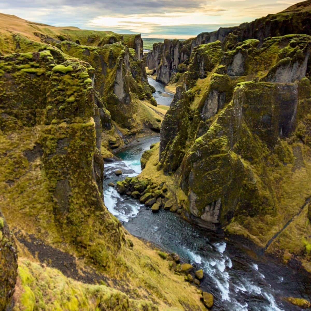
Fjadrargljufur Canyon / Iceland Ring Road Itinerary
Svartifoss (Black Waterfall)
The next stop is Svartifoss Waterfall (Black Waterfall).
Although it is only a single-drop waterfall, it is visually stunning by being surrounded by hexagonal basalt columns.
These columns were created by the cooling and contracting of lava which causes the ground to crack into long, geometric columns. This process is called columnar jointing.
The basalt columns have provided inspiration for Icelandic architects, most visibly in the Hallgrímskirkja church in Reykjavík, the National Theatre, and the church in Akureyri
It takes no more than 1-1.5 hours (2 km) to get to the waterfall from the parking lot. The hike is slightly up the hill. On the way to Svartifoss, you will pass by Heygotufoss and Hundafoss Waterfalls.
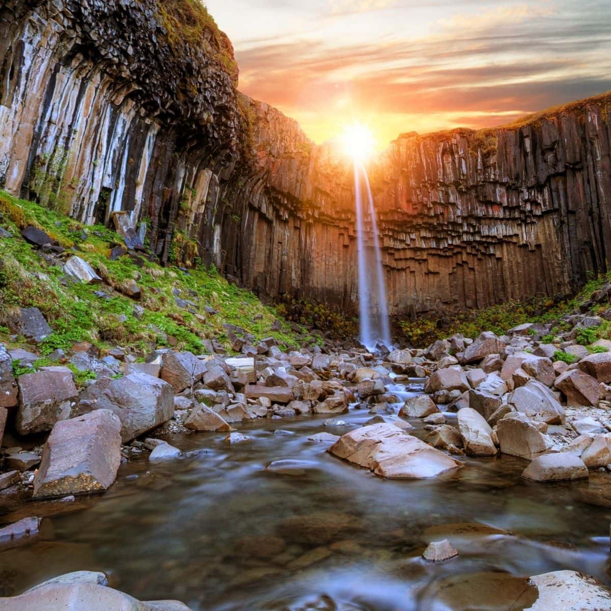
Svartifoss Waterfall / Iceland Ring Road Itinerary
Hofskirkja Turf Church
Hofskirkja Turf Church is one of the only 6 turf churches still in existence. It was built near the end of the 18th century. Its walls are made of rock and the roof is made of stone slabs all covered with turf.
By the church, you will find lots of mounds. These are the graves that are part of the nearby cemetery.
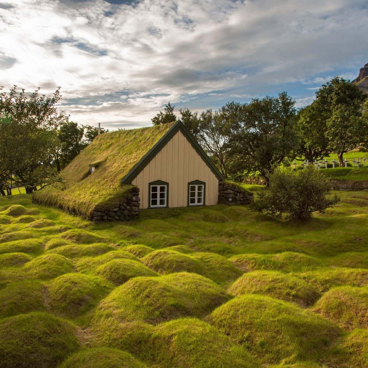
Hofskirkja Turf Chruch / Iceland Ring Road Itinerary
I have always stayed at Fosshotel Glacier Lagoon. It is my top choice in the area near Skaftafell. It is a beautiful hotel with all kinds of amenities. My recommendation is to splurge and enjoy!
After you check into your hotel, take a short drive to Eystri-Fellsjara Diamond Beach. it is no more than a 20-minute drive from Fosshotel Glacier Lagoon.
Diamond Beach is an incredible black beach with huge chunks of ice scattered on the beach and floating in the water. And, at sunset is simply an amazing view! If you are not up to it, it is ok, you will be there tomorrow morning!
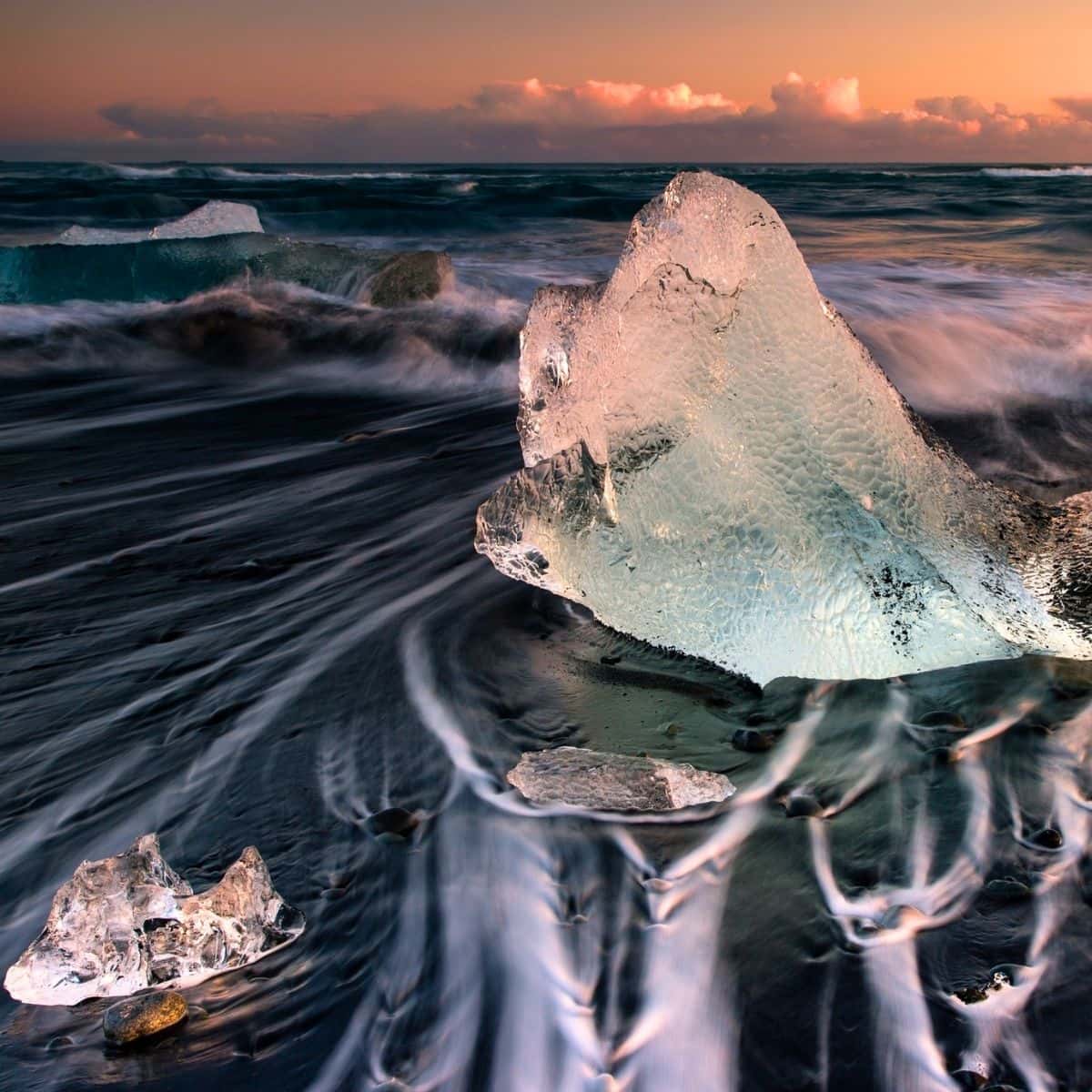
Eystri-Fellsjara Diamond Beach at Sunset / Iceland Ring Road Itinerary
DAY 3 of Iceland Ring Road itinerary
- Driving Distance: 300 miles
- Driving Time: 6 hours, 38 minutes
- Stops:
1. Diamond Beach
2. Jokusarlon Glacier Lagoon
3. Stokksnes
4. Seydisfjordur
Diamond Beach
If you went to Diamond Beach for sunset the day before, then, trust me, it is going to look so different during the day. So, my recommendation is to start your day at Diamond Beach.
This black beach is covered with glistening chunks of ice that broke from Vatnajokull Glacier and floated from Jokulsarlon Lagoon to Diamond Beach. And, once you see it, you will be in awe!
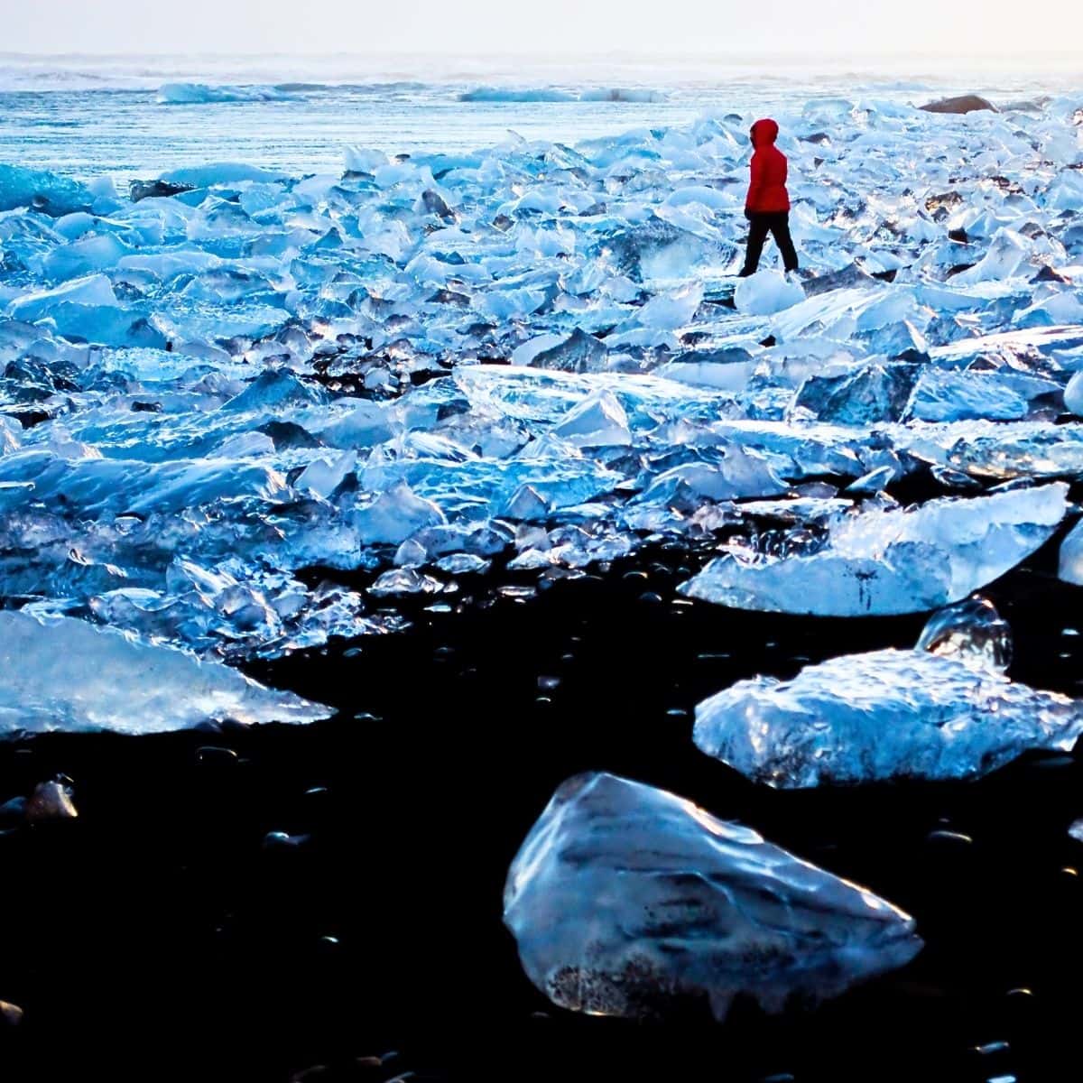
Diamond Beach / Iceland Ring Road Itinerary
Jokulsarlon Glacier Lagoon
Jokulsarlon is a large glacial lagoon at the foot of the Vatnajokull Glacier. As the ice melts, giant icebergs break away from the glacier. It is quite a sight to see them floating in the lagoon and gently moving toward the ocean and finally being washed on the shore of Diamond Beach.
What is very special is that the giant icebergs come not only in different sizes and shapes but also they appear in different colors ranging from bright blue to milky white as well as being translucent.
What you need to know is that the Jokulsarlon Glacier Lagoon has increased in size 4 times since the 1970s. It is a perfect example of the destructive impact of global warming on the Vatnajokull Glacier which is melting at an alarming rate.
The best way to explore Jokulsarlon Glacier Lagoon is to join a tour. There are different tours available. I am recommending Jokulsarlon Glacier Lagoon Tour. They offer Zodiac Tours and Amphibian Tours. Hands down, you should go on a Zodiac Tour. On the Zodiac boat, you will be able to cover large areas of the glacier lagoon and get closer to the icebergs than on the amphibian. In addition, these are small group tours!
Besides fabulous icebergs, you will be able to see many seals lounging on the icebergs. And, if you like birdwatching, then you might be able to cross arctic terns, seagulls, and great skuas off your Iceland bird list.
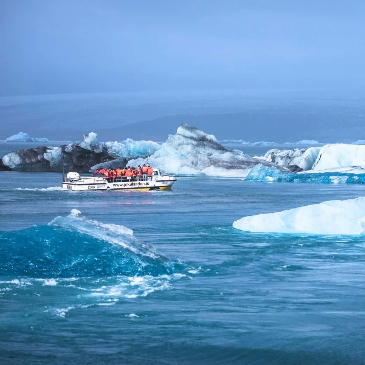
Jokulsarlon Glacier Lagoon / Iceland Ring Road Itinerary
Stokksnes Peninsula
Stokksnes Peninsula is one of the most picturesque spots you will visit in Iceland.
In the distance, you will see the stunning Vestrahorn Mountains, and in front of you will be a long stretch of black sand beach with sand dunes dotted with tufts of grass. It is a picture-perfect sight!
Now, what makes this area so unique is the reflection of the Vestrahorn Mountains in the lagoon at the foot of the mountain with the back sand beach in the foreground. It is truly a photographer’s dream!
Not far from the beach, you will find an abandoned Viking Village which was built in 2010 for Icelandic director Baltasar Kormakur. Also, there is a lighthouse, but neither of these places is anything that you need to add to your list of places to visit.
Make sure to have some cash ready or your credit card handy. Stokksness is located on privately owned land. There is a fee of 900 ISK to enter the peninsula which you can pay at the Viking Cafe operated by the owner of the land.
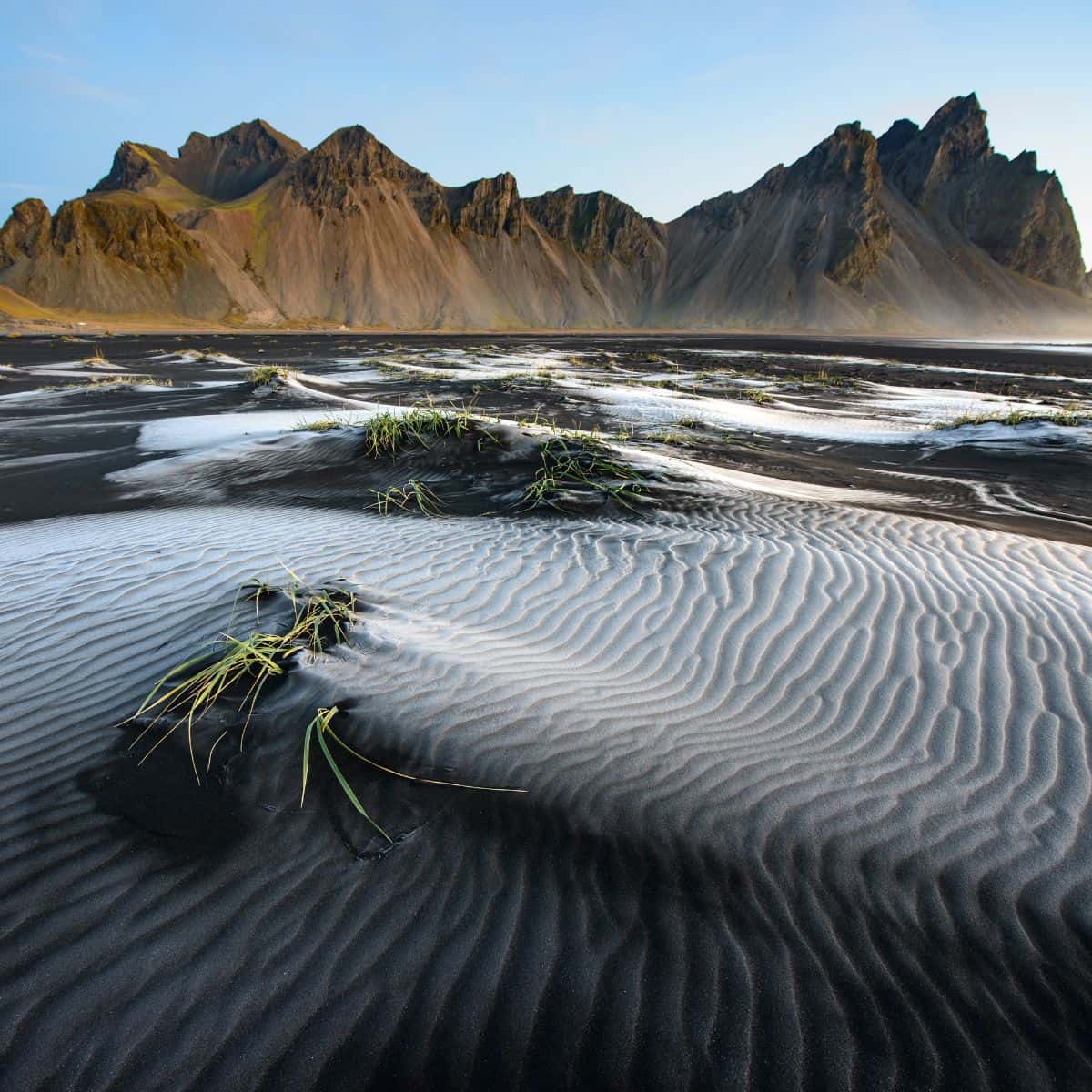
Stokksnes Peninsula / Iceland Ring Road Itinerary
Seydisfjordur
Seydisfjordur is a small picturesque town that sits on the fjord. It is located about 30 minutes from Ring Road.
The road leading to it has some of the most breathtaking scenery. It climbs over a snow-capped mountain pass (expect to see snow even during the summer months). Next, you will travel into a valley and continue along the Fjadrara River.
Right before you reach Seydisfjordur, you will be passing by Gufufoss Waterfall. There is a small parking lot, so pull over and snap a few pictures of this gorgeous waterfall.
However, what draws tourists to Seydisfjordur is an iconic Blue Church Seydisfjardarkirkja with a rainbow path leading to it.
The street is also lined with many cafes and souvenir shops, so make sure to stop for a bite to eat and check out a couple of shops.
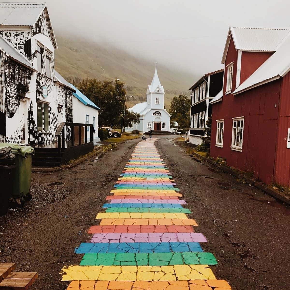
Seydisfjordur / Iceland Ring Road Itinerary
My recommendation is to stay in Egilsstadir. There are plenty of places to choose from. I stayed at Hotel Eyvindara and Gistihusid Lake Hotel. Hotel Eyvindara is a seasonal hotel with simple rooms and cabins. Gistihusid Lake Hotel is fancier and located right at the lake.
However, another place that I want you to check out is about an hour away from Egilsstadir. It is called Borgarfjordur and it is a small fishing village. I stayed at Blabjorg Resort. It is a special place, remote and you will feel like you are at the end of the world! Plus, if you are a birdwatcher and puffins are on your list of birds to see, then Borgartjordur is the place to go.
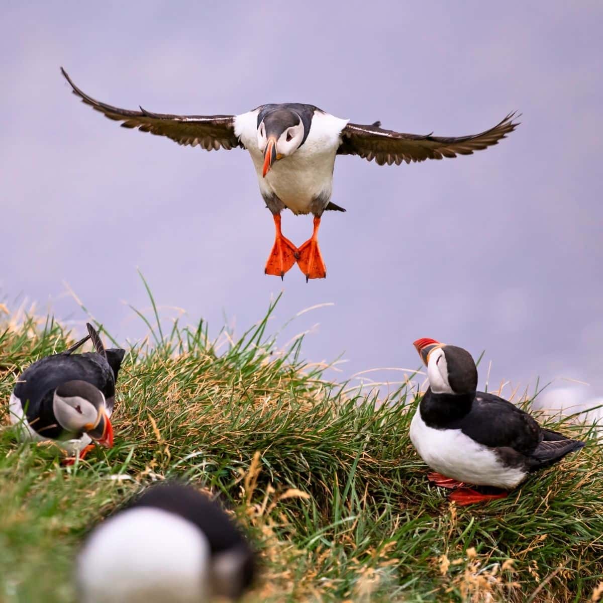
Puffins in Borgarfjordur / Iceland Ring Road Itinerary
DAY 4 of Iceland Ring Road itinerary
- Driving Distance: 256 miles
- Driving Time: 6 hours, 36 minutes
- Stops:
1. Studlagil Canyon
2. Detifoss Waterfall
3. Krafla Caldera
4. Heverir Geothermal Area
5. Grjotagja
6. Hverfjall Volcano
7. Dimmuborgir Lava Field
8. Skutustadir Psueudocraters
Studlagil Canyon
Ok, so the first stop today is Studlagil Canyon. I saw this canyon several times and every time I am in awe of how amazing it is! It has the largest number of basalt rock columns in Iceland and a stunning blue-green glacial river flowing through it.
Studlagil Canyon was created by a glacial river. However, it was inaccessible and completely submerged under the Jokla River until 2009 when a hydroelectric plant was built. The water level decreased and revealed stunning hexagonal basalt rock columns framing the canyon.
These hexagonal columns are formed in a process called columnar jointing. It happens when basaltic lava flows and cools slowly over time and cracks into symmetrical patterns.
Studlagil Canyon is not super easy to get to, which is kind of challenging and special. It is an off-the-beaten-path destination making it one of Iceland’s hidden gems.
What you need to know is that there are 2 viewpoints. One is on the west side and the second is on the east side of the canyon. My recommendation is to head directly to the viewpoint on the east side of the canyon for the best views.
Now, if you just type Studlagil Canyon into Google Maps, it will give you directions to the west side view of the canyon. This is not what you want. You need directions to the east-side viewpoint and here is how to do it:
- From Ring Road turn onto Road 923.
- From road 923 turn into a dirt road called Jokuldalsvegur.
- After driving south on Jokuldalsvegur dirt road for about 16 km (10 miles), you will come to a junction in the road. There is a sign for Grund Farm to the left. Turn left and after a short drive, you will reach the first parking lot.
- Continue driving until you reach a small white bridge. Cross the bridge. Once you cross the bridge, you will be on the east side of the canyon. Continue driving for about 1.25 miles (2 km) until you reach the second parking lot.
- Ahead of you is an easy 2.5 mile (4 km) hike with little elevation change and before you know it, you will reach the viewpoint!
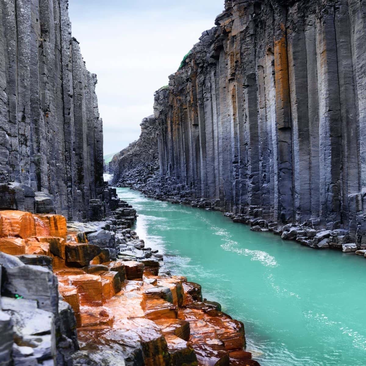
Studlagil Canyon / Iceland Ring Road Itinerary
Dettifoss Waterfall
Are you ready to meet Dettifoss Waterfall, the most powerful and voluminous waterfall in Iceland? It plummets 45 meters (150 feet) down and it is 100 meters (330 feet) wide. It is often referred to as the Beast as it has an average water flow of 193 meters cubed per second (6,186 cubic feet).
Dettifoss is fed from the glacier river Jokulsa a Fjollum which originates from Vatnajokull Glacier.
Make sure to make your way to an observational platform, which overlooks the waterfall. Also, with the amount of mist it generates, be prepared to get very wet! If you happen to be visiting on a sunny day, then you will be rewarded with the most spectacular rainbows.
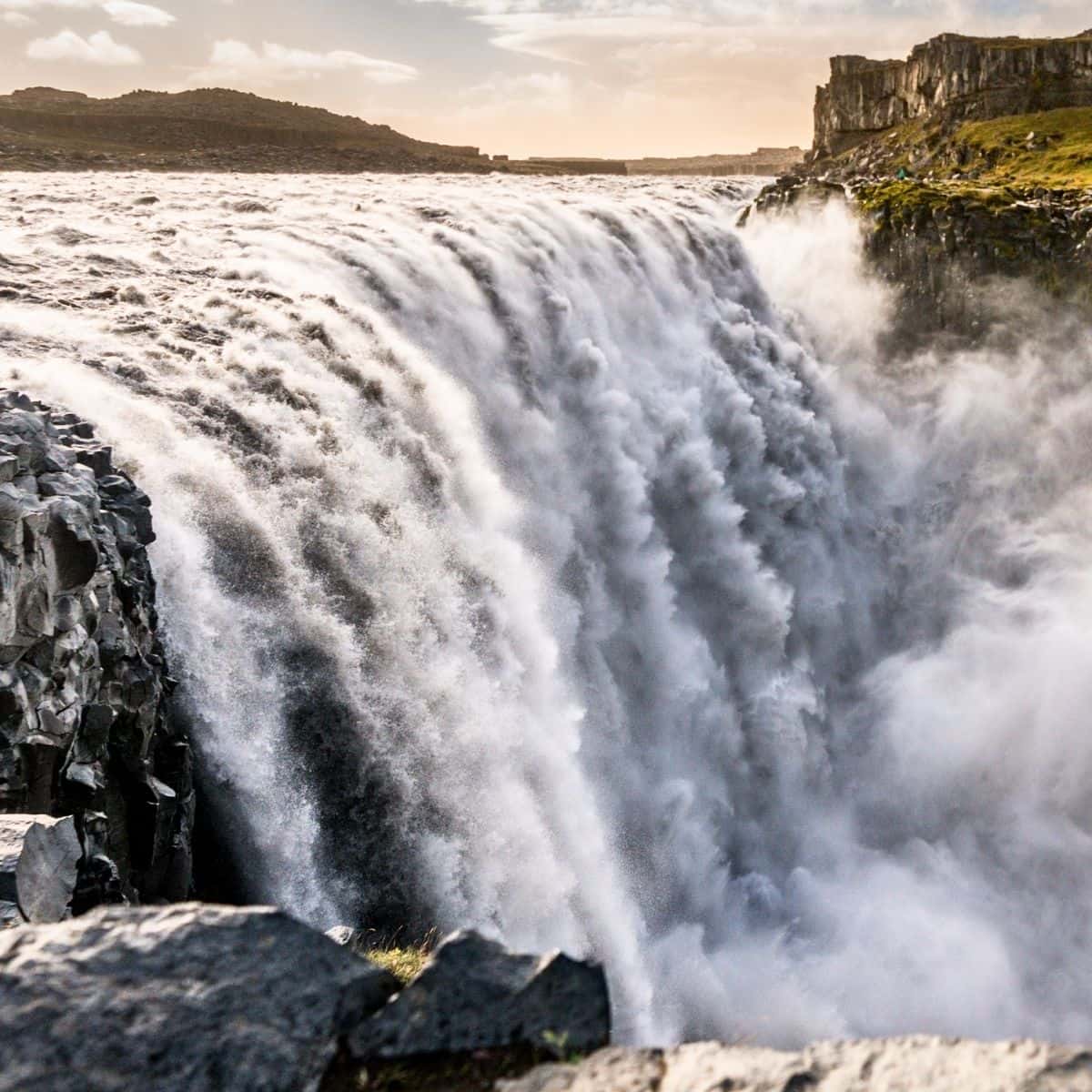
Dettifoss Waterfall / Iceland Ring Road Itinerary
Krafla Volcanic Caldera
Krafla Volcanic Caldera is a large volcanic area, about 10 km wide and 90 km long. It is on the Mid-Atlantic Ridge and is one of the most active volcanic areas in Iceland.
Since 1977 the Krafla area has been the source of the geothermal energy used by a 60 MWe power station.
Krafla includes Víti, an explosion crater, with a spectacular icy blue crater lake inside it. The word viti means hell in the Icelandic language.
Also, do not miss Leirhnjukur Lava Field. There is a trail that runs through these steamy lava fields and make sure to have your camera ready because it is a visually stunning place!
What is a caldera?
A caldera is a large depression formed when a volcano erupts and collapses. During a volcanic eruption, magma present in the magma chamber underneath the volcano is expelled, often forcefully. When the magma chamber empties, the support that the magma had provided inside the chamber disappears. As a result, the sides and top of the volcano collapse inward. Calderas vary in size from one to 100 kilometers (0.62 to 62 miles) in diameter.
Source: National Geographic
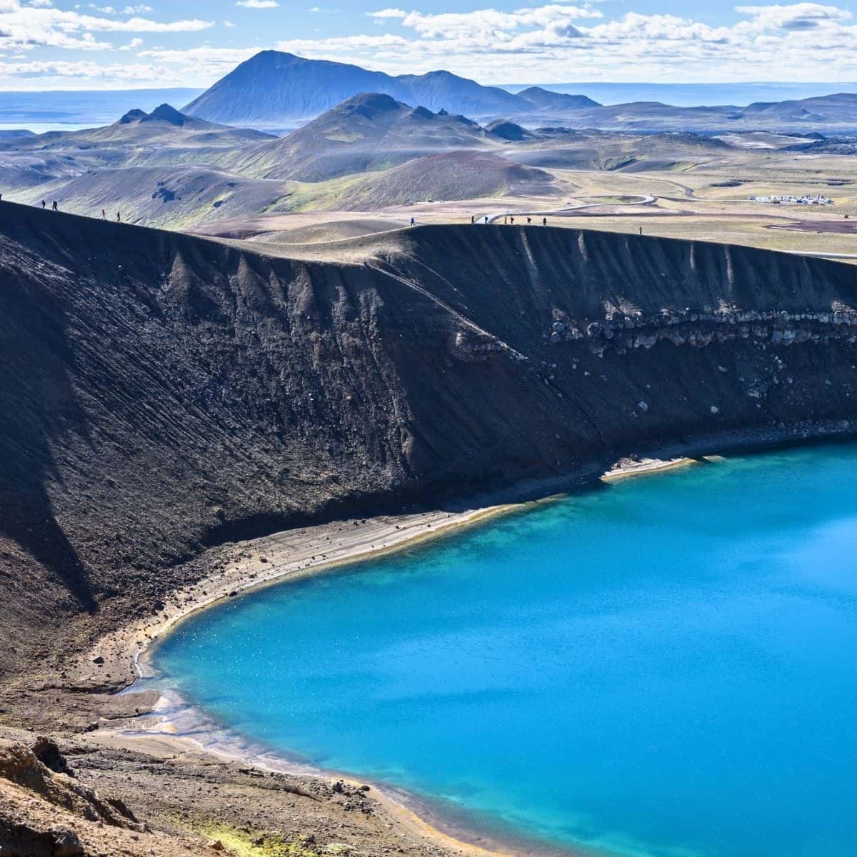
Viti in Krafla / Iceland Ring Road Itinerary
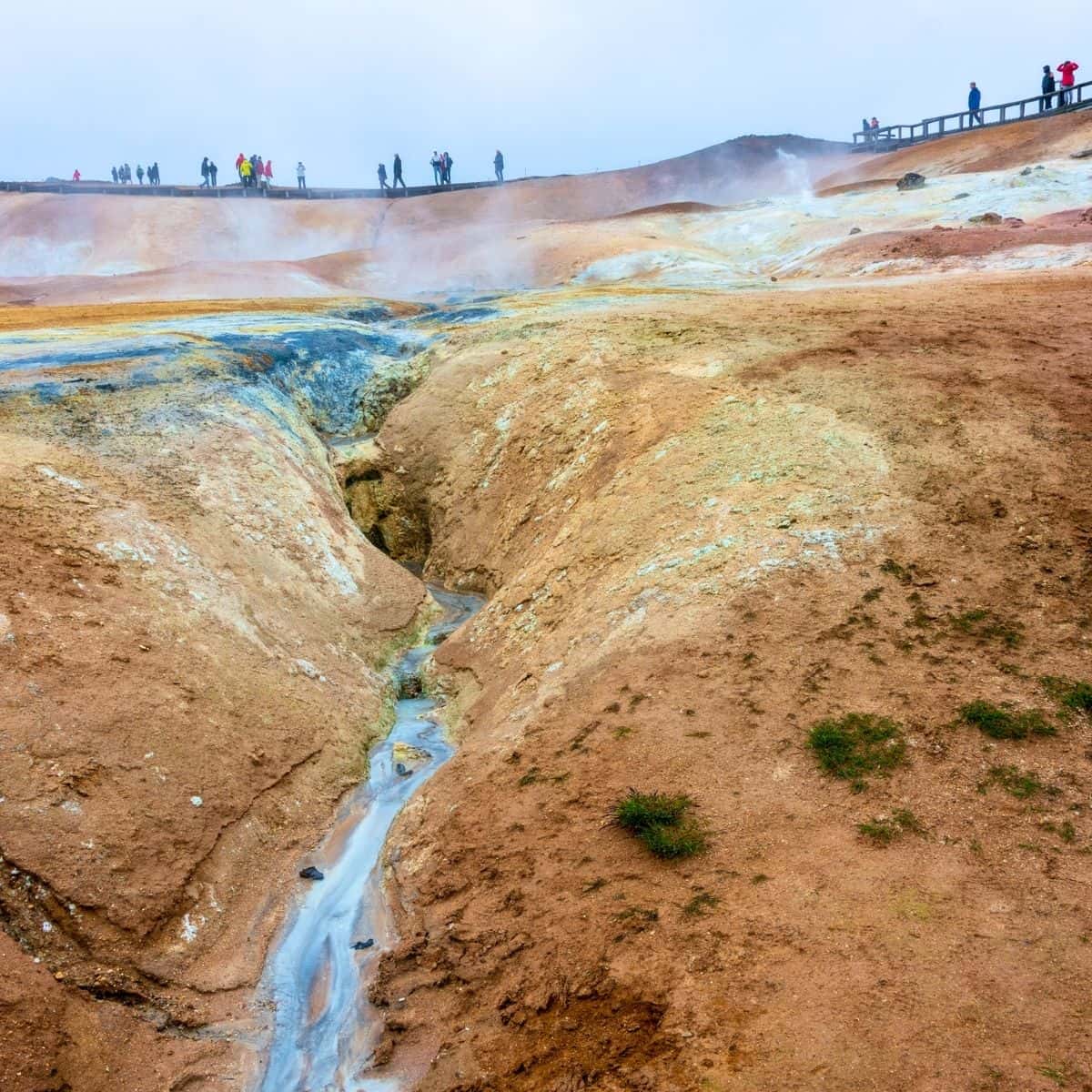
Leirhnjukur Lava Field / Iceland Ring Road Itinerary
Hverir Geothermal Area
Hverir Geothermal Area, also known as Hverir, Namafjall, Namaskard, or Hverardnd is a large geothermal area with smoking fumaroles, hissing steam vents, and bubbling mud pools.
You will be amazed by the colors of the sulfur crystals inside the cracked grounds and needless to say, the distinctive sulfur smell from fumarole gas that contains hydrogen sulfide will accompany you at this stop on the Iceland Ring Road itinerary!
The parking lot is next to the viewing platform where you can get the first glimpse of the area. However, make sure to take a short trail that meanders through and gets you closer to the smoking fumaroles, steam vents, and bubbling mud pools.
Another trail that I am recommending is Namafjall Loop Trail! It is an easy 2.5 km long trail that goes to Namafjall Mountian and starts right by the viewing platform. Along the way, you will be rewarded with fantastic views of the Hverir Geothermal Area as well as Lake Myvatn.
If you decide to do the hike, then keep in mind that the Namafjall Trail is a loop and you can do it in either direction. My recommendation is to start it counterclockwise. The incline on the right side is more gradual and it is easier to hike. All in all, the hike should not take you longer than about 1 hour.
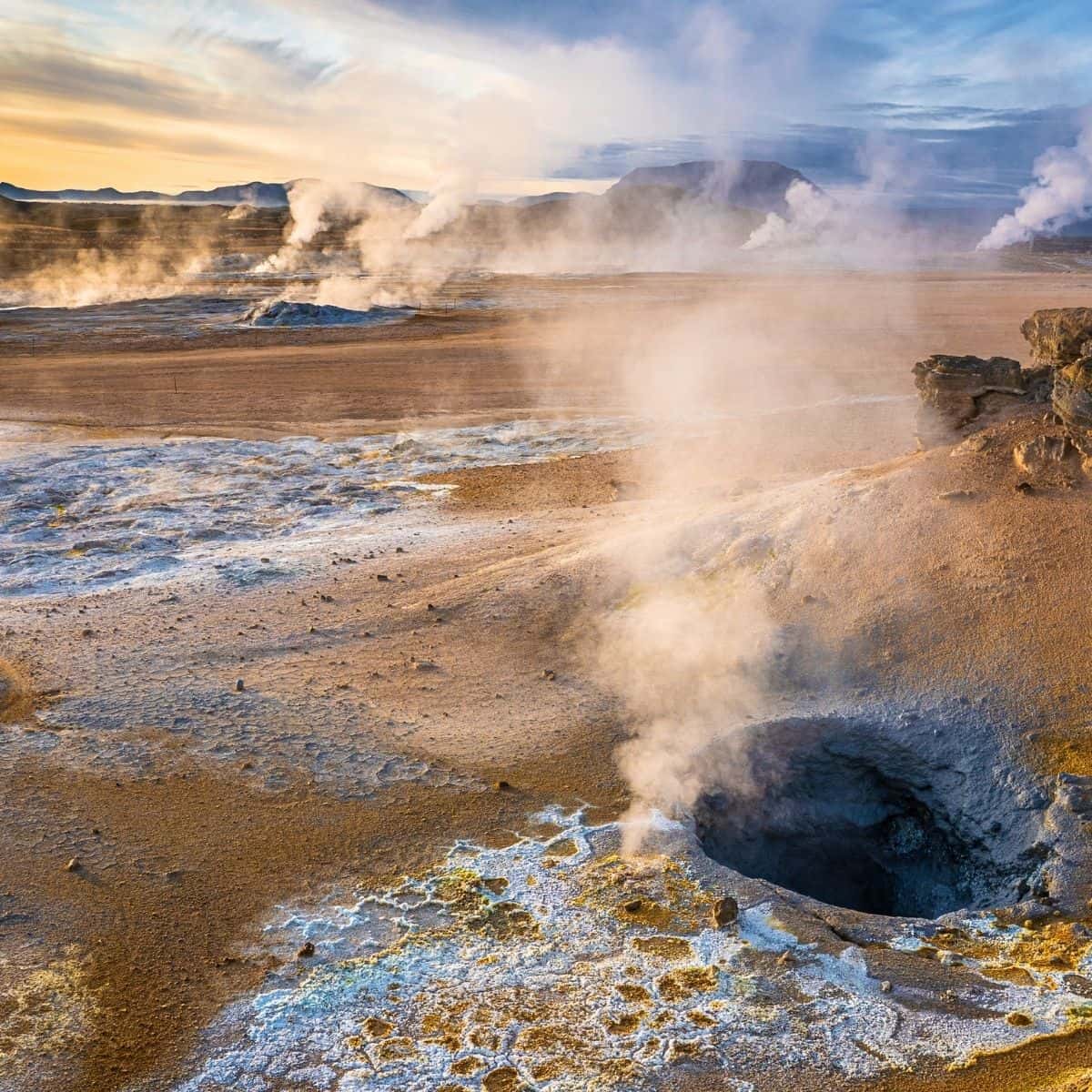
Hverir Geothermal Area / Iceland Ring Road Itinerary
The next section of the Iceland Ring Road itinerary will take you around Lake Myvatn.
You will need to take Road 848 which goes around the lake for 36 km and you will explore some of the most amazing places
Before we dive into the remaining stops of the day, I want to tell you a bit about Lake Myvatn.
Lake Myvatn is a shallow lake set in a unique volcanic landscape. Many different species of birds nestle here. It has fascinating flora, however, it is famous for its geological diversity.
The lake itself was created approximately 2300 years ago by a volcanic eruption.
One attraction that you will hear about is Myvatn Nature Baths. They are often considered a better alternative to the Blue Lagoon in Reykjavik. In my opinion, both places are great. However, if this is your first-time visit to Iceland, I feel that you can’t miss Blue Lagoon and I scheduled it for the last day of your itinerary before you head home.
Lake Myvatn is home to midges in summer! The closer you get to the lake the more abundant they are. Sometimes they are tolerable and other times they come in waves. I tried and unfortunately, any insect repellant did not work for me. My recommendation is to wear a hat, and sunglasses and tie a scarf around your nose and mouth.
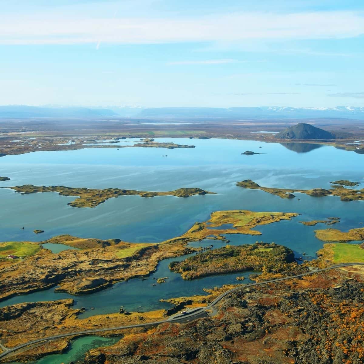
Lake Myvatn / Iceland Ring Road Itinerary
Grjotagja
Grjotagja is a small volcanic cave with an amazing blue-colored hot pool. It is worth making a quick stop and seeing it.
However, the water temperature is unstable and visitors are not allowed to soak in the hot pool.
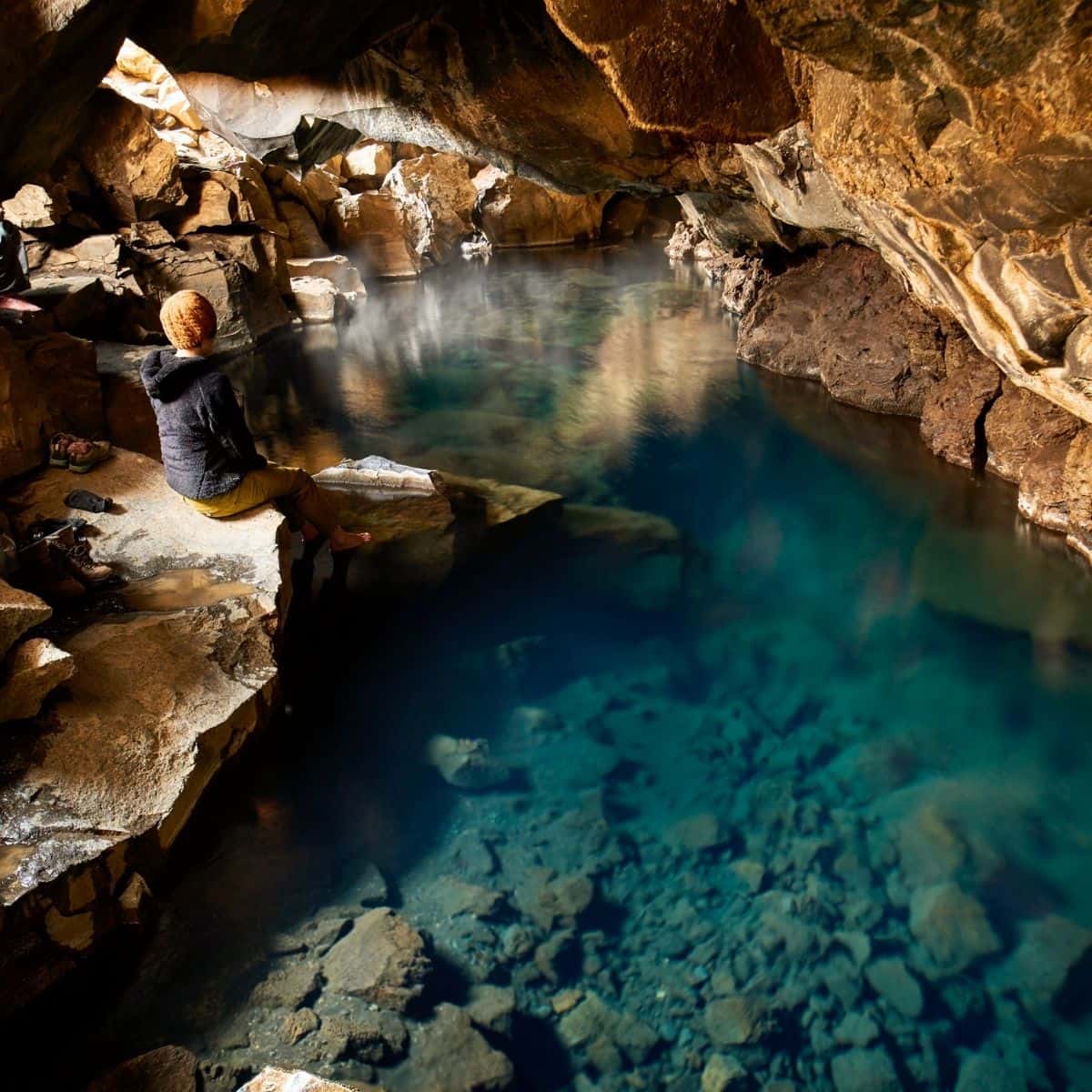
Grjotagja / Iceland Ring Road Itinerary
Hverfjall Volcano
The next stop is Hverfjall Volcano.
Hverfjall is a 396 m (1,300 ft) high tephra explosion crater that boasts a conical shape.
The term tephra defines all pieces of all fragments of rock ejected into the air by an erupting volcano. Most tephra falls back onto the slopes of the volcano, enlarging it, hence the conical shape of Hverfjall.
There is a trail that will take you to the rim. The hike is fairly easy and will take you no more than 20-30 minutes. Once at the top, you can walk around the rim and enjoy the views of Lake Myvatn, Dimmuborgir, and the surrounding lava fields.
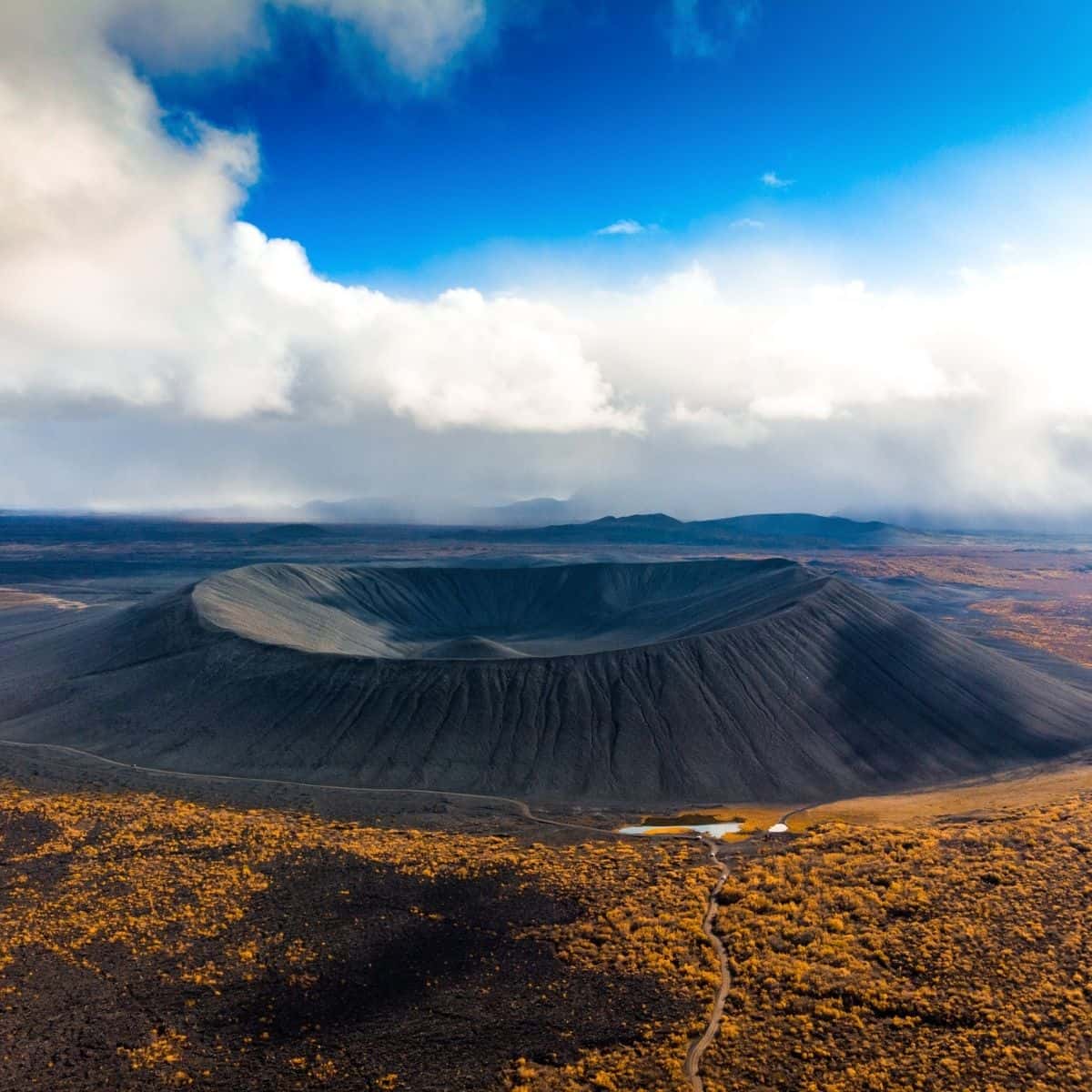
Hverfjall Volcano / Iceland Ring Road Itinerary
Dimmuborgir Lava Field
Dimmuborgir, or Dark Castles, Lava Field is an area of dramatically shaped lava formations reminiscent of collapsed castles.
These formations were created when flowing lava pooled over the ponds. The water boiled and the vapor rose through the lava forming lava pillars ranging from drainpipe size up to several meters in diameter. As the lava continued flowing towards the lower ground in the Myvatn area, the top crust collapsed, but the hollow pillars of solidified lava remained.
The flowing lava must have been at least 10 m deep, as estimated by the tallest structures still standing.
When you reach Dimmuborgir’s entrance, there is a large map with many hiking trails. My recommendation is to just take any short paved trail so that you can get up close to these spectacular formations.
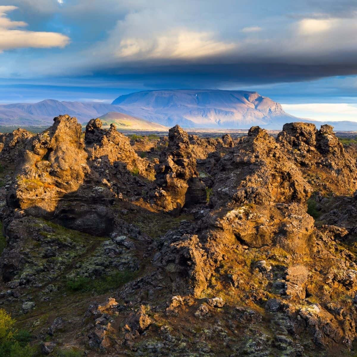
Dimmuborgir Lava Field/ Iceland Ring Road Itinerary
Skutustadir Pseudocraters
The next stop is Skutustadagigar Pseudocraters.
Hands down, these are the most interesting natural phenomena that I have ever encountered! From a distance, they look like giant bowls.
Skutustadagigar Pseudocraters are also called rootless craters as they are not connected to a direct magma conduit. They were formed when lava flowed over the wetlands, pools, and boggy areas and created giant pressurized steam caps beneath the surface. Extreme steam pressure caused explosions creating the pseudocraters.
Several trails circle around the pseudocraters and you will be able to get a closer look at these unique formations.
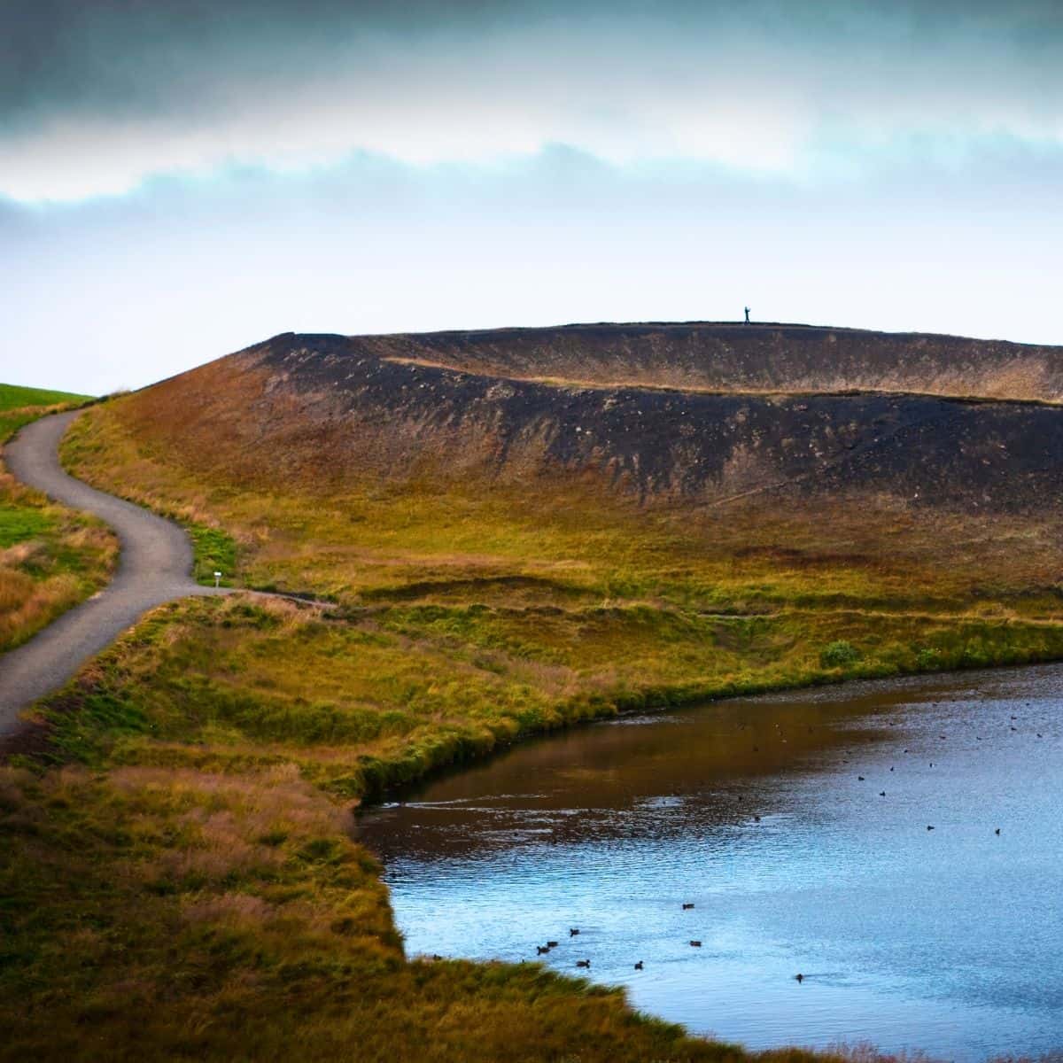
Skutustadir Pseudocraters / Iceland Ring Road Itinerary
Tonight stay in Husavik. It will be a perfect location for the next day’s early morning whale-watching activity.
My favorite place to stay in Husavik is Fosshotel Husavik. It is a beautiful, modern hotel that I am sure you are going to love! Do not skip the fabulous breakfast. It is top-notch!
DAY 5 of Iceland Ring Road itinerary
Driving Distance: 106 miles
Driving Time: 2 hours, 33 minutes
Stops:
1. Husavik – Whale-Watching Tour
2. Godafoss Waterfall
3. Siglufjordur
4. Trollaskagi Lighthouse
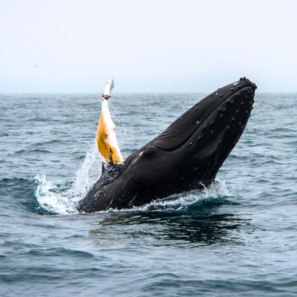
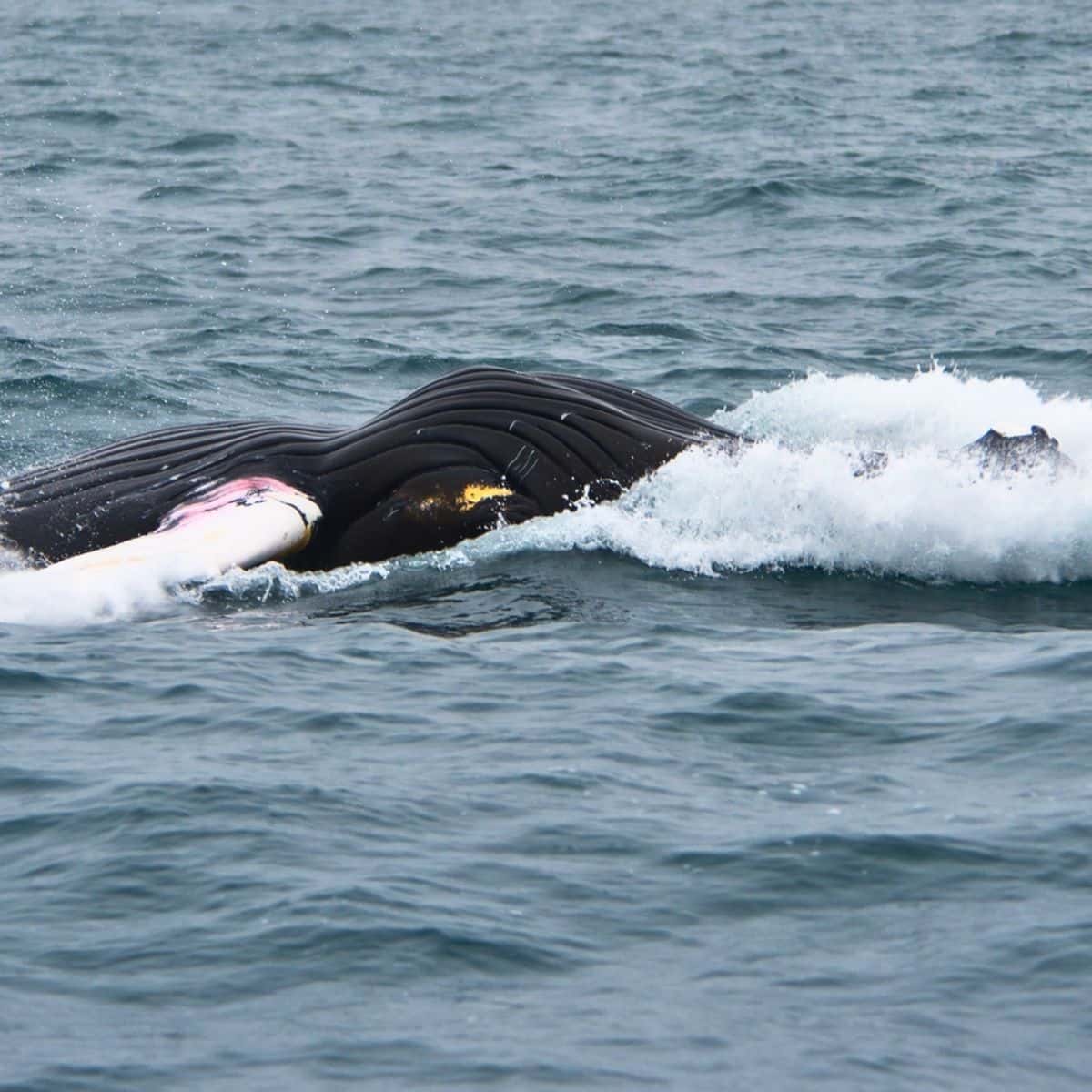
Husavik Whale-Watching Tour
Start your day with Big Whales and Puffins Tour. It is a 2-hour whale-watching tour on a RIB boat from the harbor of Husavík – The Whale Capital of Iceland. The RIB boats are fast and able to cover good distances making it more likely to have a close encounter with the giants. What I like the most is that these boats are small and can only accommodate 12 passengers.
Make a note that the puffin season is from about 1st May to 20th August. Outside that timeframe, the tours are Big Whales exclusive.
You will be given a water-resistant overall suit and a life vest. However, dress warm, wear a hat, and bring gloves.
Whale-watching in Husavik / Iceland Ring Road Itinerary
Godafoss Waterfall
Godafoss Waterfall is fed by the Skjalfandafljot River which falls from a height of 12 meters over a width of 30 meters.
The origin of the waterfall’s name is not completely clear. In modern Icelandic, the name can be read either as a waterfall of the god (pagan idols) or a waterfall of the godi (chieftain).
Linguist and placename expert Svavar Sigmundsson suggests that the name derives from two crags at the falls which resemble pagan idols.
There a 1.8-mile trail loops around the waterfall area. It will take you to a platform on the west side and you will get an awesome view of the waterfall.
Next, walk across the bridge to the east side and hike to the platform on the east side to get a different view of the waterfall.
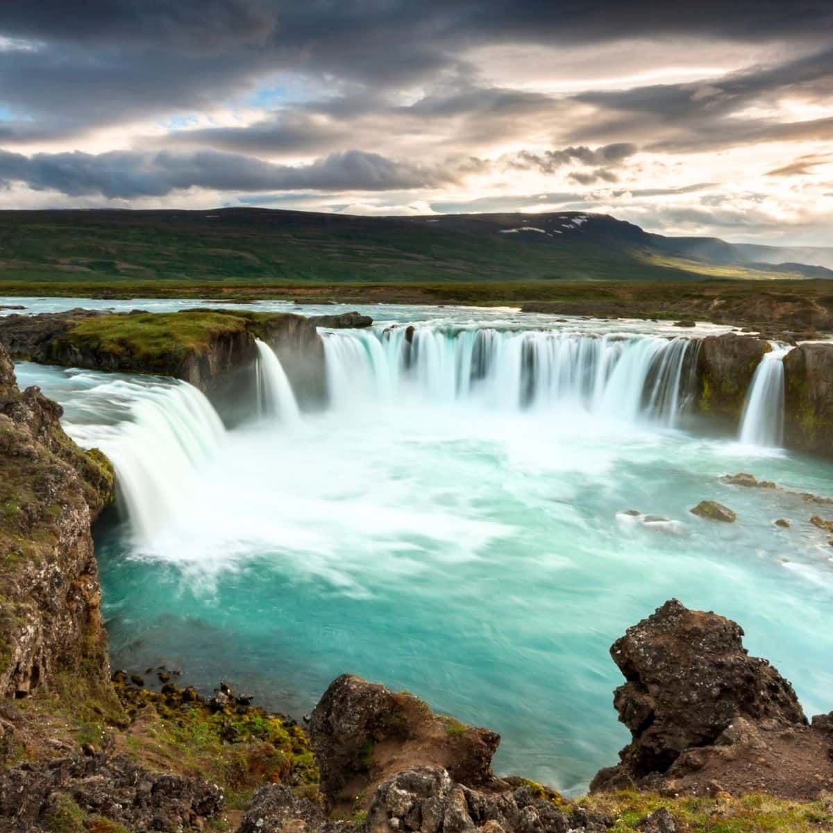
Godafoss / Iceland Ring Road Itinerary
Siglufjordur
Next is Siglufjörður, a small fishing town in a narrow fjord with the same name on the northern coast of Iceland, and this is where you are going to spend the night.
Siglufjordur is the site of The Herring Era Museum, a maritime museum that opened in 1994. The town grew up around the herring industry that was very strong in the 1940s and 1950s.
If you are a fan of Ragnar Jonasson then you probably already know that Siglufjordur is the setting of his detective series Dark Iceland.
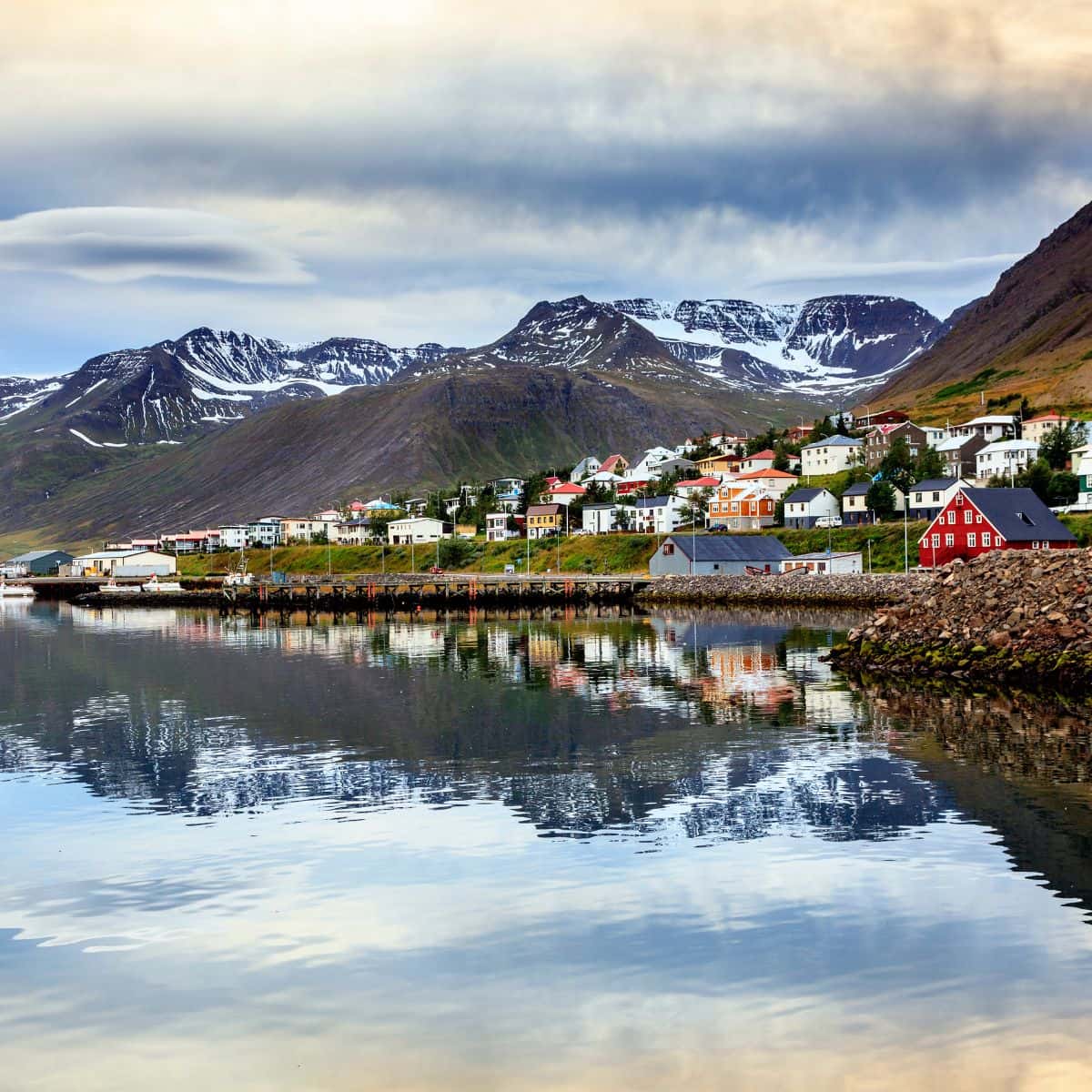
Siglufjordur / Iceland Ring Road Itinerary
Trollaskagi Lighthouse
The orange Trollaskagi Lighthouse is located at the most northern point of Siglufjordur. From a distance, it looks like orange boxes stacked on top of each other and perched at the end of a cliff overlooking the Atlantic Ocean.
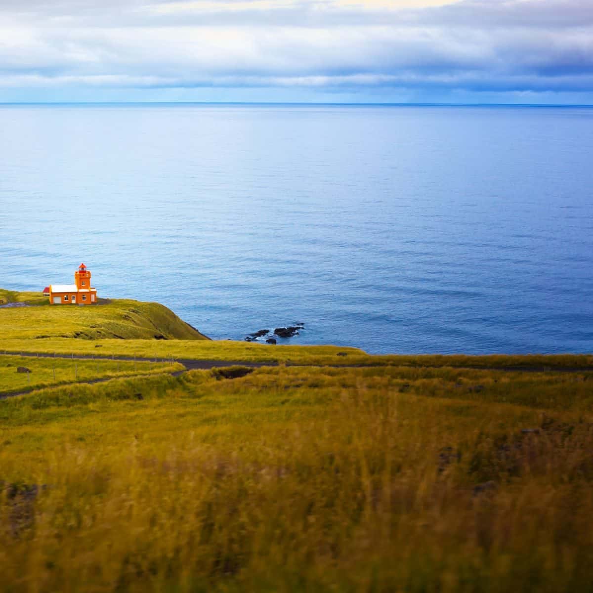
Trollaskagi Lighthouse / Iceland Ring Road Itinerary
Tonight, you will stay in Siglufjordur at Siglo Hotel. It is one of my favorite hotels in Iceland. The location is perfect right on the pier with a great view. The rooms are big and the beds are comfy. I guarantee that you will not want to leave!
DAY 6 of Iceland Ring Road Itinearay
Driving Distance: 293 miles
Driving Time: 7 hours
Stops:
1. Hofsos Village
2. Glaumbaer Farm and Museum
3. Vidimyrarkirkja Turf Church
4. Kolugljufur Canyon and Kolufossar Waterfalls
5. Hvitserkur
6. Eiriksstadir
Hofsos Village
The first stop on day 6 of the Iceland Ring Road itinerary is Hofsos.
If you are a history buff, then my recommendation is to stop at the Icelandic Emigration Centre (Vesturfarasetrid). It is a fascinating museum that details the mass emigration of Icelanders to North America in the late 1800s.
Hofsos thermal swimming pool is another attraction that you should not miss! It is one of the most beautiful infinity pools that I have seen. If the weather is nice, then this is a perfect spot to enjoy the pool and the stunning views of the island Drangey which rises almost vertically out of the sea.
Finally, just 4 km past Hofsos, you will find Grafarkirkja Turf Church, Iceland’s oldest turf church.
It was Gísli Þorlaksson, bishop of Holar in the late 17th century. The church is believed to be the work of a well-known wood carver of the time, Gudmundur Gudmundsson, whose baroque carvings can be seen on the altar and verge boards.
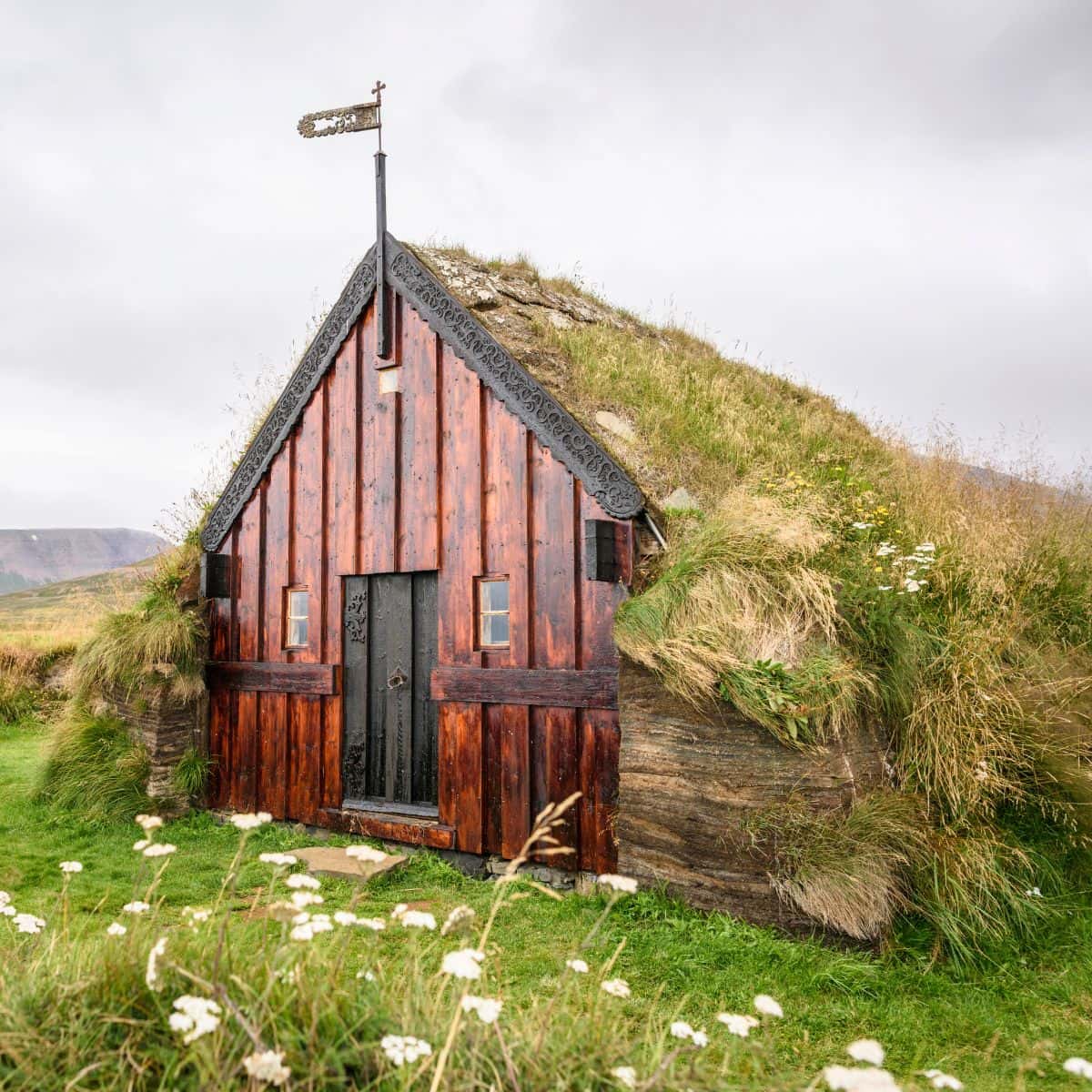
Grafarkirkja Turf Church / Iceland Ring Road Itinerary
Glaumbaer Farm and Museum
Glaumbaer Farm and Museum is a fascinating place! This perfectly preserved farm comprises 13 buildings and offers a rare insight into how Icelandic people lived in the past.
The buildings date from 1750 and 1879. They were inhabited until 1947. However, the site itself dates back to the Settlement of Iceland in the 9th century.
The houses are constructed with turf and insulated with thick Icelandic grass. Although they look like single dwellings, they are all connected by a narrow corridor. The rooms include a kitchen, pantries, storerooms, a workshop, and a communal living room. There are lots of interesting artifacts on display like toys that are made of animal bones and shoes made out of fish skin.
As I was told, the farm was home to Snorri Þorfinsson, the first American born of European parents, in the 11th century. Snorri was the son of Gudrídur Þorbjarnardottir and Þorfinnur Karlsefni and was born while his parents were on an expedition to the Americas long before Columbus.
Snorri’s mother, Gudrídur, is considered Iceland’s most-traveled woman of her time. The sculpture of Gudrídur by Asmundur Sveinsson can be seen in front of the Glaumbaer Church.
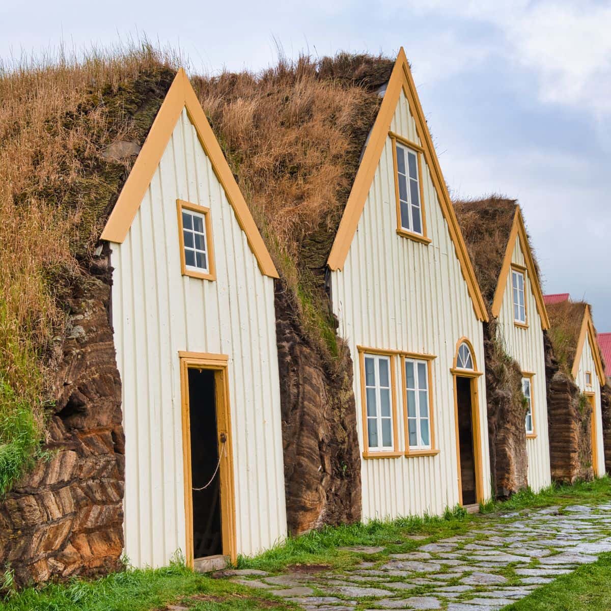
Glaumbaer Farm and Museum / Iceland Ring Road Itinerary
Vidimyrarkirkja Turf Church
Vidimyrarkirkja Turf Church was built in 1834. It was constructed with turf from Vidimyr and driftwood from the Skagi peninsula.
In front of it is a lychgate which was built in 1836. The bell that is hung inside it dates back to 1630.
The church is a photographer’s dream with bright orange frames around the windows and a green-painted door and gate contrasting beautifully with the black front.
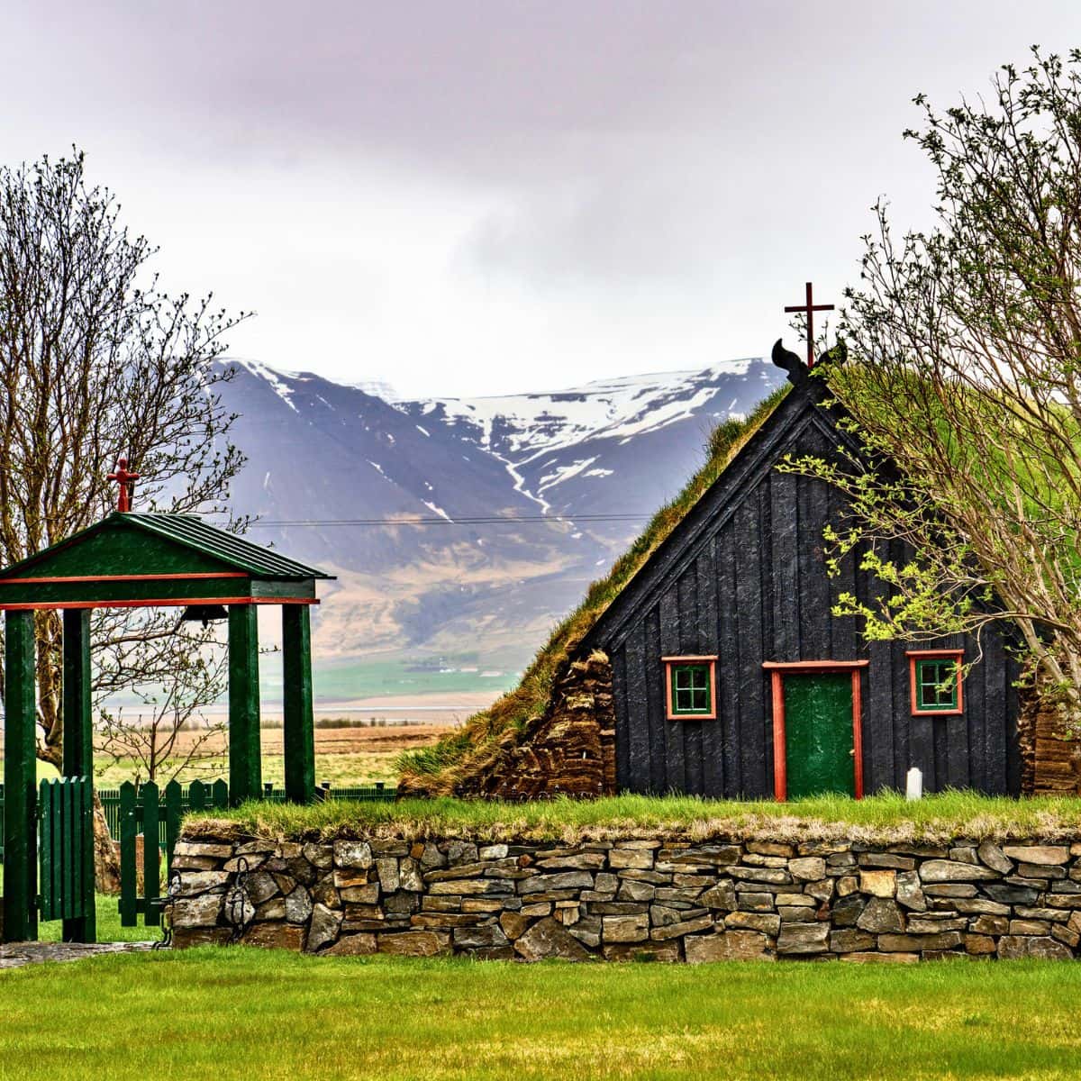
Vidimyrarkirkja Turf Church / Iceland Ring Road Itinerary
Kolugljufur Canyon and Kolufossar Waterfalls
The next stop is Kolugljufur Canyon and its Kolufossar Waterfalls.
A series of waterfalls, Kolufossar Waterfalls, are created by Vididalsa River, Iceland’s salmon river, as it flows flowing through the narrow Kolugljufur Canyon and then plunges down the gorge.
There is a viewing platform right next to the bridge where you can get a pretty good view of the canyon and the waterfalls. If you are up to it and want to stretch your legs for a bit, then take a path that meaders on the edge of the canyon and goes on for about 1 km.
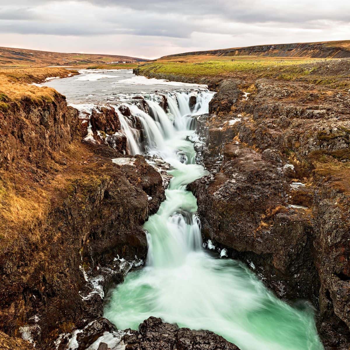
Kolugljufur Canyon / Iceland Ring Road Itinerary
Hvitserkur
Next, we are heading toward the Vatnsnes Peninsula and the first stop here is Hvitserkur protruding from Hunafloi Bay.
Hvitserkur, known as the Troll of Northwest Iceland, is a 15 m high basalt stack with two holes at the base, which give it the appearance of a dragon (rhino, elephant, or dinosaur) that is drinking.
The base of the stack has been reinforced with concrete to protect its foundations from the sea.
Several species of birds, such as gulls and fulmars, live at Hvítserkur and its name and hence the name Hvitserkur, White Shirt, comes from the color of the bird droppings deposited on its rocks.
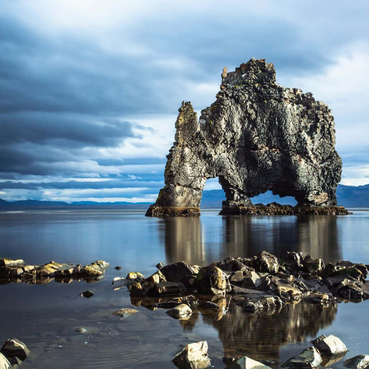
Hvitserkur / Iceland Ring Road Itinerary
Viking Longhouse at Eiriksstadir
I was debating whether I should add this stop to the itinerary or not. I finally decided to add it since you might hear about it. However, you be the judge and decide if it is something that might interest you.
The Vikings started coming over to Iceland to settle around 874 and the Viking Longhouse at Eirisstadir is a reconstruction of one of their dwellings. It is a fun place to visit and see how the Vikings lived.
The staff is dressed in Viking costumes and tells interesting stories about the Vikings. You can even get dressed up in some of the Viking outfits that they provide.
My recommendation is to stay in Grundarfjordur. It is situated right on Snaefellsnes Peninsula which is just a perfect location for exploring the peninsula.
The place that I have stayed at and really enjoyed is called Grundarfjordur Bed and Breakfast. It is a simple no-frills place. It is clean, the beds are comfortable and I enjoyed their breakfast.
DAY 7 of Iceland Ring Road Itinerary
Driving Distance: 205 miles
Driving Time: 5 hours
Stops:
1. Mount Kirkjufell and Kirkjufellsfoss Waterfall
2. Svodufoss
3. Skardsvik Beach
4. Ondverdarness Cape and Ondverdarnesviti Lighthouse
5. Saxholl Crater
6. Djupalonssandur – Black Lava Pearl Beach
7. Arnarstapi
8. Raudfeldsgja Gorge
9. Gerduberg Cliffs
Mount Kirkjufell and Kirkjufellsfoss Waterfall
Today the first stop on the Iceland Ring Road itinerary is Mount Kirkjufell and Kirkjufellsfoss Waterfall.
Kirkjufell is 463 meters high and its name means Church Mountain as its shape resembles a congregation hall. With Kirkjufellsfoss Waterfall in front of it, it becomes one of the most picturesque and most photographed places in Iceland!
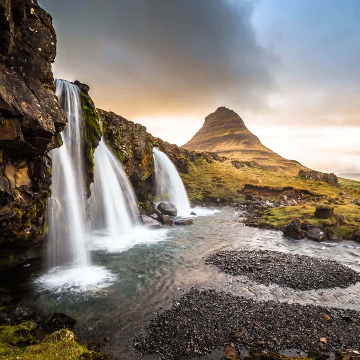
Mount Kirkjufell and Kirkjufellsfoss Waterfall / Iceland Ring Road Itinerary
Svodufoss Waterfall
Svodufoss Waterfall is another picture-perfect waterfall that is very popular to photograph. It is situated in front of the Snaefellsjokull Glacier, and on clear days, you can get fantastic views of the glacier caps of Snaefellsjokull and the waterfall in front of them.
Also, if you are up to it then hike to the top of the waterfall to get a different view. It is an easy hike and it will be good to get a little exercise.
Not far from the Svodufoss, there is also another waterfall called Kerlingarfoss. Not as powerful and impressive, but still worth stopping by.
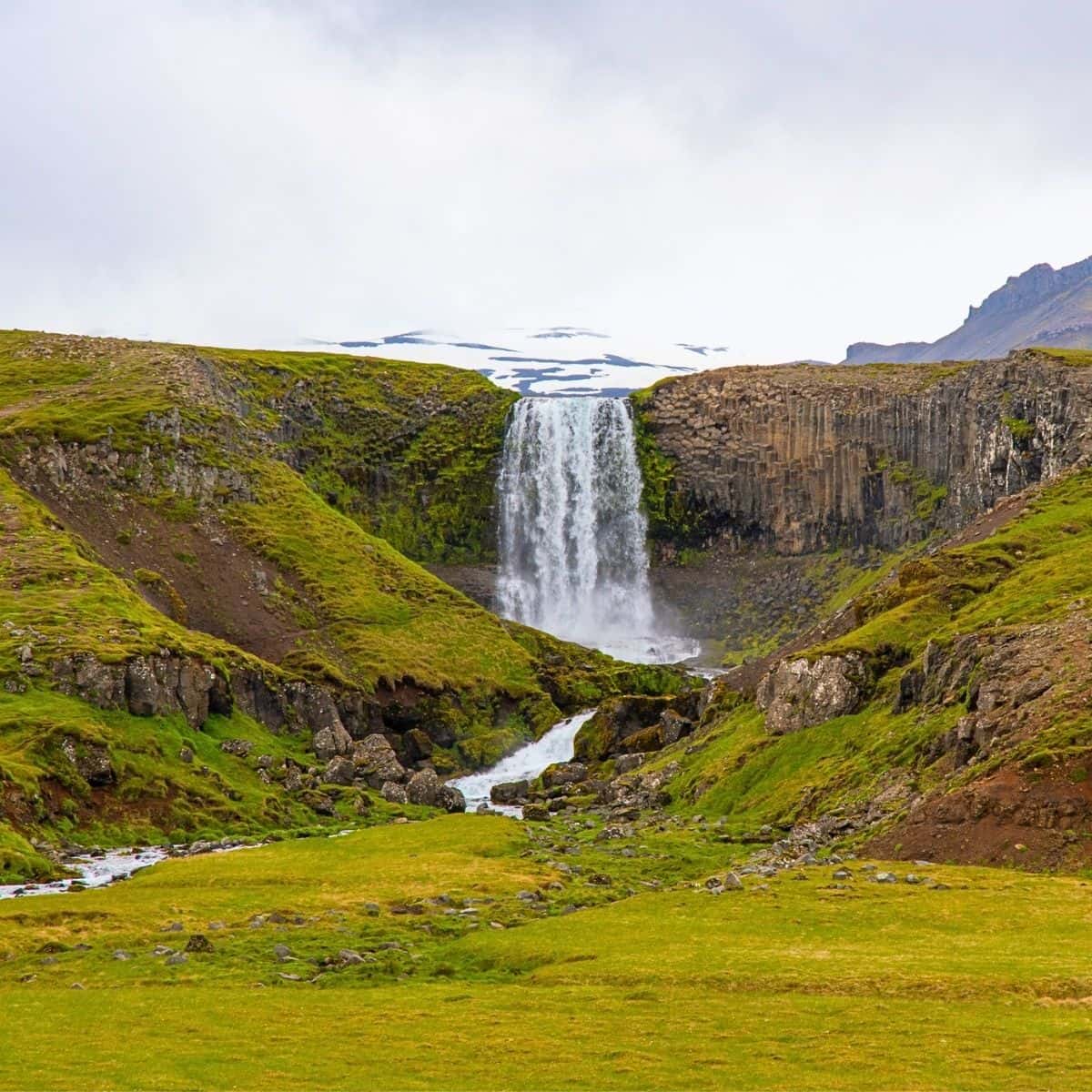
Svodufoss Waterfall / Iceland Ring Road Itinerary
Skardsvik Beach
Are you ready for a change of scenery? After seeing many black sand beaches on this Iceland Ring Road itinerary, Skardsvik Beach is quite a treat to see. It is a beautiful golden sandy beach with turquoise water.
To add a little drama the beach is surrounded by black volcanic rocks which create a stunning contrast with the golden beach and blue water.
Make sure to visit the beach during the low tide and calm weather. Otherwise, use caution because the waves can be very powerful here!
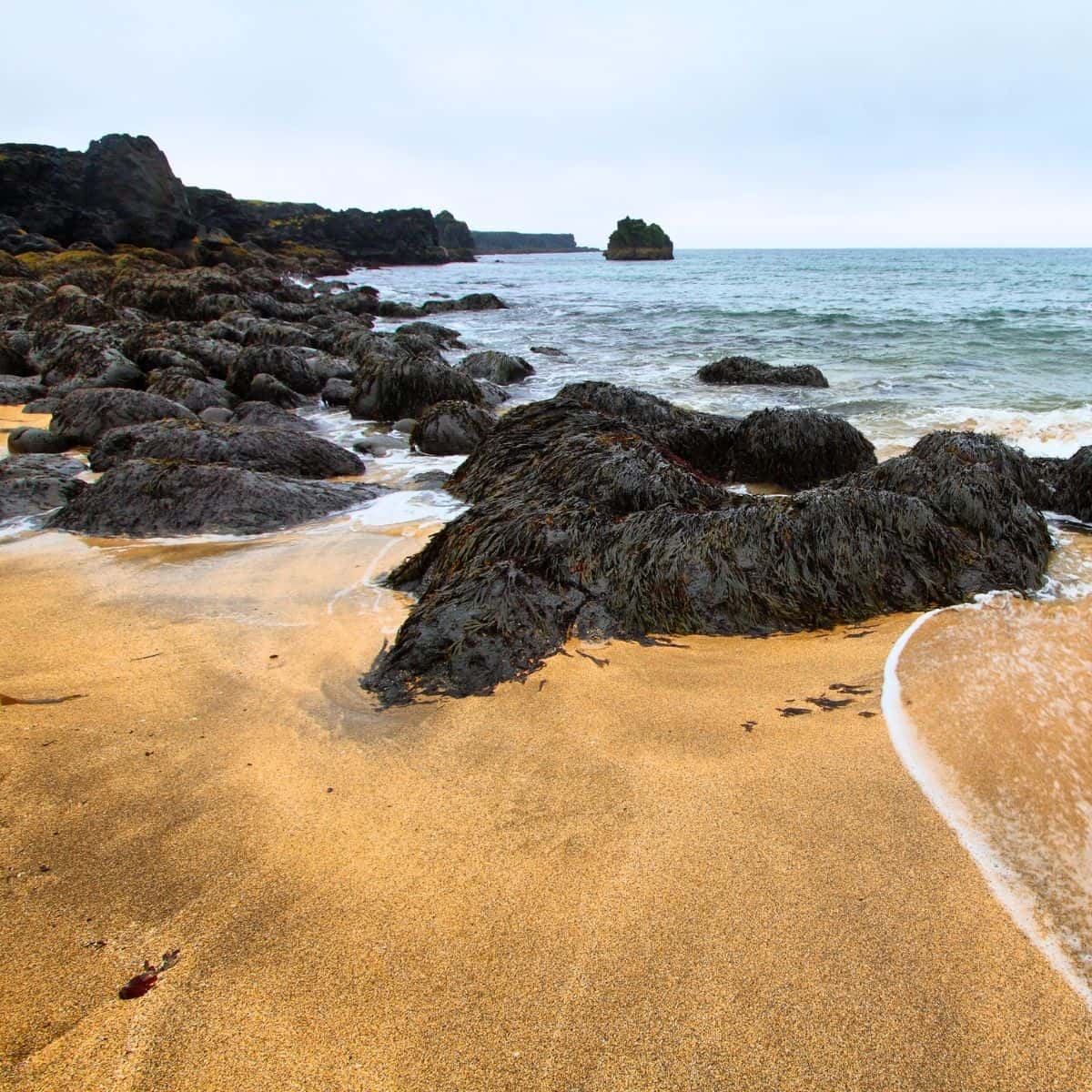
Skardsvik Beach / Iceland Ring Road Itinerary
Ondverdarnes Cape and Ondverdarnesviti Lighthouse
Ondverdarnes is the name of the outermost point of the Snaefellsnes Peninsula and at the tip of it, you will see a little orange Ondverdarnesviti Lighthouse.
Ondverdarnes used to be a fishing station. You can still see the ruins of the inhabitants’ dwellings and fish storage huts scattered around this narrow strip of land. There is a stone well as well that provided freshwater to the community.
When you visit Ondverdarness and you will see the rocky cliffs, you will understand what adversaries the fisherman had to overcome to work and live in this area.
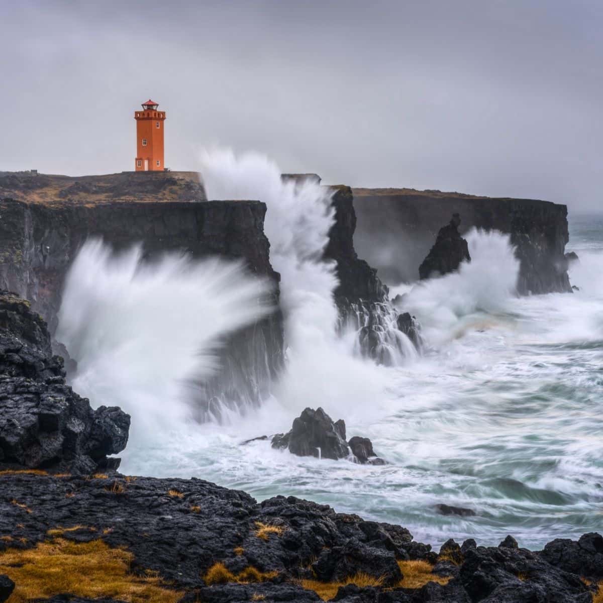
Ondverdarnes Cape and Ondverdarnesviti Lighthouse / Iceland Ring Road Itinerary
Saxholl Crater
The landscape of the Snaefellsnes Peninsula was greatly shaped by an eruption of the Saxholl Crater about 3000 years ago.
You can hike to the top of the crater. There is a path with metal stairs and it takes about 10 minutes to reach the rim of the crater. Once at the rim, you will be rewarded with fantastic views of the Atlantic Ocean and Snaefellsnes Peninsula.
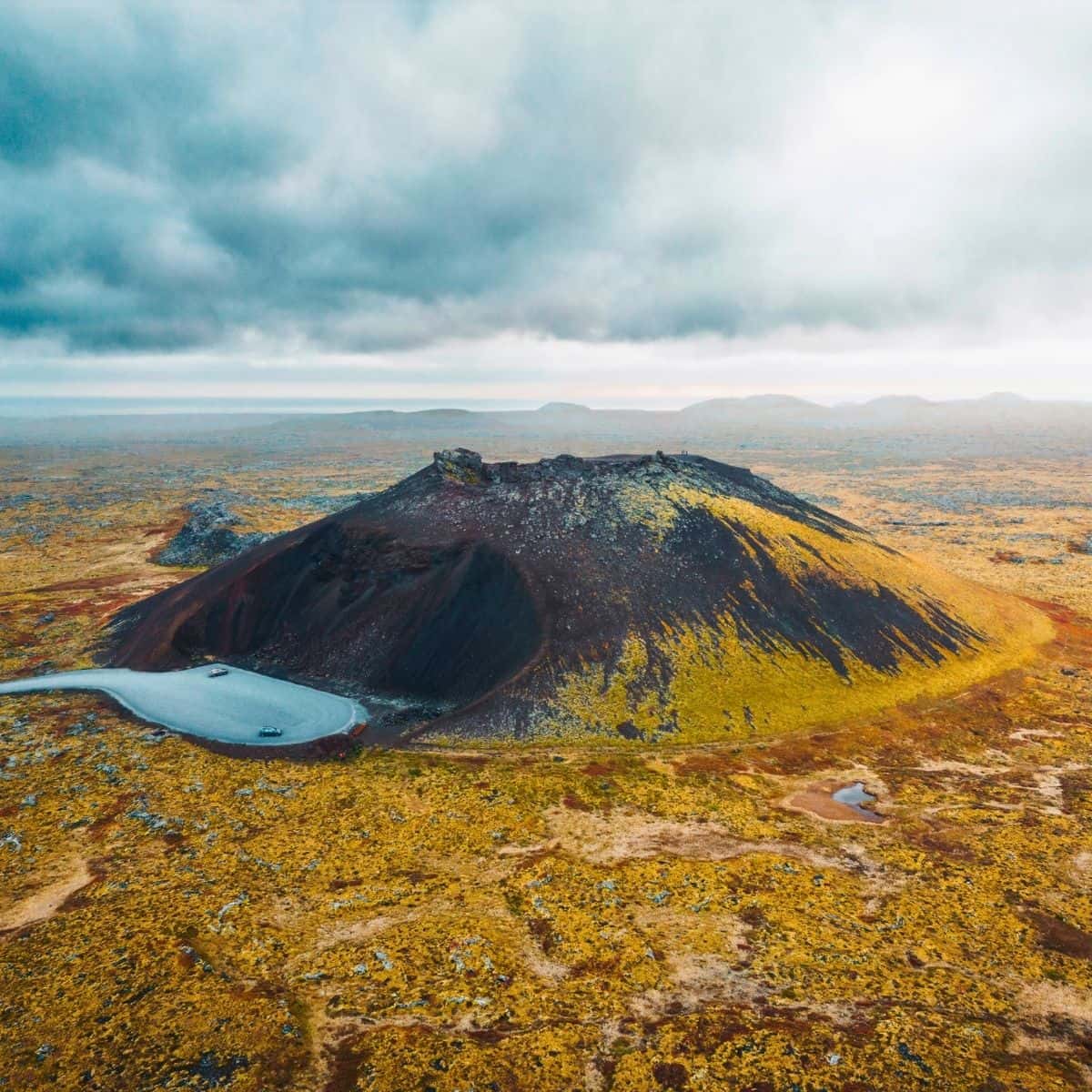
Saxholl Crater / Iceland Ring Road Itinerary
Djupalonssandur - Black Lava Pearl Beach
Djupalonssandur, Deep Lagoon Beach, is one of the most beautiful places in Iceland.
The path that leads to the beach is called Nautastigur and it means Path of the Bull. Bulls used to be led down this path to a freshwater lagoon called Djupulon, hence the name of the beach.
The path meanders through a lava field with extraordinary lava formations. One of the famous lava formations that you will pass by is called Gatklettur. It has a huge opening right in the middle of it.
Once you reach the beach, you will be able to see lots of metal debris that came from the British trawler which crashed east of Dritvik Cove in 1948.
The beach is made of small ocean-smoothed stones which are called Djupalonsperlur, Pearls of Djupalon.
Make sure not to miss some other fascinating lava rocks. There is one called Sonklettur, Singing Rock, which has a vibrant red color. And, another one called Kerling, Troll Woman, which looks like a humped body carrying a heavy load.
As you are exploring the beach, you will come across the 4 powerlifting stones, Aflraunasteinar Steinatok used to measure the strength of fishermen.
The names of the lifting stones are Fullsterkur (Strong), Halfsterkur (Half-Strong), Halfdraettingur (Half), and Amlodi (Lightweight). If the fishermen were not able to Halfdraettingur, then they were not accepted as oarsmen on the fishing boats rowing from Dritvík.
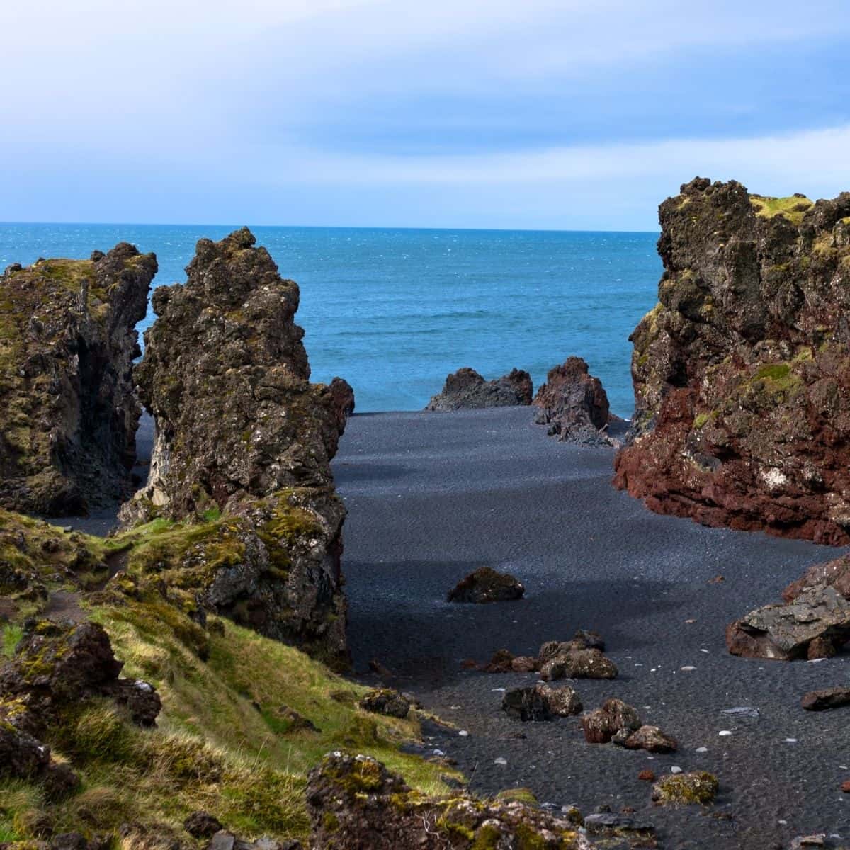
Djupalonssandur Beach / Iceland Ring Road Itinerary
Arnarstapi
The next stop of the Iceland Ring Road itinerary is Arnarstapi, a picturesque village situated on the southern side of the Snaefellsnes Peninsula.
A few things here are worth checking out.
- First of all, do not miss the stunning Arnarstapi Cliffs made out of basalt columns.
- Next, make sure to get a glimpse of a fantastic rock formation called Londrangar.
- Hands down, my favorite is Gatklettur. It is an eroded stone arch and it is just the most perfect photo spot!
- And, finally, the Statue of Bardur, a striking sculpture created from local stones represents Bardur Snaefellsas, the half-man half-troll.
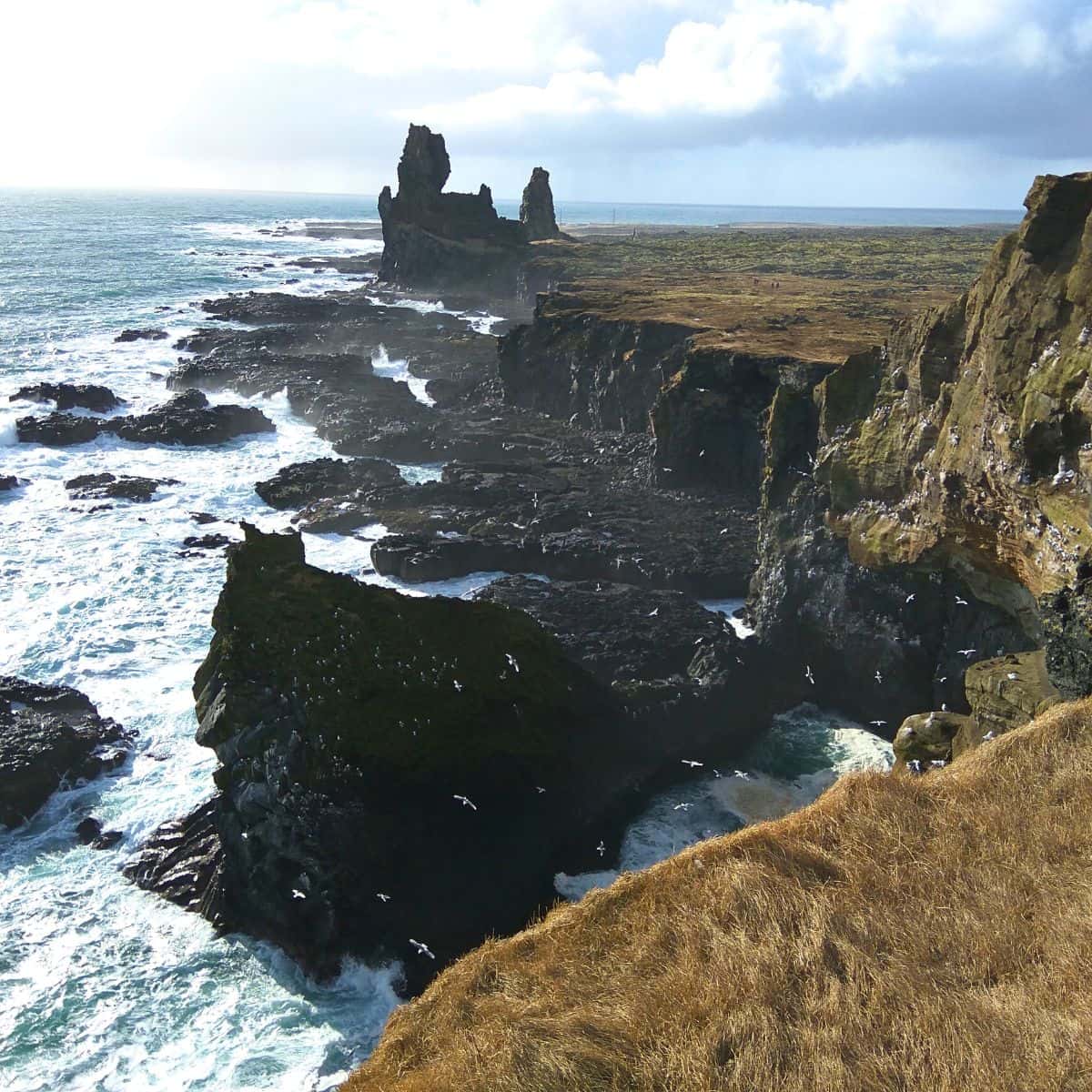
Londrangar / Iceland Ring Road Itinerary
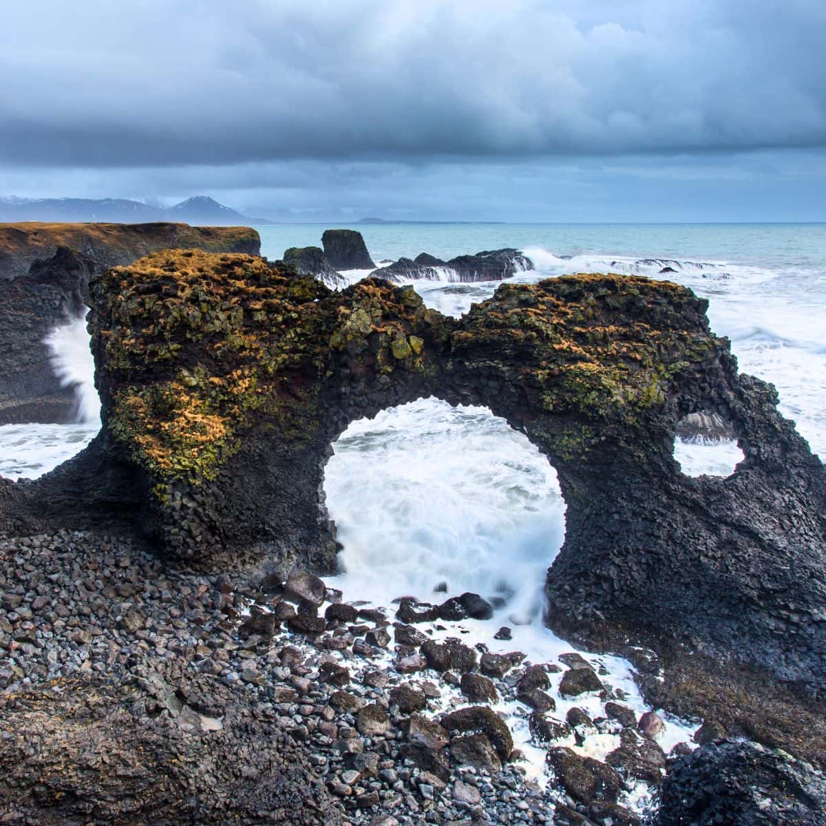
Gatklettur / Iceland Ring Road Itinerary
I just can’t resist and have to tell you about another photo opportunity!
Just a few kilometers from Arnarstapi is Budakirkja, a tiny Lutheran church located in the village of Budir. Its black facade contrasts so beautifully with the surrounding landscape.
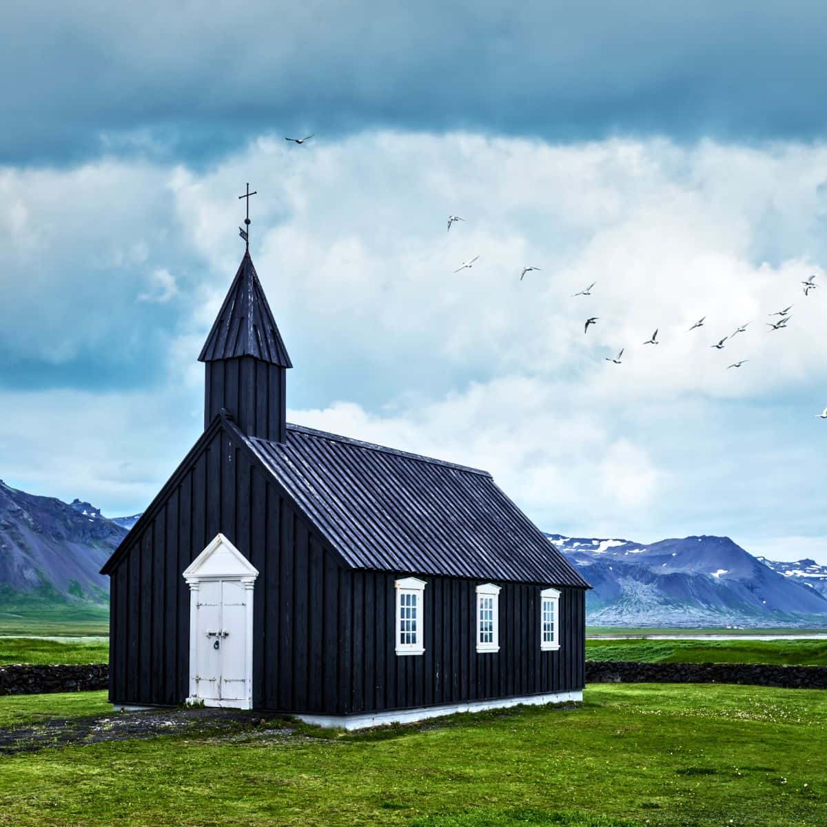
Budakirkja / Iceland Ring Road Itinerary
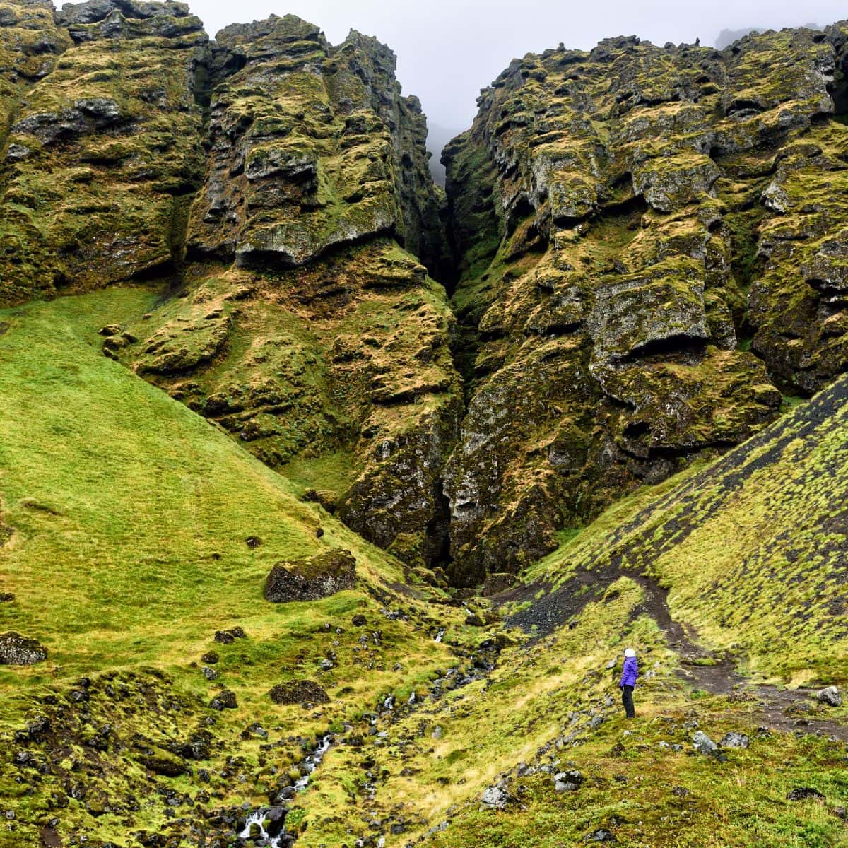
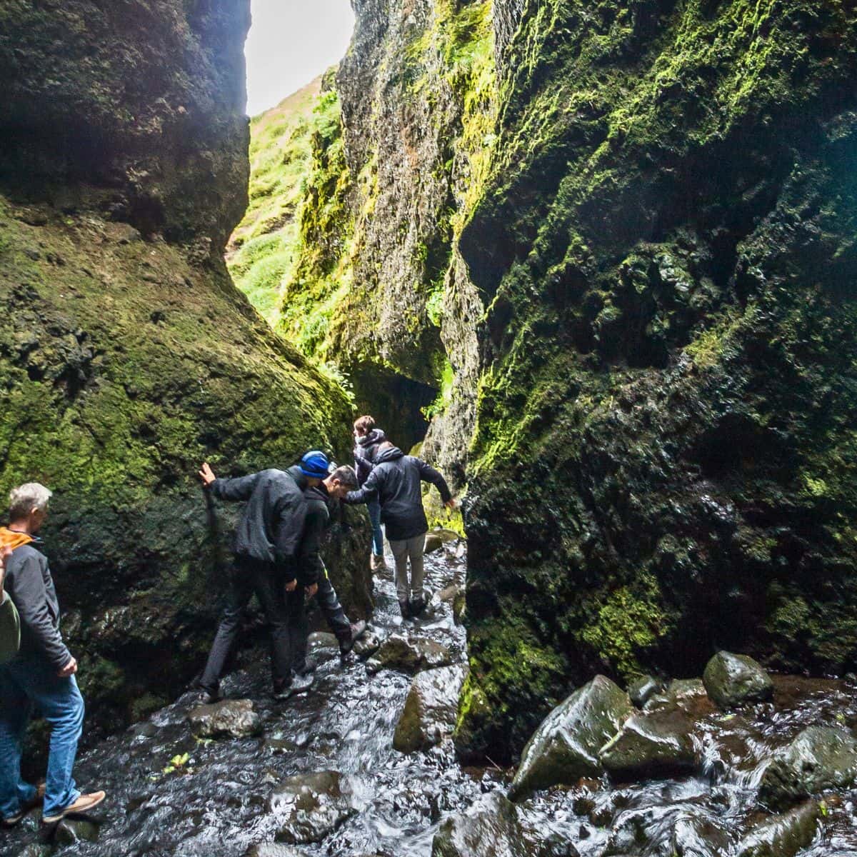
Raudfeldsgja Gorge
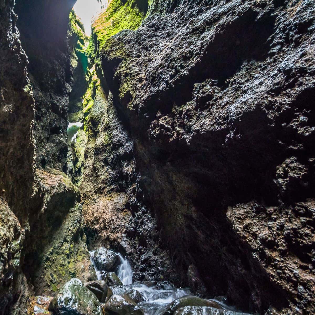
Raudfeldsgja is a narrow gorge that you can see from a distance. It looks like a small crack in the mountain.
You can go inside and check it out. First, you will feel like you are inside a temple with a small opening at the top and a small stream flowing through it. As you venture further inside, you will be able to see a waterfall.
Raudfeldsgja Gorge / Iceland Ring Road Itinerary
Gerduberg Cliffs
Gerduberg Cliffs are one of the most impressive formations of hexagonal-shaped stacks and pillars in Iceland
The pillars were created through the process known as Columnar Jointing. It happens when thick basalt lava flows cool, they tend to form hexagonal cracks, called columnar joints.
It is quite a sight to see this army of perfectly shaped pillars standing side-by-side.
They are mostly twelve to fourteen meters high and about one and a half meters in diameter. Some of them are leaning forward.
There is a path that goes from the parking lot to the cliffs and another one that you can take to the top of the cliffs.
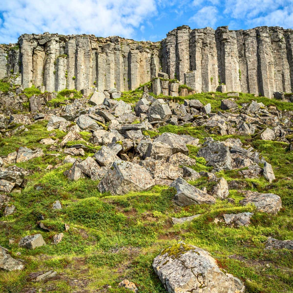
Gerduberg Cliffs / Iceland Ring Road Itinerary
Tonight stay in Reykjavik. I always stay near Keflavik Airport. It is close to the Blue Lagoon (scheduled for tomorrow) and convenient for car rental return. There are several hotels that I stayed in around the airport. They are pretty much all the same. However, check out Courtyard by Marriott Reykjavik. It is clean, the rooms are a good size, and the staff is super nice.
DAY 8 of Iceland Ring Road Itinerary
Driving Distance: 31 miles
Driving Time: 53 minutes
Stops:
1. Blue Lagoon
Blue Lagoon
Alrighty, today is the last day of the Iceland Ring Road itinerary.
What I usually do is sleep in a bit and then have a decent breakfast at the Courtyard and pack and hang out. It is a good time for me to think about the trip and go through some of the photos I took along the way.
Then, my recommendation is to head out to the Blue Lagoon and relax your body. Let the water and the minerals calm it all down before you board your plane and head out back home.
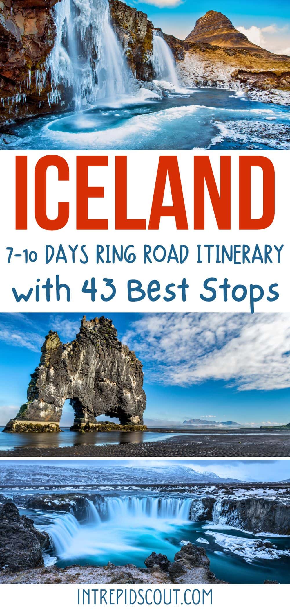
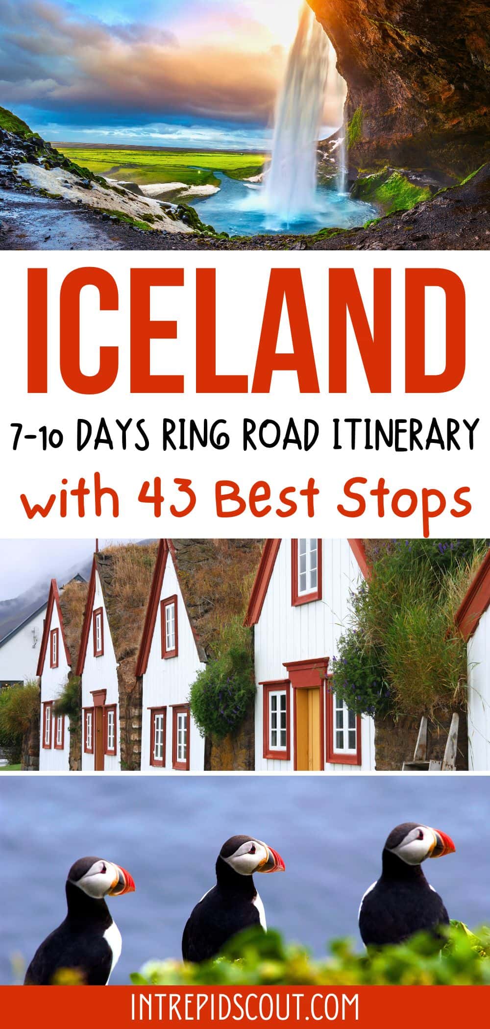
Did You Find Iceland Ring Road Itinerary Useful?
Why Not Save It to Your Pinterest Board!
Now, It Is Your Turn, I Would Like to Hear Back from You!
Are you planning your trip to Iceland?
Please let me know! Drop me a quick comment right below!
Click on any of the images below to get inspired and to help you with the planning process for your trip to Iceland!
