This site uses affiliate links, meaning that if you make a purchase through our links, we may earn an affiliate commission.
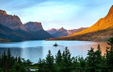
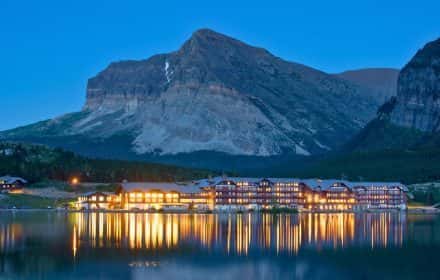
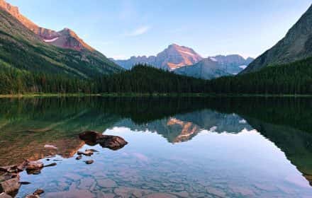
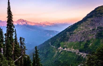
With over 700 miles of hiking trails and over 50 day-hikes that lead to the most spectacular places along the way, Glacier National Park is truly a hiker’s paradise. Here are the most scenic hikes in Glacier National Park that must be on your hiking bucket list.
If you are looking for easy hikes in Glacier National Park that are mostly flat, with very little elevation change and are perfect for every fitness level, then check out 8 Fun and Easy Hikes in Glacier National Park. Some might be a little longer, however, you can shorten them to make sure they are enjoyable for everyone.
There are other things to do besides hiking the Glacier National Park’s trails! For a break from the hiking trails in Glacier, make sure to put 18 Best Stops on Going-to-the-Sun Road, a breathtaking scenic mountain drive that traverses through Glacier National Park. This scenic drive will take you to Glacier National Park’s best viewpoints.
- 1. Glacier National Park At-A-Glance
- 2. Essential Hiking Gear for Glacier National Park
- 3. 9 Most Scenic Hikes in Glacier National Park
-
- 3.1. Avalanche Lake Trail
- 3.2. Hidden Lake Trail
- 3.3. Highline Trail
- 3.4. Three Falls Trail
- 3.5. Swiftcurrent Pass Trail
- 3.6. Grinnell Glacier Trail
- 3.7. Cracker Lake Trail
- 3.8. Iceberg Lake Trail
- 3.9. Ptarmigan Tunnel Trail
- 4. Intrepid Scout's Tips for Most Scenic Hikes in Glacier National Park
Glacier National Park At-A-Glance
Before diving in, here are a few highlights to help you plan your trip:
- What You Need to Know About Glacier National Park
1. Glacier National Park became the United States’ 8th National Park in 1910. It preserves 1 million acres of land with 792 lakes and 2,800 streams.
2. Glacier National Park is famous for its breathtaking mountain views (10,448-foot Mt. Cleveland near Goat Haunt is the highest peak), numerous waterfalls, and, of course, glaciers. Currently, there are 26 glaciers in the park (Blackfoot Glacier is the largest).
3. Glacier is home to over 70 species of mammals – grizzly and black bears, mountain goats, bighorn sheep, moose, wolverines, grey wolves, and mountain lions.
4. Glacier National Park is the 10th most visited National Park in the US with 3 million visitors annually.
- Glacier National Park Regions
Glacier National Park is divided into 5 main regions:
1. Lake McDonald Valley Region – it is situated on the western side of the park along beautiful Lake McDonald.
2. St. Mary and Logan Pass Region – St. Mary Region is located east of Lake McDonald Valley and Logan Pass is the highest point reachable by car on the Going-to-the-Sun Road.
3. Two Medicine Valley Region – it is situated on the southeastern side of Glacier National Park and can be reached by exiting the park on the east side and driving south on Highway 89 for about an hour and then re-entering the park.
4. Many Glacier Valley Region – it is located on the eastern side of the park. You will need to exit the park on the east side and then continue north on Highway 89 for about 30 minutes and then re-enter the park.
5. North Fork and Goat Haunt Region – this area is located on the northwestern side of Glacier National Park. North Fork is only accessible by unpaved roads and Goat Haunt requires backcountry hiking access.
- Best Time to Visit Glacier National Park
Hands down, summer is the best (and most popular) time to visit Glacier National Park. The weather is warm and all park facilities are open. However, my favorite time to visit is early to mid-September. The weather can be awesome in the fall and it is a great time to avoid the crowds and find some solitude on the trails.
- How to Get to Glacier National Park
Glacier National Park is located in northwestern Montana and the closest airport to Glacier National Park is Glacier Park International Airport (FCA). It is located in Kalispell which is 12 miles from the town of Whitefish and 30 miles from the West Entrance to Glacier National Park.
- How to Get Around in Glacier National Park
Driving your car or renting a car is the best option to get around Glacier National Park. This option is the most convenient and gives you the most flexibility.
Glacier National Park offers West and East Shuttle Service that operates on the Going-to-the-Sun Road. There are some pros and cons to using the shuttle. From my personal experience, the shuttle system is not very efficient.
- Where to Stay in Glacier National Park
Finding where to stay in Glacier Nationa Park can be confusing, especially if this is your first visit. Here are my favorite 14 best places to stay in Glacier National Park whether you are visiting the west or east side (or both) of this amazing national park.
- How to Reserve Entrance Pass
Starting in May through September, from hours 6 am to 3 pm MDT, you are required to have a reservation ticket. Reserve your Entrance Pass here.
- Intrepid Scout’s Tip:
It costs $35 to enter the park. The entrance pass is good for 7 consecutive days. If you are visiting several national parks then make sure to get America the Beautiful National Park Pass. This $80 pass is valid for 12 months and gets you into all 400+ national park sites!
Essential Hiking Gear for Glacier National Park
Here is a reminder to make sure to have the basic hiking gear for hiking in Glacier National Park:
- Appropriate footwear
Trail shoes are great; hiking boots are even better since they offer more support. You’ll want sturdy, comfortable hiking boots with solid traction. Don’t forget to break in your shoes before bringing them to Glacier National Park. Also, do not forget merino wool socks. They will keep your feet dry, and protect you from blisters.
- Plenty of water
Without enough water, your body’s muscles and organs simply cannot perform as well. Consuming too little water will not only make you thirsty but susceptible to hypothermia and altitude sickness. I have been using Yeti Rumbler 26 oz insulated, stainless steel bottle, and I am highly recommending it!
- Food
Food will help keep up energy and morale. I like RXBAR. It is a high-protein bar, gluten-free, and it is super yummy! Make sure to get a variety pack to keep it interesting.
- Rain gear and extra clothing
The weatherman is not always right. Be prepared for unannounced rain or a cold spell. Dress in layers. It will allow you to adjust to changing weather and activity levels. Two rules: avoid cotton (it keeps moisture close to your skin) and always carry a hat. I have had my North Face Women’s Osito Triclimate Jacket for years, and I love it. Also, I highly recommend these Patagonia moisture-wicking hiking shirts and Patagonia warm fleece pullovers.
- First aid kit
Prepackaged first-aid kits for hikers are available at any outfitter.
- Knife
A knife or even better, a multi-purpose tool is always good to have. These enable you to cut strips of cloth into bandages, remove splinters, etc.
- Protect Yourself from the Sun
If you are hiking in the summer, keep in mind that many trails are unshaded, so it’s important to protect yourself from the sun. Sunscreen is essential, however, a lightweight long sleeve shirt is a must! My favorite are sun shirts by Columbia. Also, it is a good idea to wear lightweight long pants to protect yourself from the sun and bugs!
Wear sunglasses with UV protection. Sunglasses are an important part of your sun-protective wardrobe. When purchasing sunglasses, always look for lenses that offer UV protection.
A wide-brimmed hat is a simple and effective way to cover up your face and neck. When selecting a hat, choose one that has a wide brim, which will protect your ears, as well as your head and neck. Avoid baseball hats or straw hats with holes, as these are not as effective in protecting you outdoors.
- Apply an effective insect repellent
Insect repellent is an important step against mosquitoes and ticks that can spread diseases like West Nile and Lyme. When selecting an effective insect repellent, do not look at the brand names, but rather, look at the concentration of the active ingredients. Concentrations of DEET at 25 to 30% are the best to keep you protected.
- Daypack/backpack
You need something you can carry comfortably and has features designed to keep you hiking smartly. Don’t forget the rain cover; some packs come with one built-in. I have Osprey Daylite Daypack and it is perfect for day hiking.
- Camera!!!
Glacier National Park is a photographer’s dream! If you are like me, you will be taking hundreds, if not thousands, of photos. The scenery is just breathtaking and constantly changing. I have a Nikon COOLPIX P1000 Super Telephoto Camera that I bought a couple of years ago and I really like it.
- A spare battery for the camera
Make sure to have a spare battery for your camera. I think there is nothing more frustrating than knowing that you still have half a day ahead of you, yet your camera’s battery is gone.
- Tripod
If you are taking photos during the golden hour (shortly after sunrise or before sunset) when the light is softer, a tripod is essential for long exposure shots. Also, I like a tripod since it gives me more stability when taking close-ups of wildlife. I have Manfrotto Befree Live Carbon Fiber Tripod with Fluid Head. It is only 3.0 pounds and it fits nicely in my backpack.
- Binoculars!
If your camera does not have a good zoom, then binoculars are a must. I know that luck will be on your side and you will see a moose, and hopefully a black bear, and what to treat to see them up close.
- Trash Bag
This will make sure that the trail will stay beautiful for generations to come. A zip-lock bag is a great option as well for keeping the trash you pick up along the trail separate from the rest of your gear.
- Bear spray
Bear Spray is an essential safety item for hiking in Glacier National Park. If you are flying into Glacier National Park, then keep in mind that you will not be able to take it on the plane with you. However, there are plenty of places to buy it once you get to Grand Teton. If you are driving, then buy bear spray ahead of time to save money.
9 Most Scenic Hikes in Glacier National Park
So here we go! Here are 9 most scenic hikes in Glacier National Park with breathtaking scenery:
To make it more manageable these easy hikes are grouped by each region in Glacier National Park:
- Lake McDonald Valley Region
- St. Mary and Logan Pass Region
- Two Medicine Valley Region, and
- Many Glacier Valley Region
Avalanche Lake Trail
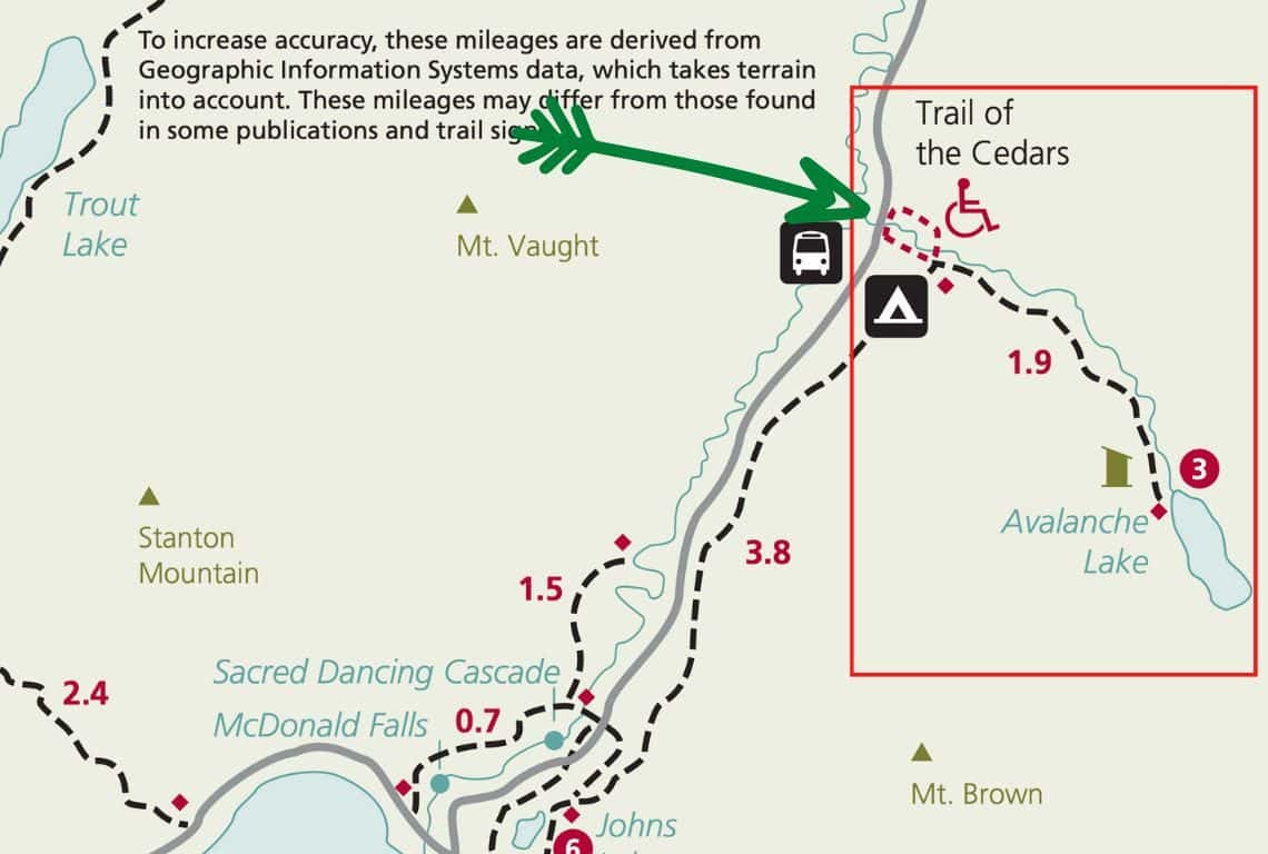
Avalanche Lake Trail Map / Image Credit: NPS / Most Scenic Hikes in Glacier National Park
Avalanche Lake Trail is a great hike that actually starts with Trail of the Cedars (0.7 loop), which is a fun and easy hike among ancient red cedars, and then takes you to the most stunning Avalanche Lake (3.8 roundtrip).
- Roundtrip Distance: 4.5 miles
- Elevation Gain: 730 feet
- Trailhead Location: Avalanche Creek (Lake McDonald Valley Region on the Going-to-the-Sun Road in Glacier National Park)
- Time: 2-2.5 Hours
- Difficulty: Moderate
The parking for the Avalanche Creek Trailhead is located 5.5 miles east of Lake McDonald Lodge and getting a parking spot at this trailhead can be tough.
The trail starts with the Trail of the Cedars hike which is a loop and can be done in either direction. If you start on the east side, then the trail starts by going on a raised boardwalk and meandering through the forest of old western red cedars.
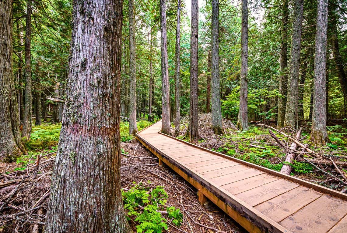
Avalanche Lake Trail / Most Scenic Hikes in Glacier National Park
At about 0.5 miles from the trailhead, you will reach a footbridge over Avalanche Creek. It is a pretty good spot to take a few pictures of the lower Avalanche Gorge.
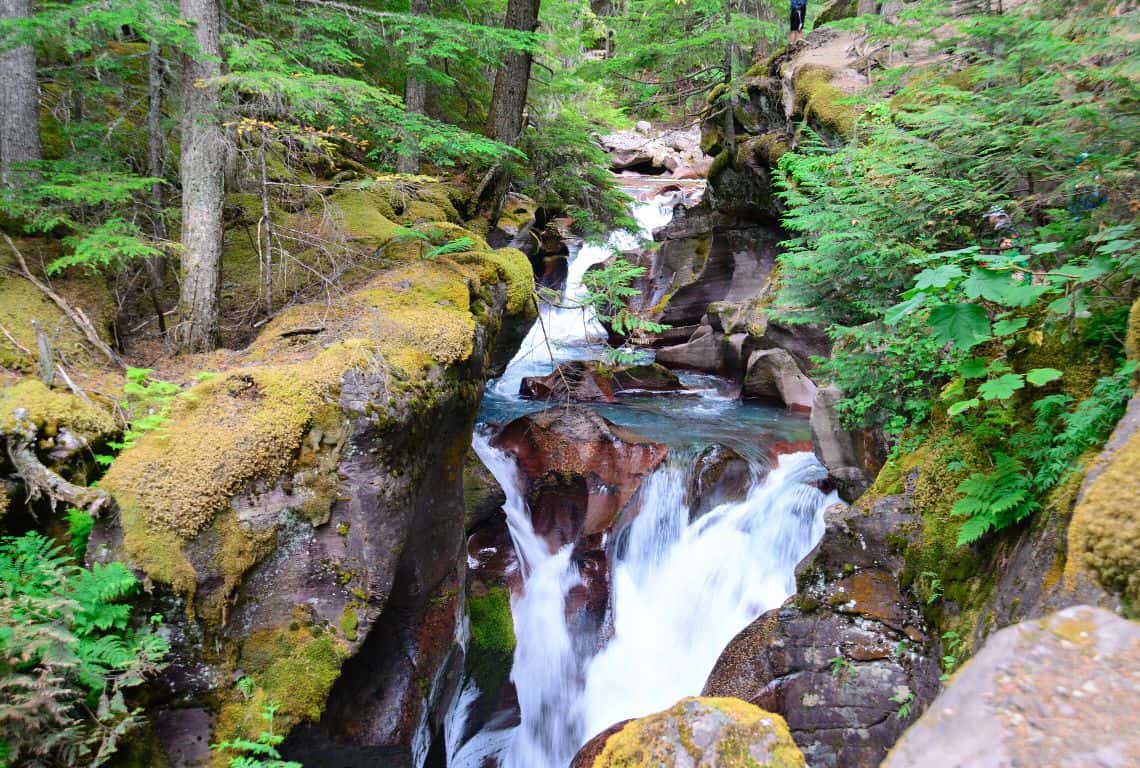
Avalanche Lake Trail / Most Scenic Hikes in Glacier National Park
Just past the footbridge is a junction with Avalanche Lake Trail. The views of the gorge with cascading water are even better at this point.
Next, you follow the sign for Avalanche Lake Trail. The trail will travel away from Avalanche Creek and go through a dense forest. Eventually, you will pass by an area devastated by a recent avalanche.
At About 2.2 miles from the trailhead, you will start getting glimpses of the lake and soon you will be rewarded with the most stunning of Avalanche Lake.
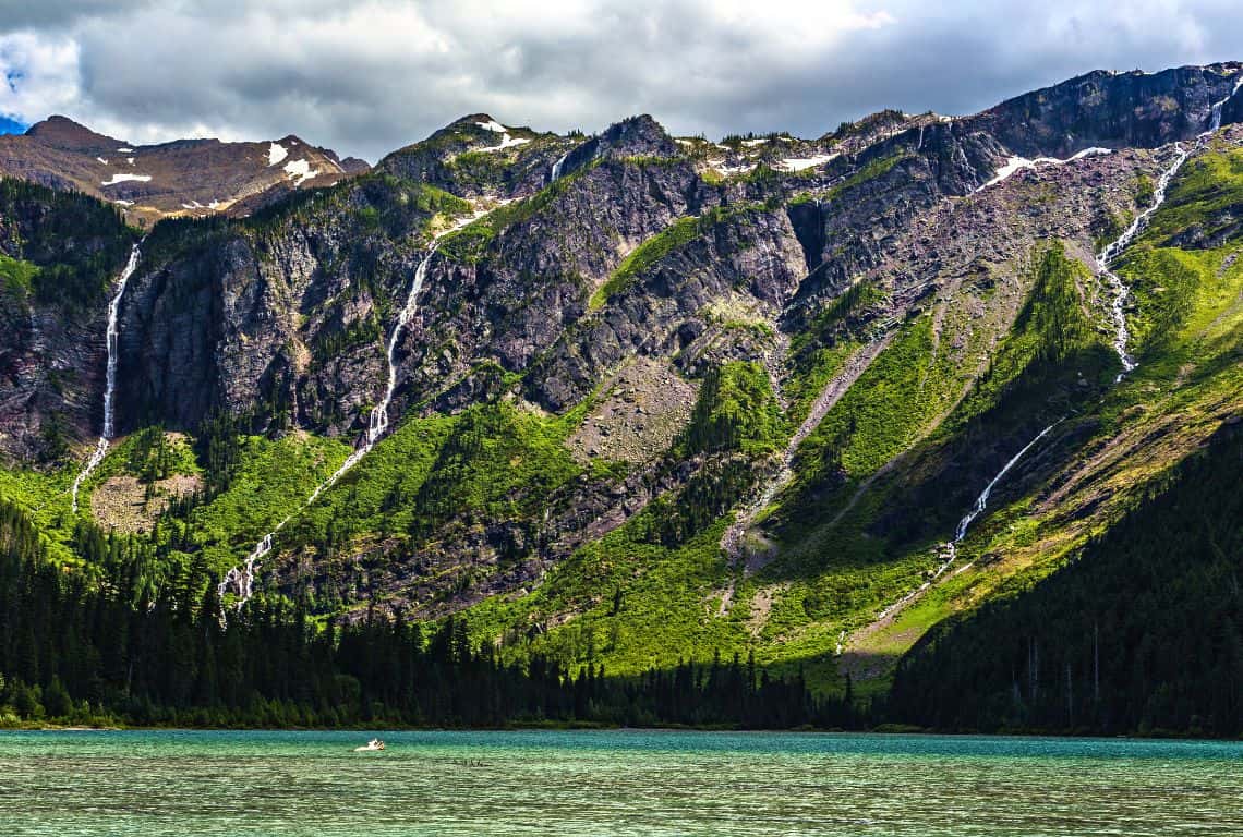
Avalanche Lake Trail / Most Scenic Hikes in Glacier National Park
Avalanche Lake sits in a bowl-shaped canyon and is surrounded by Bearhat Mountain standing at 8,694 feet, Little Matterhorn at 7,886 feet, and Mount Brown at 8,569 feet.
GOOD TO KNOW: If you are hiking to the lake during spring or early summer, then you will be rewarded with awesome views of many waterfalls cascading hundreds of feet down Bearhat and Little Matterhorn Mountains making this a picture-perfect setting.
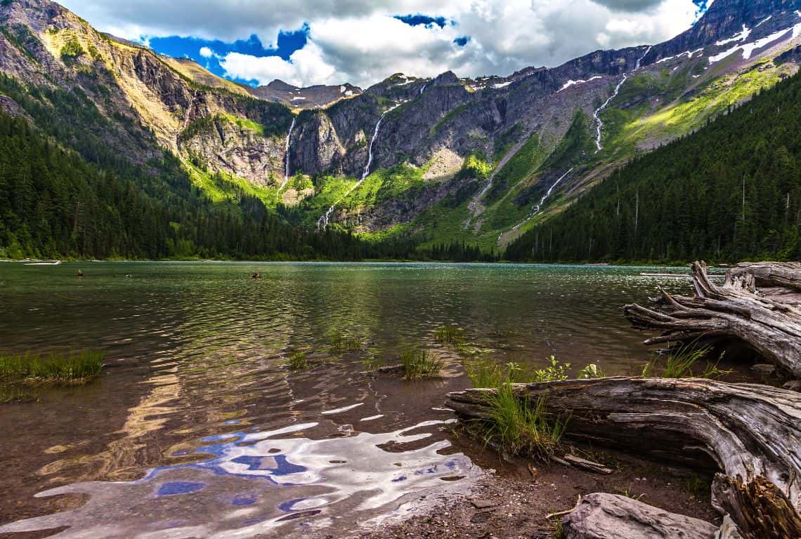
Avalanche Lake Trail / Most Scenic Hikes in Glacier National Park
Hidden Lake Trail
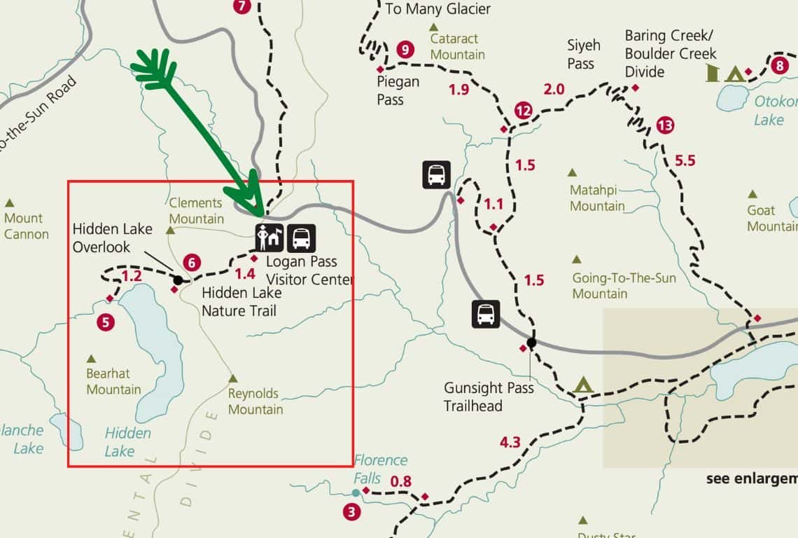
Hidden Lake Trail Map / Image Credit: NPS / Most Scenic Hikes in Glacier National Park
Hidden Lake Trail is another outstanding trail that will take you along alpine meadows to Hidden Lake Overlook and then down to the shore of Hidden Lake with the spectacular views of the lake surrounded by mountains.
- Roundtrip Distance: 5.4 miles
- Elevation Gain: 1,325 feet
- Trailhead Location: Logan Pass Visitor Center (Logan Pass and St. Mary Valley on the Going-to-the-Sun Road in Glacier National Park)
- Time: 3-3.5 Hours
- Difficulty: Moderate
Hidden Lake Trail starts on the back side of the Logan Pass Visitor Center. Once you get there, be on the lookout for a sign for the Hanging Gardens Trail, which is also referred to as The Hidden Lake or the Hidden Lake Nature Trail.
The reason for calling it the Hanging Gardens Trail is that the trail will take you through beautiful alpine meadows known as the Hanging Gardens.
The trail starts with a paved surface, and then, traverses over a raised boardwalk, which will keep you above small streams and mud especially if you are hiking during the spring and early summer months. Later on, during the summer months, this entire area is covered with colorful wildflowers.
The views will be pretty spectacular right from the start with 8,760 Foot Clements Mountain directly in front of you.
At 1.2 miles from the trailhead, you will reach the Continental Divide, and just beyond that, you will get to Hidden Lake Overlook.
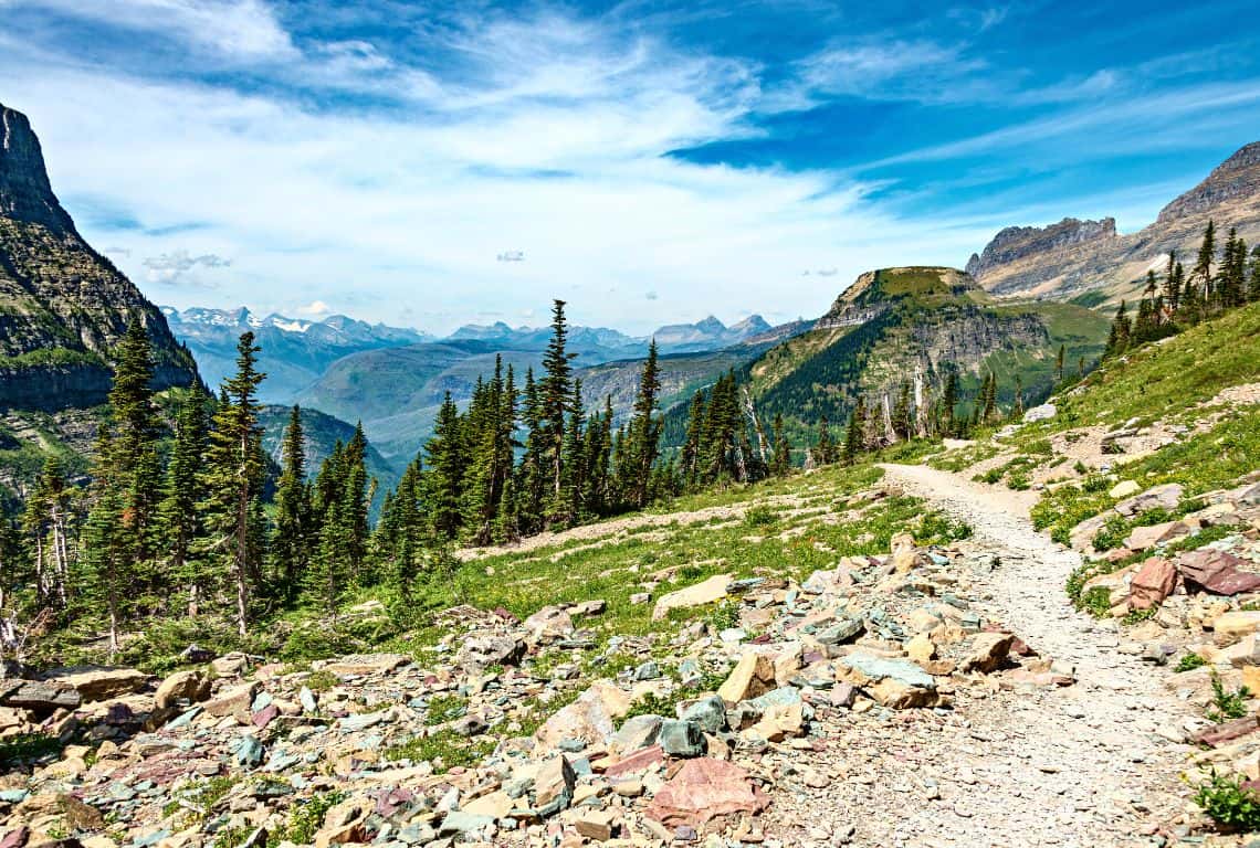
Hidden Lake Trail / IMost Scenic Hikes in Glacier National Park
Hidden Lake Overlook offers the most incredible panoramic views of Hidden Lake and surrounding mountains, and 8,684-foot Bearhat Mountain will dominate the view.
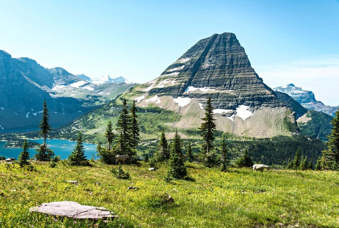
Hidden Lake Trail / IMost Scenic Hikes in Glacier National Park
INTREPID’S PRO TIP: Be on the lookout for wildlife. The chances of seeing mountain goats, bighorn sheep, marmots, and maybe even grizzly bears are very good here.
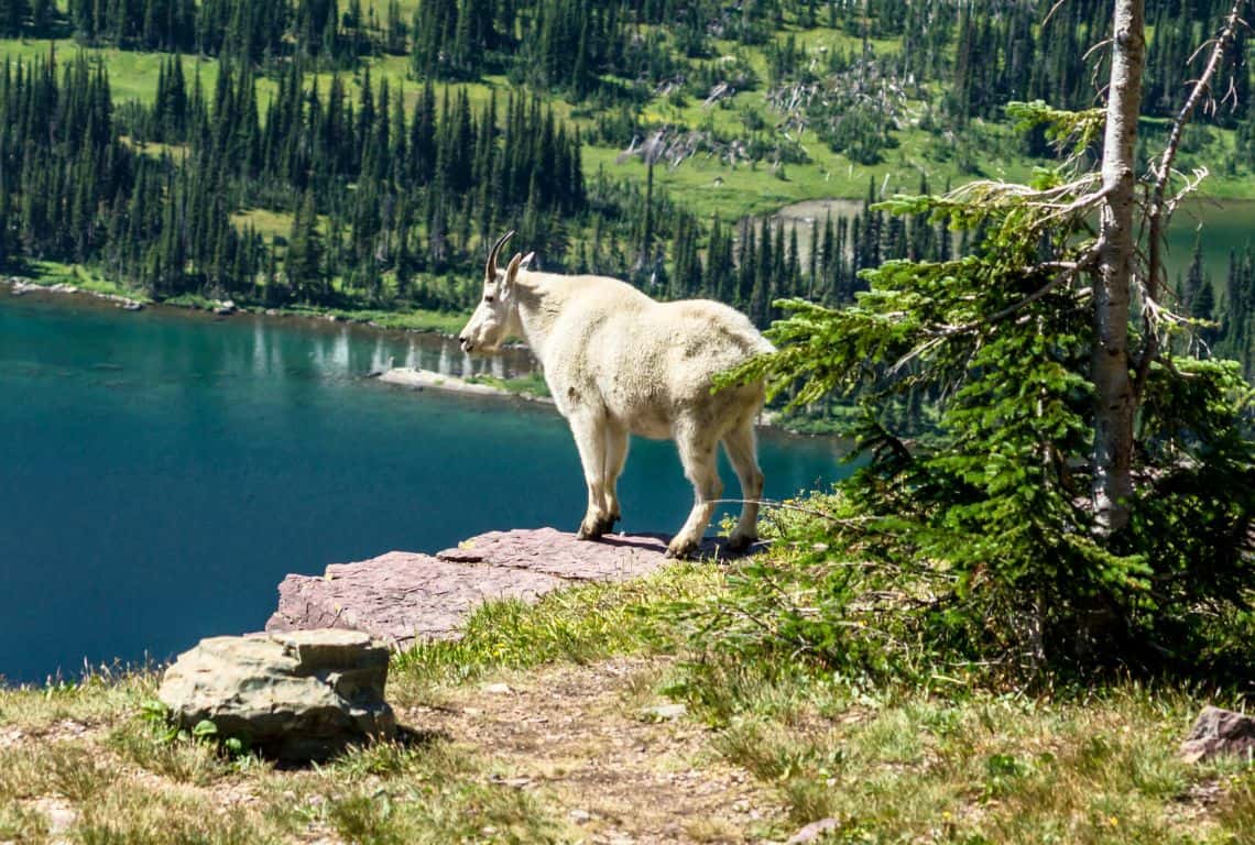
Hidden Lake Trail / IMost Scenic Hikes in Glacier National Park
Next, continue past the overlook. Here, the trail will descend about 770 feet. and at about 2.7 miles from the trailhead, you will reach the shore of Hidden Lake.
The views are off the charts!
Make sure to find a nice quiet spot to relax and have a snack or lunch and soak in the views. When you are ready to head back, there is a steep climb ahead of you until you reach the overlook, and then, get back to where you started.
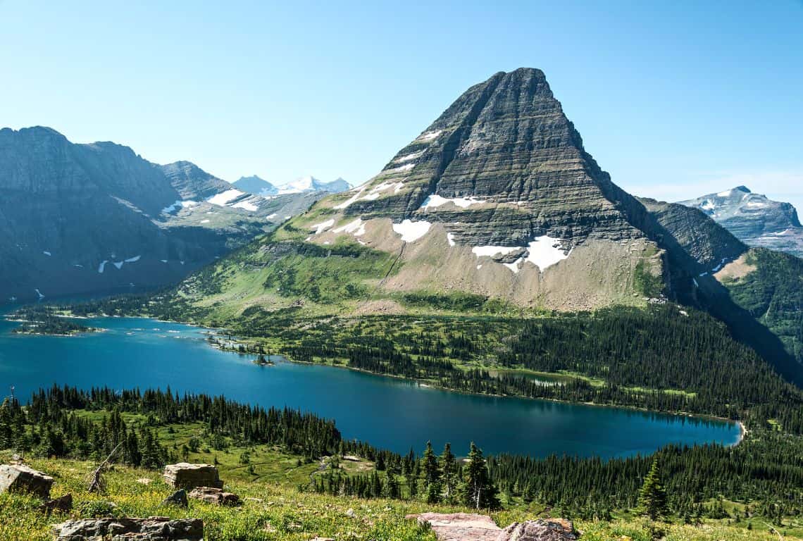
Hidden Lake Trail / IMost Scenic Hikes in Glacier National Park
Highline Trail
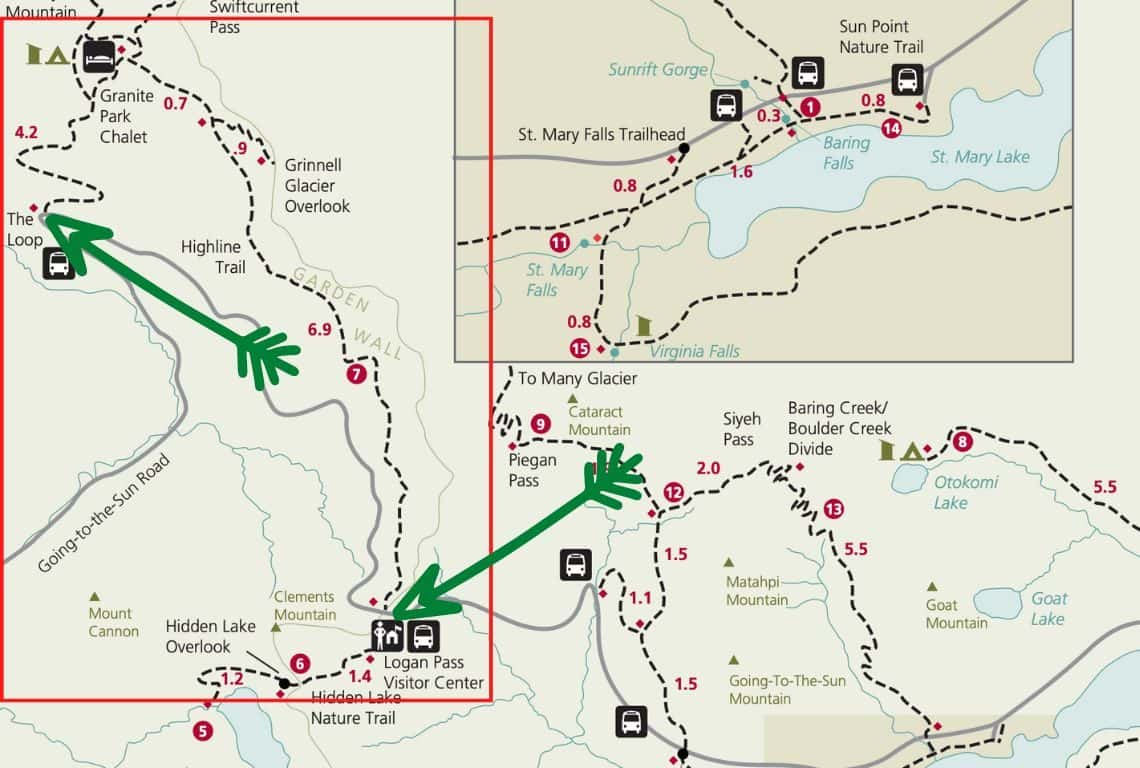
Highline Trail Map / Image Credit: NPS / Most Scenic Hikes in Glacier National Park
Hands down, Highline Trail is the most popular hike in Glacier National Park. And, I am not surprised because on this hike you will be rewarded with the most scenic views of the mountains, you will see glaciers, and I have no doubt, you will encounter some wildlife along the way.
GOOD TO KNOW: Now, if you are looking for peace and solitude, you will not find it on this hike. Even though it is a long and strenuous hike, be prepared to have plenty of company every step of the way.
- Roundtrip Distance: 11.8
- Elevation Gain: 1,950 feet
- Trailhead Location: Logan Pass Visitor Center (Logan Pass on the Going-to-the-Sun Road in Glacier National Park)
- Time: 6-8 Hours
- Difficulty: Strenuous
What you need to know about Highline Trail is that it is also called Highline Loop Trail, however, this is not a loop. You will start at the Logan Pass Visitor Center and end at the Loop.
INTREPID’S PRO TIP: There are a few options for doing this hike:
- Now, if you are in a group with two vehicles, you can park at each end of the trail. I recommend that you drive and park at the Loop first, then carpool to the Logan Pass Visitor Center.
- Another option is if you have friends and family that can drop you off at the Logan Pass Visitor Center and then pick you up at the Loop, then it would work as well.
- Finally, you can use the shuttle. Make sure to park at the Loop, then take the shuttle to the Logan Pass Visitor Center and start your hike there.
Once you are done with your hike at the Loop, be prepared to wait for a shuttle. The shuttles are small and can take only a few people at a time. If you are coming back from your hike late in the afternoon, then you might have to wait 1-2 hours (or longer) before you get a ride.
GOOD TO KNOW: To avoid the crowds, be able to find a parking spot, and catch the shuttle, you must start your hike early in the morning!
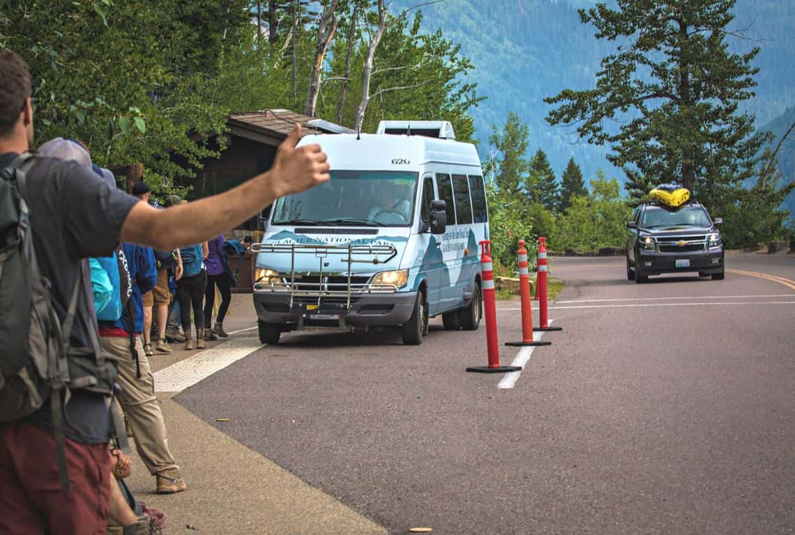
Highline Trail / Most Scenic Hikes in Glacier National Park
The first section of Highline Trail goes parallel to the Going-to-the-Sun Road and it is no doubt the most famous as well as the scariest portion of the trail.
Basically, you are hiking along a narrow ledge with sharp drop-offs on one side. However, do not be intimidated by this portion of the trail! First of all, this section is short, no more than 0.3 miles, and there is a cable that you can hold on to.
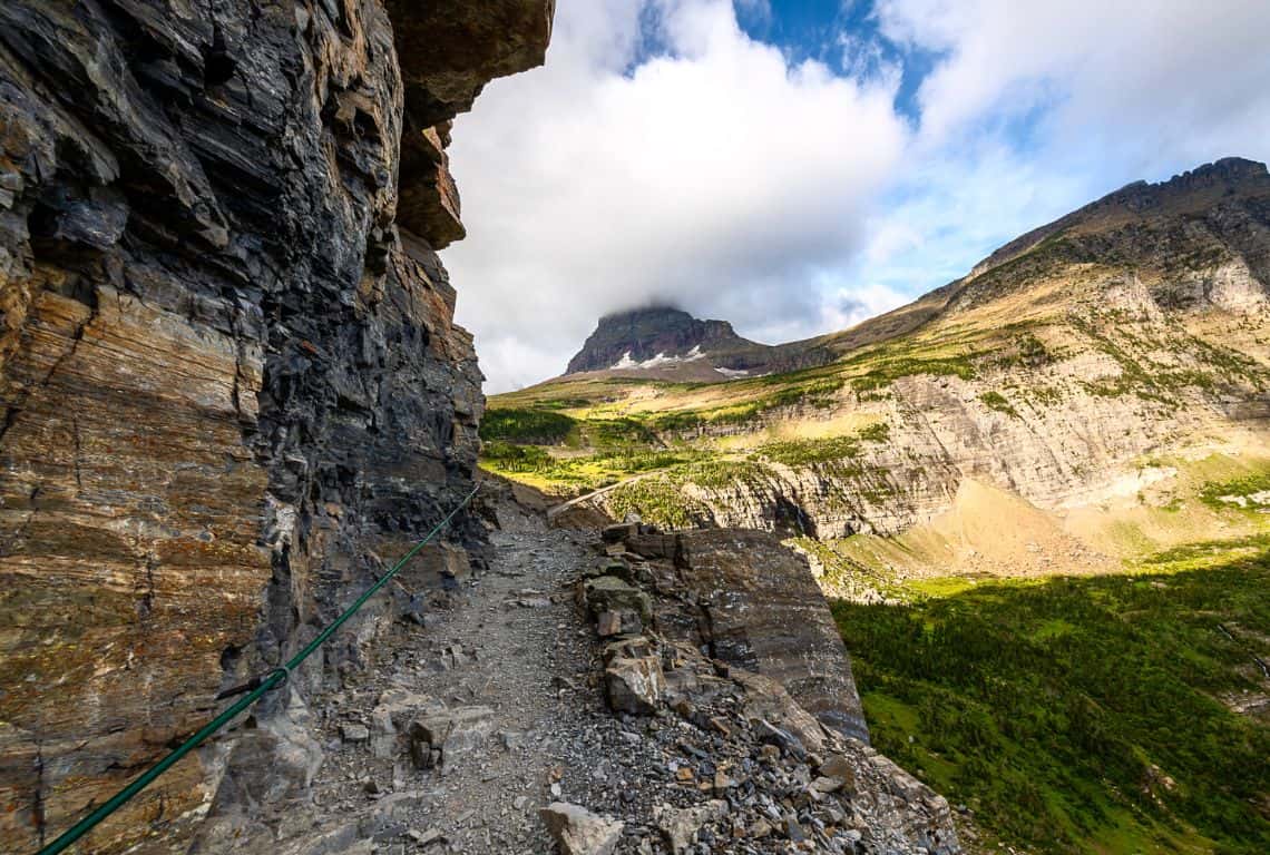
Highline Trail / Most Scenic Hikes in Glacier National Park
At 2.5 miles from the trailhead, the trail veers away from the Going-to-the-Sun Road, and the views of the Lake McDonald Valley with Mount Oberlin and Mount Cannon are awesome at this section of the trail.

Highline Trail / Most Scenic Hikes in Glacier National Park
Next, at about 4 miles from the trailhead, ahead of you will be a few switchbacks that will take you to the other side of the valley through the pass between Haystack Butte and the Garden Wall.
GOOD TO KNOW: This is an excellent spot to see marmots and mountain goats.
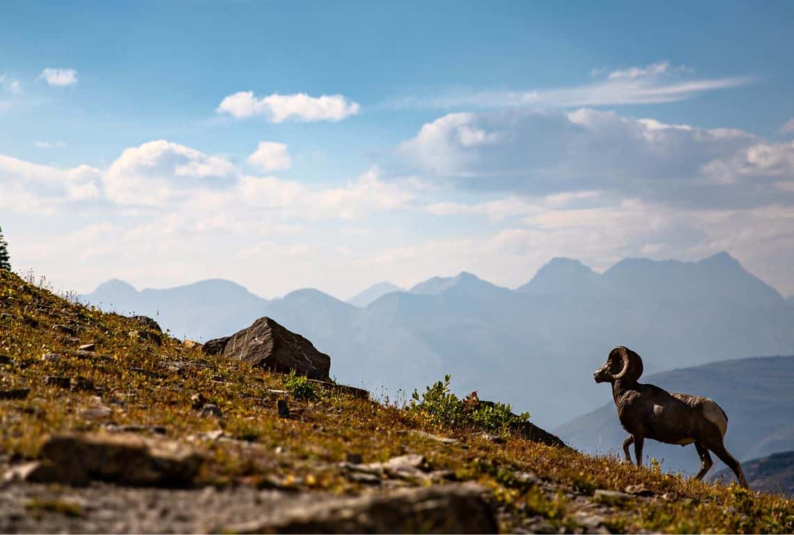
Highline Trail / Most Scenic Hikes in Glacier National Park
For the next 2.5 miles, the trail runs along the western side of the Continental Divide. This area is referred to as “the Garden Wall”.
The views along this section are stunning!

Highline Trail / Most Scenic Hikes in Glacier National Park
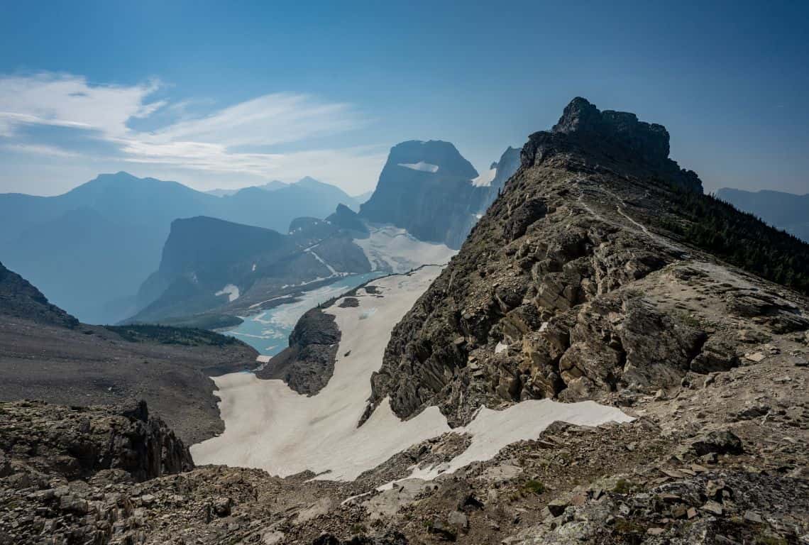
At about 6.5 miles from the trailhead, you will pass a side trail leading to Grinnell Glacier Overlook. It is a short hike, however, it is very steep. You will have to climb 1000 feet in 0.9 miles. If you are up to it, then you definitely should do this section.
The views are great from the overlook! Probably the best views in the entire Glacier Nationa Park. You will see Lake McDonald Valley to the west and Many Glacier Valley to the east and below you will be Salamander Glacier and Grinnell Glacier.
Highline Trail / Most Scenic Hikes in Glacier National Park
Once back on the main trail, you will reach Granite Park Junction at 7.6 miles from the trailhead. Turn left at the junction.
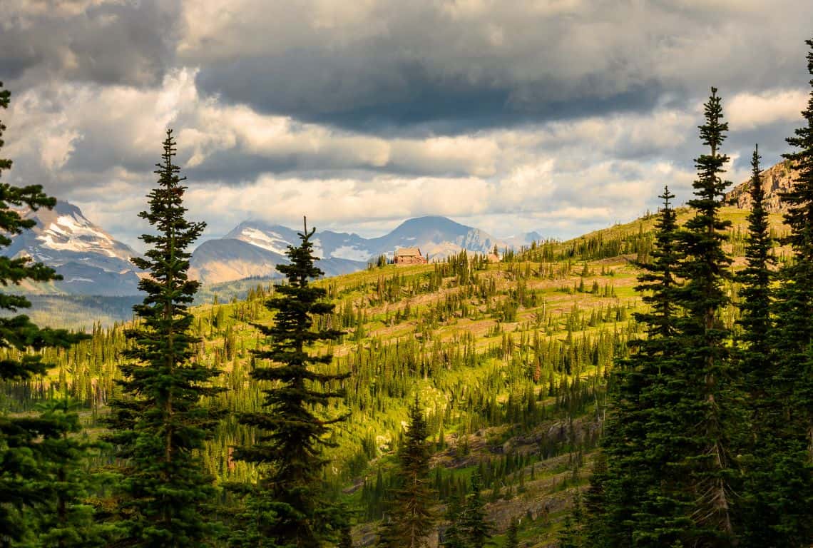
Next, you will reach the historic Granite Park Chalet. It is a perfect spot to rest and refuel your body.
Highline Trail / Most Scenic Hikes in Glacier National Park
Ahead of you is the final section of the trail leading to the Loop. The first portion is almost entirely down the hill. At 11.2 miles you will reach Packers Roost Trail Junction. and shortly after you will reach the Loop and the Going-to-the-Sun Road.
Three Falls Trail
Three Falls Trail Map / Image Credit: NPS / Most Scenic Hikes in Glacier National Park
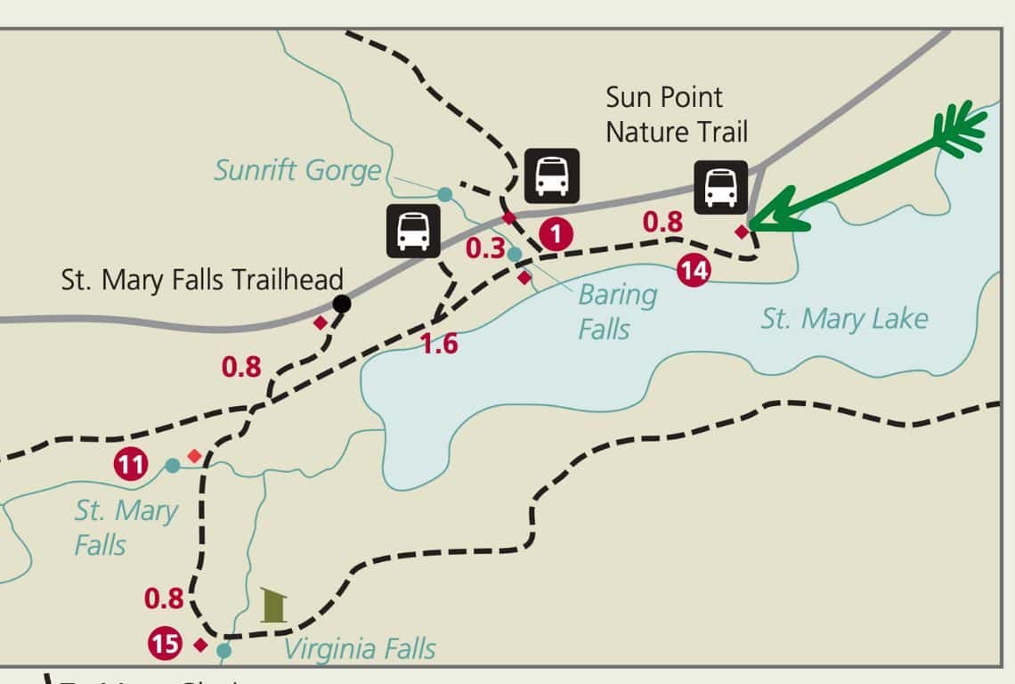
Three Falls Trail is a delightful trail that meanders along the shore of St. Mary Lake and takes you to three picturesque falls.
The trial is relatively moderate with some evaluation changes. You can shorten this trail any way you like to make it more manageable.
INTREPID’S PRO TIP: I like to start at Sun Point Nature Trailhead, then continue to Baring Falls, followed by St. Mary Falls, and finish at Virginia Falls.
- Roundtrip Distance: 6.4
- Elevation Gain: 775 feet
- Trailhead Location: Sun Point Nature Trailhead (St. Mary Valley Region on the Going-to-the-Sun Road in Glacier National Park)
- Time: 2.5-3 hours
- Difficulty: Easy/Moderate
Sun Point Nature Trailhead is located on the Going-to-the-Sun Road in the St. Mary Valley Region of Glacier National Park. Specifically, it is 9.3 miles from St. Mary Entrance to the park.
Right from the start, the trail starts to descend toward St. Mary Lake and you will be rewarded with excellent views of St. Mary Lake and the surrounding mountains. In front of you will be Dusty Star Mountain, and to the south, you will see Little Chief Mountain.
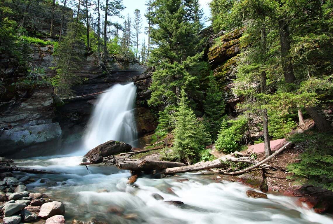
Soon you will reach a short side trail that will take you to 25-30-foot Baring Falls.
Three Falls Trail / Most Scenic Hikes in Glacier National Park
Next, you will hike through an area that was burned during the Reynolds Creek Fire in 2015.
Right after, you will reach a junction with the Piegan Pass Trail. Make sure to veer to the left and stay on St. Mary Falls Trail.
First, you will reach St. Mary River, and right after, St. Mary Falls.
St. Mary Falls is stunning as it drops 35 feet down in several separate tiers and forms gorgeous turquoise color pools at the bottom.
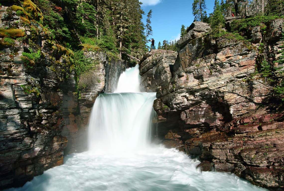
Three Falls Trail / Most Scenic Hikes in Glacier National Park
Ahead of you is the last section of the trail that will take you to Virginia Falls.
Virginia Falls is the most beautiful of the three falls. It is a multi-tiered waterfall with the first tier that drops down about 50 feet and several smaller ones cascading to the pools below.
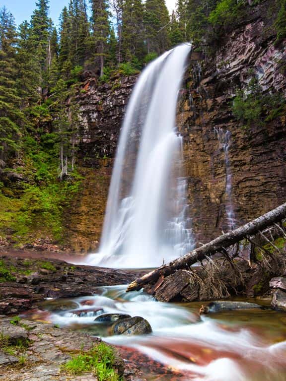
Three Falls Trail / Most Scenic Hikes in Glacier National Park
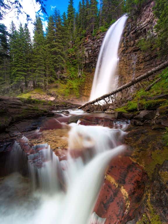
Three Falls Trail / Most Scenic Hikes in Glacier National Park
This is a perfect spot to take a break and soak in the views.
When you are ready to get back simply retrace your steps to where you started your hike.
Swiftcurrent Pass Trail
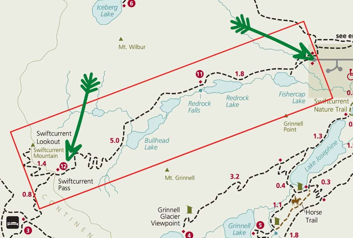
Swiftcurrent Pass Trail Map / Image Credit: NPS / Most Scenic Hikes in Glacier National Park
Swiftcurrent Pass Trail is one of the most scenic hikes in Glacier National Park. On this trail, you will visit beautiful lakes and waterfalls before reaching Swiftcurrent Pass on the Continental Divide.
INTREPID’S PRO TIP: This trail is long and the last section is very challenging. If you are not up to such a long and strenuous hike, then just hike to Redrock Falls. You will still get to see two stunning lakes and waterfalls along the way, and there is very little elevation change which is perfect for every fitness level.
- Roundtrip Distance: 13.6 Miles
- Elevation Gain: 2,400 Feet
- Trailhead Location: Swiftcurrent Pass Trailhead (Many Glacier Valley Region of Glacier National Park)
- Time: 7-8 Hours
- Difficulty: Strenuous
Swiftcurrent Pass Trailhead is located at the end of the parking lot adjacent to Swiftcurrent Motor Inn.
In about 0.3 miles from the trailhead, you will reach a short side trail that will take you to Fishercap Lake. The views of the surrounding mountains reflected in the water are magnificent. Also, be on the lookout for wildlife. This is especially an excellent area to spot moose.
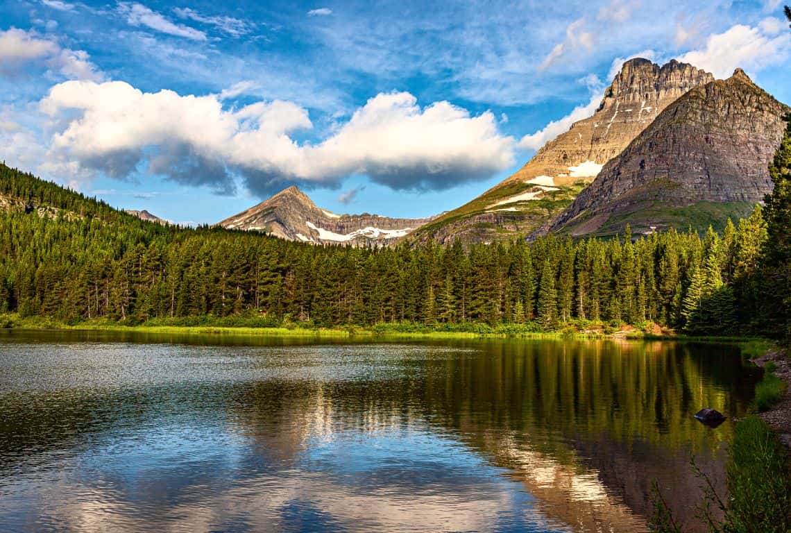
Swiftcurrent Pass Trail / Most Scenic Hikes in Glacier National Park
At 1.7 miles from the trailhead, you will reach Redrock Lake. The views of 8,851-foot Mt. Grinnell Mountain and 8,436-foot Swiftcurrent Mountian are spectacular here.
Next, follow the trail and continue along the shore of Redrock Lake. At about 2 miles from the trailhead, you will reach an unmarked junction, turn left at the junction, and follow this side trail to Swiftcurrent Creek as it tumbles down in a series of cascades over some red rocks and forms beautiful Lower Redrock Falls.
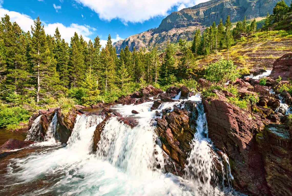
Swiftcurrent Pass Trail / Most Scenic Hikes in Glacier National Park
Next, the trail will take you through several open sections and you will get to enjoy some great views of Mount Grinnell, Swiftcurrent Mountian, and Mt Wilbur.
Also, you should be able to start catching glimpses of Swiftcurrent Glacier to the left of Swiftcurrent Mountian.
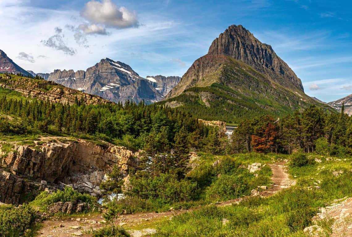
Swiftcurrent Pass Trail / Most Scenic Hikes in Glacier National Park
At 3.4 miles from the trailhead, you will reach the first footbridge.
Next, the trail goes down to Bullhead Lake and the views of the surrounding mountains are even better at this spot.
Shortly after, at 4.1 miles, you will cross the second footbridge.
Ahead of you is a steep climb, however, you will be rewarded with some awesome views of Swiftcurrent Valley.
At about 7 miles from the trailhead, you will reach Swiftcurrent Pass. Congratulations! You made it!
GOOD TO KNOW: Now, what you need to know is that there is a side trail that leads to the fire lookout atop Swiftcurrent Mountain. This side trail is 1.4 miles long and climbs 1,250 feet. However, if you are up to it, then you should do it. Once you reach it, you can pat yourself on the back for hiking to the highest trail maintained in Glacier National Park.
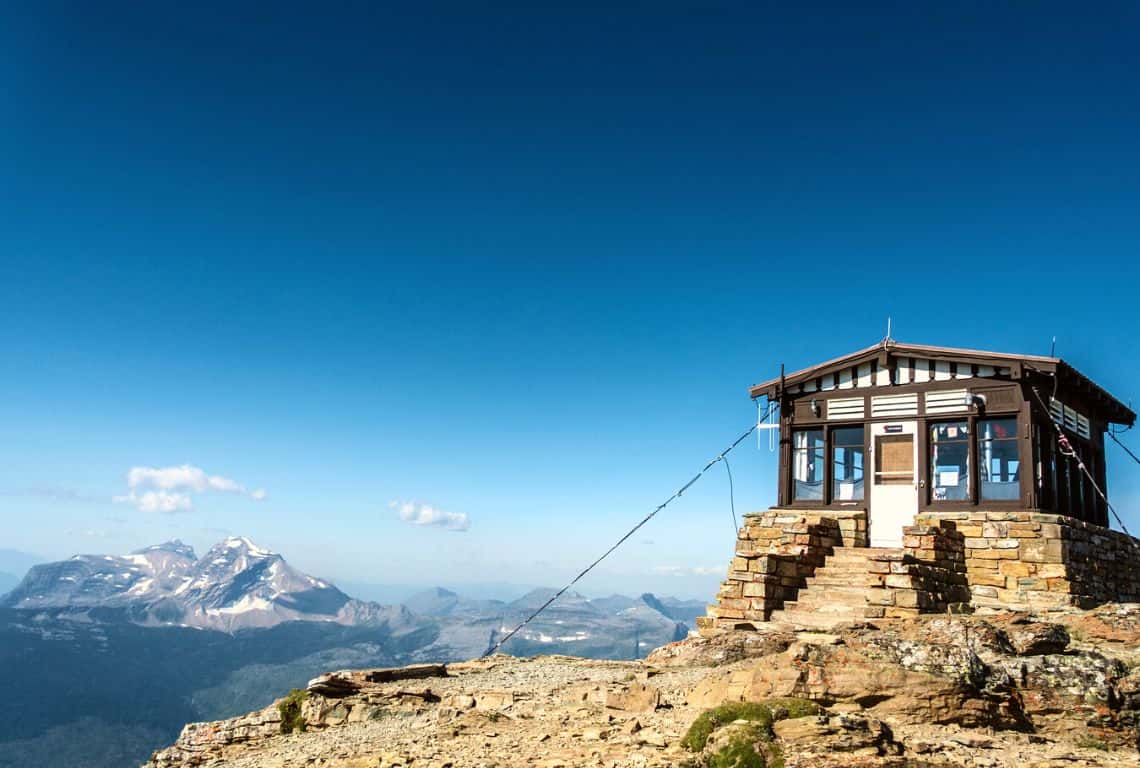
Swiftcurrent Pass Trail / Most Scenic Hikes in Glacier National Park
Grinnell Glacier Trail
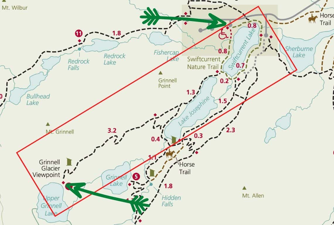
Grinnell Glacier Trail Map / Image Credit: NPS / Most Scenic Hikes in Glacier National Park
If you are visiting Glacier National Park, then Grinnell Glacier Trail needs to be on your hiking bucket list. The views are great on this hike and I am sure you will some wildlife along the way. However, the best part is reaching Grinnell Glacier!
Needless to say, it is a very popular hike, so be prepared to have plenty of company along the way.
INTREPID’S PRO TIP: The trail is 10.6 miles roundtrip, but there is a way to shorten this hike by about 3.4 miles if you take two shuttle boats. The first shuttle boat runs across Swiftcurrent Lake (10 min ride) and then the second one across Lake Josephine (15 min ride). If you decide to take the shuttles then my recommendation is to make reservations.
Another tip is to start this hike as early as possible to not only avoid the crowds but to be able to find a parking spot. Once the parking lot is full, park rangers turn visitors away at the Many Glacier Entrance.
- Roundtrip Distance: 10.6 Miles
- Elevation Gain: 1,600 Feet
- Trailhead Location: Grinnell Glacier Trailhead (Many Glacier Valley Region of Glacier National Park)
- Time: 5-6 Hours
- Difficulty: Strenuous
Grinnell Glacier Trailhead is located 0.8 miles from Many Glacier Hotel. If the parking lot at Grinnell Glacier Trailhead is full, then try parking at Many Glacier Hotel. You might have more luck finding a parking spot at the hotel since it has a bigger parking lot.
You start your hike on Swiftcurrent Lake Nature Trail, which goes for 0.8 miles on the side of Swiftcurrent Lake, and right from the start, you will be in awe of the stunning views!
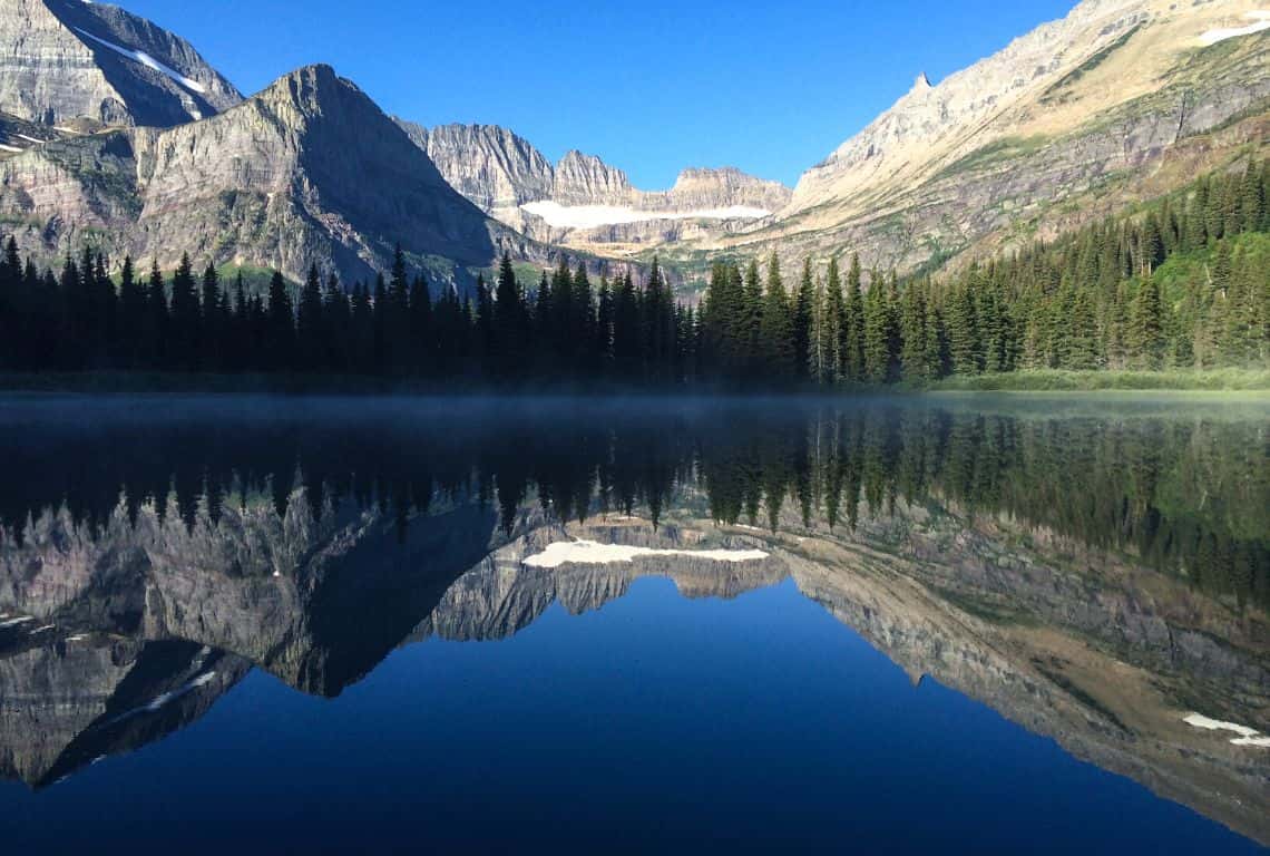
Grinnell Glacier Trail / Most Scenic Hikes in Glacier National Park
Next, for about 1.3 miles the trail meanders along Lake Josephine. And, the views at this section of the trail are stunning!
At 2.1 miles from the trailhead, you will get to the end of Lake Josephine and this is where you will start climbing. As you gain elevation, the views of both Swiftcurrent Lake and Lake Josephine will get better.
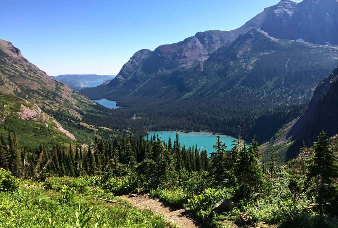
Grinnell Glacier Trail / Most Scenic Hikes in Glacier National Park
The most challenging section will be right before you reach Grinnell Glacier Viewpoint. It is a steady climb up the hill.
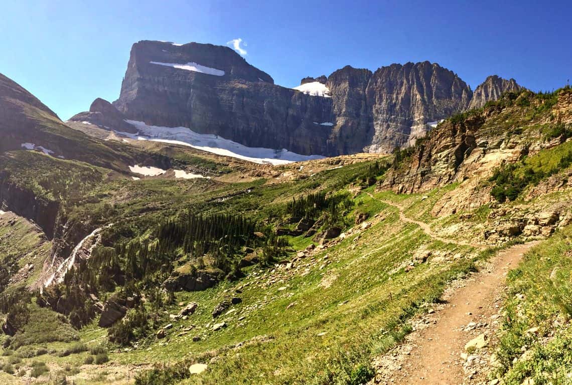
Grinnell Glacier Trail / Most Scenic Hikes in Glacier National Park
Once you get to Grinnell Glacier Viewpoint, you will be rewarded with an awesome view of the 152-acre Grinnell Glacier, Upper Grinnell Lake, the Garden Wall, and Mount Gould.
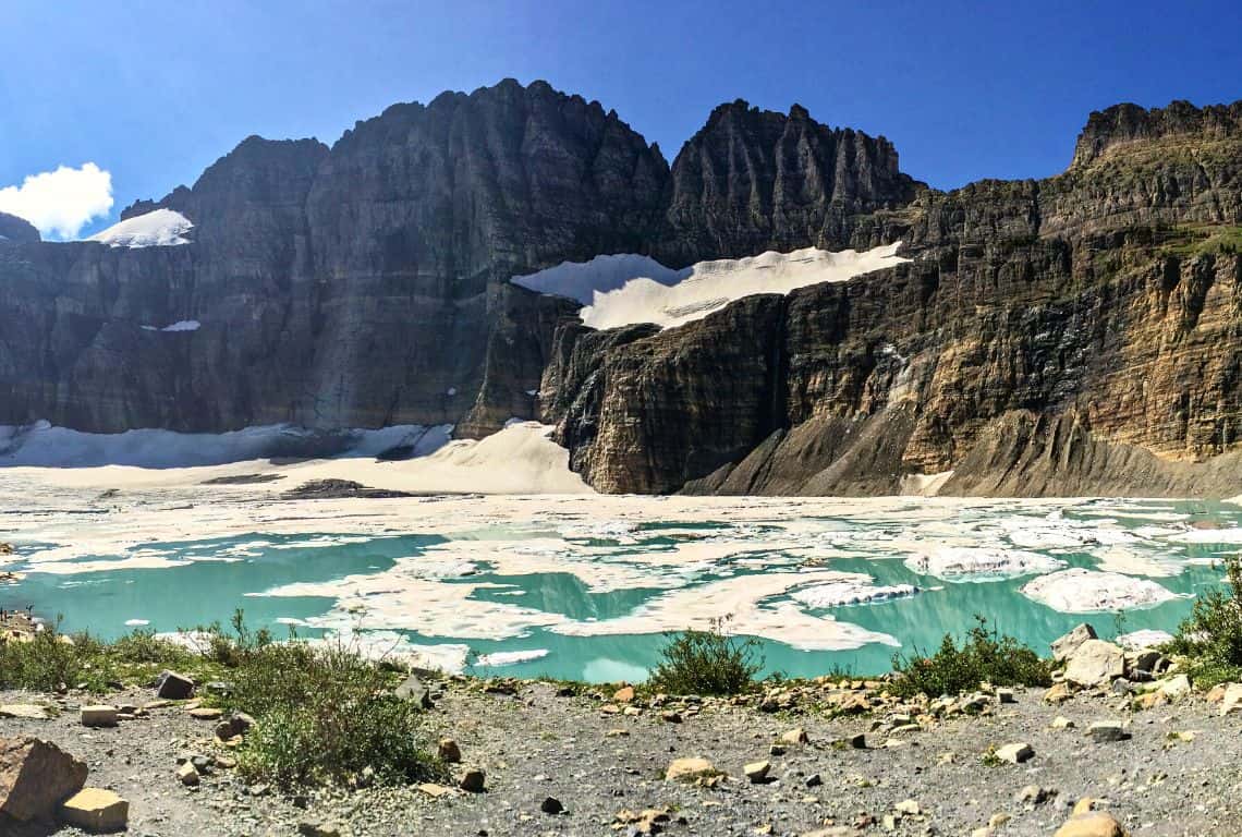
Grinnell Glacier Trail / Most Scenic Hikes in Glacier National Park
INTREPID’S PRO TIP: You can walk closer to Upper Grinnell Lake and get an even better view of the glacier. You will probably see people walking on the glacier. If you are tempted to do so, use caution and do not venture far out. Just keep in mind that there might be some deep openings covered with snow that you might not be able to see.
Above all, the view is awesome and it is a great spot to take a break and relax for a bit before heading back.
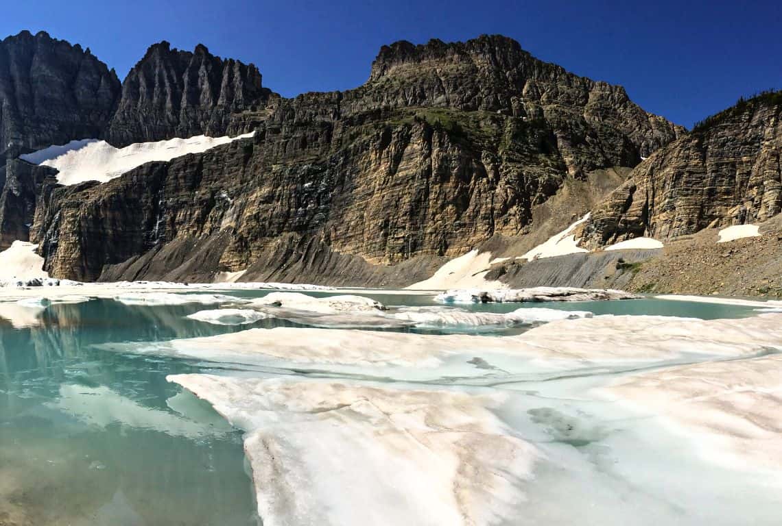
Grinnell Glacier Trail / Most Scenic Hikes in Glacier National Park
Cracker Lake Trail
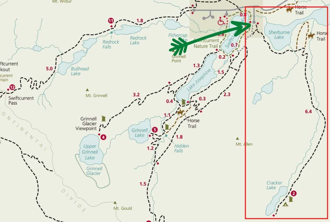
Cracker Lake Trail Map / Image Credit: NPS / Most Scenic Hikes in Glacier National Park
Cracker Lake Trail is just an awesome hike through breathtaking scenery that will take you to a gem of a lake! And, hopefully, you will find some solitude on this trail.
- Roundtrip Distance: 12.8 Miles
- Elevation Gain: 1,400 Feet
- Trailhead Location: Cracker Lake Trailhead (Many Glacier Valley Region of Glacier National Park)
- Time: 5-6 Hours
- Difficulty: Strenuous
Cracker Lake Trailhead is located at the south end of the parking lot above the Many Glacier Hotel.
Right from the start, you will get to enjoy awesome views of Lake Sherburne.
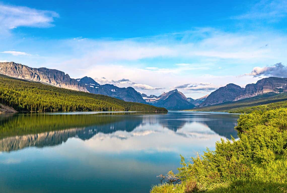
Cracker Lake Trail / Most Scenic Hikes in Glacier National Park
At 1.4 miles from the trailhead, you will get a footbridge across Allen Creek, and ahead of you will be a couple of switchbacks. On the right-hand side, you will have Allen Creek and on the left side will be Canyon Creek.
The next section of the trail is fairly long and goes through the forest. Eventually, the forest thins out and at 5.8 miles from the trailhead, you will be able to get the first glimpses of Cracker Lake. If you continue for no more than half a mile, the views of the lake are even better.
GOOD TO KNOW: You will be amazed by the color of the water. It is especially beautiful if it is a sunny day and the light is refracted through suspended glacial silt.
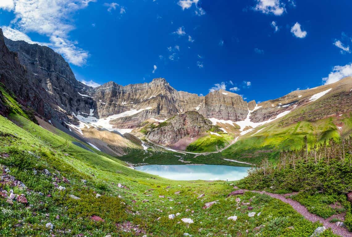
Cracker Lake Trail / Most Scenic Hikes in Glacier National Park
Next, the trail continues to the long abandoned Craker Lake Mine, and right after you will reach the lake.
Many side trails go down to the rocky shoreline. This is a perfect spot to take a break before heading back to where you started.
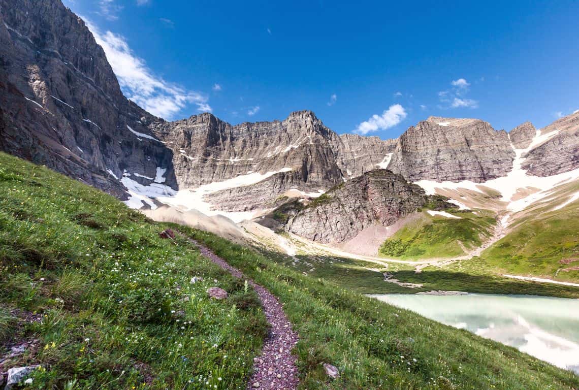
Cracker Lake Trail / Most Scenic Hikes in Glacier National Park
Iceberg Lake Trail
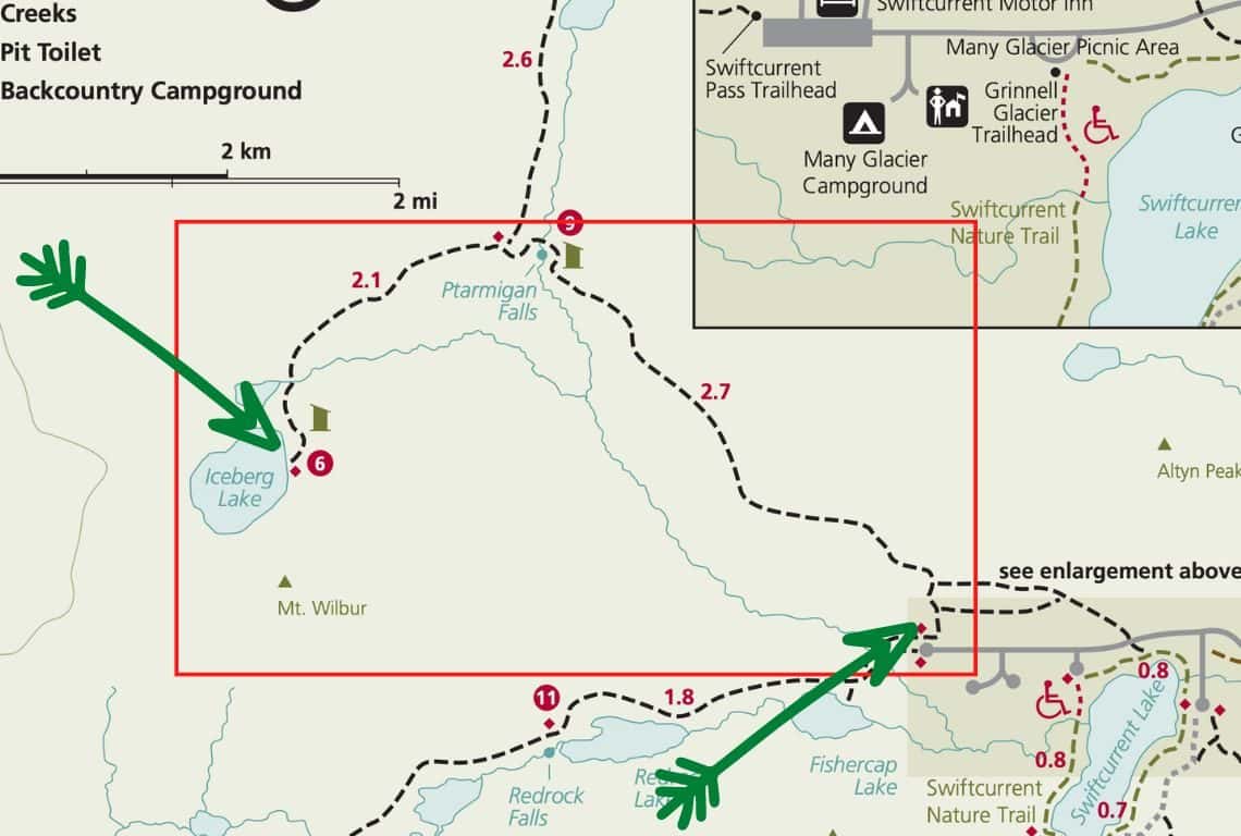
Iceberg Lake Trail Map / Image Credit: NPS / Most Scenic Hikes in Glacier National Park
Iceberg Lake Trail is another one of my favorite most scenic hikes in Glacier National Park. The scenery along the way is breathtaking and at the end of the hike, you will reach stunning Iceberg Lake.
Iceberg Lake sits at an elevation of 6,094 feet and it is surrounded by Mt. Wilbur to the south and Continental Divide to the west. Snow and ice linger here well into the summer months.
- Roundtrip Distance: 9.6 Miles
- Elevation Gain: 1,275 Feet
- Trailhead Location: Iceberg Lake Trailhead (Many Glacier Valley Region of Glacier National Park)
- Time: 5-6 Hours
- Difficulty: Strenuous
Iceberg Lake Trailhead is located behind the Swiftcurrent Motor Inn.
The first section of the hike goes along Ptarmigan Trail and it is at a fairly moderate ascend and goes on for about 2.5 miles.
The views of 8,851-foot Mount Grinnell, 8,436-foot Swiftcurrent Mountian, and. 9,321-foot Mount Wilbur are awesome!
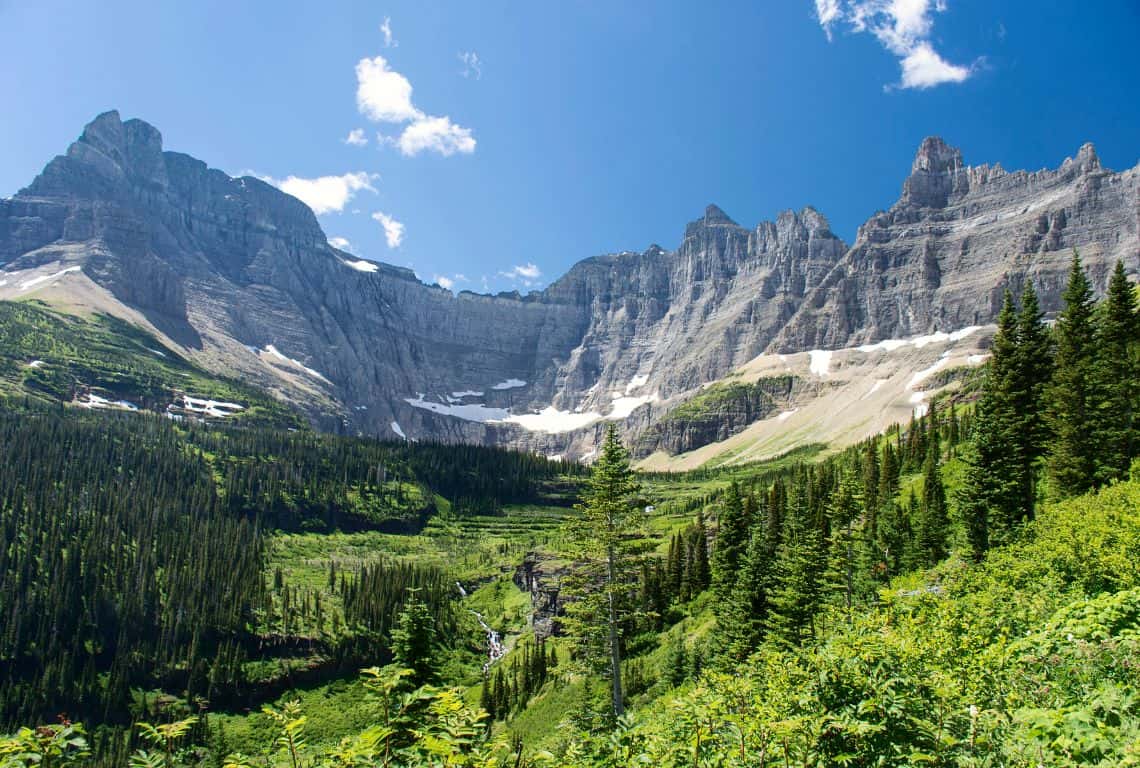
Iceberg Lake Trail / Most Scenic Hikes in Glacier National Park
At about 2.5 miles, you will reach Ptarmigan Falls and there will be a footbridge over Ptarmigan Creek.
At 2.7 miles from the trailhead, you will reach a junction with Iceberg Lake Trail. Follow the trail to Iceberg Lake. Pretty soon you will get good views of Iceberg Lake.
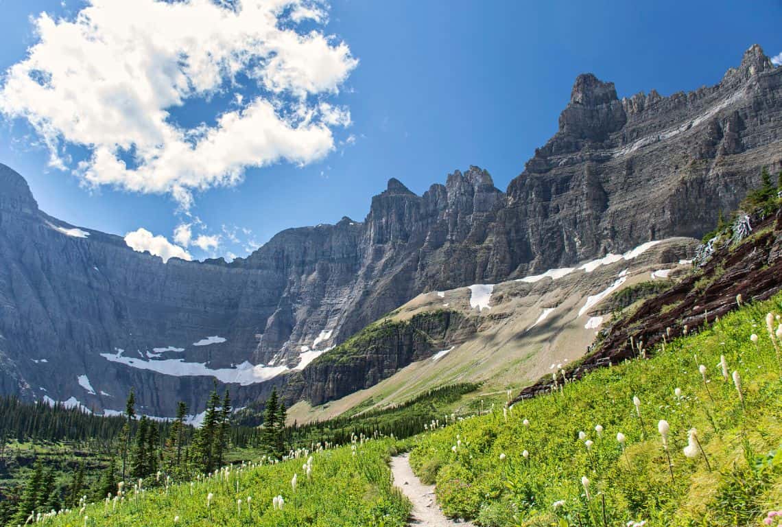
Iceberg Lake Trail / Most Scenic Hikes in Glacier National Park
At about 4.5 miles from the trailhead, there will be a footbridge over Iceberg Creek. Next, the trail meanders through some beautiful meadows, and after a sharp incline, you will get to the lake.
GOOD TO KNOW: There are a couple of side trails leading to the lake. Make sure to find a quiet spot and enjoy the view before heading back.
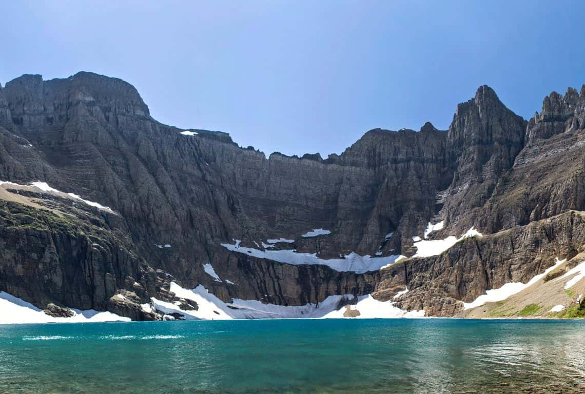
Iceberg Lake Trail / Most Scenic Hikes in Glacier National Park
Ptarmigan Tunnel Trail
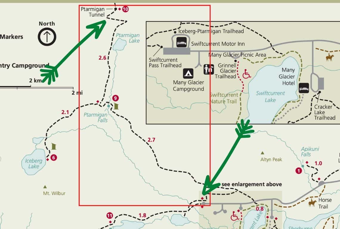
Ptarmigan Tunnel Trail Map / Image Credit: NPS / Most Scenic Hikes in Glacier National Park
Ptarmigan Tunnel Trail is hands down, one of the most scenic hikes in Glacier. The views along the way are to die for, however, the highlight of this hike is going through a 240-foot tunnel that runs through the Ptarmigan Wall. And, honestly, walking out of the tunnel on the other side of the Ptarmigan Wall is like stepping into another world.
- Roundtrip Distance: 10.6 Miles
- Elevation Gain: 2,300 Feet
- Trailhead Location: Iceberg Lake Trailhead (Many Glacier Valley Region of Glacier National Park)
- Time: 6-7 Hours
- Difficulty: Strenuous
The trailhead is located behind the Swiftcurrent Motor Inn.
The first section of the trail is a steady incline that goes on for about 2.5 miles. The views of 8,851-foot Mount Grinnell, 8,436-foot Swiftcurrent Mountian, and. 9,321-foot Mount Wilbur are awesome!
At about 2.5 miles, you will pass Ptarmigan Falls and then cross a footbridge. over Ptarmigan Creek. Shortly after, you will reach a junction with Iceberg Lake Trail. At the junction veer to the right and continue on Ptarmigan Tunnel Trail.
Ahead of you is a steady steep climb and a few switchbacks before you reach the tunnel. Enjoy the views of Ptarmigan Lake and the valley below with Mt. Wilbur towering over it all.
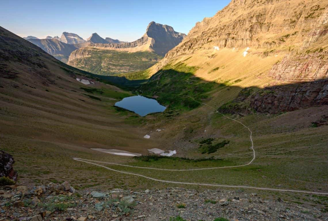
Ptarmigan Tunnel Trail / Most Scenic Hikes in Glacier National Park
Pretty soon you will see the entrance to the tunnel. It is visually stunning to see this small opening in a towering mountain.
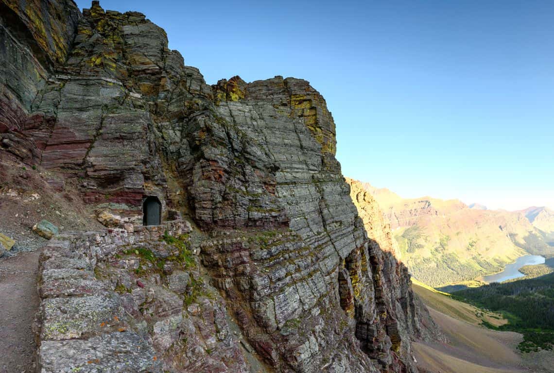
Ptarmigan Tunnel Trail / Most Scenic Hikes in Glacier National Park
Crossing the tunnel is like stepping into another world! In front of you will be Gable Mountain standing at 9,262 feet and below you will see the Belly River flowing into Elizabeth Lake.
If you continue for just a bit more, the views get even better. When you are ready to head back simply retrace your steps. Ahead of you is a long hike to where you started.
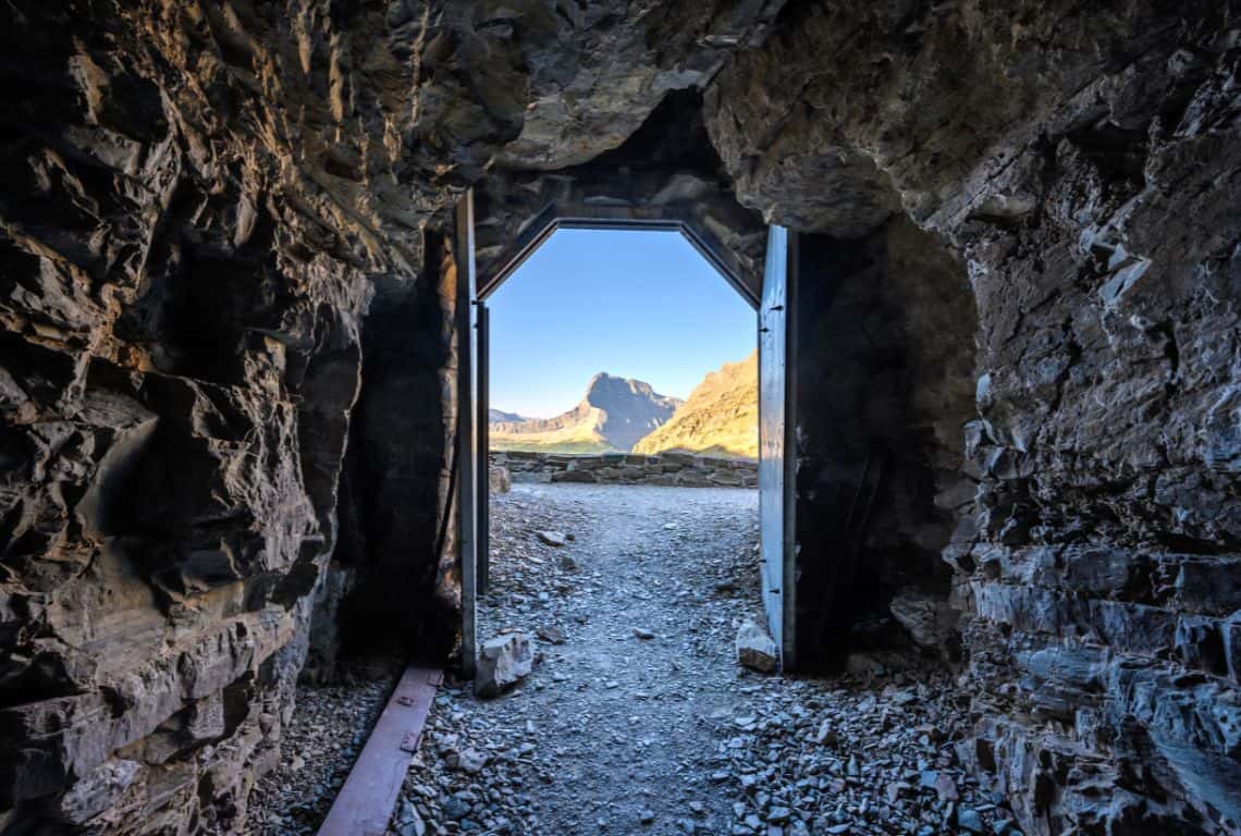
Ptarmigan Tunnel Trail / Most Scenic Hikes in Glacier National Park
Intrepid Scout's Tips for Most Scenic Hikes in Glacier National Park
Glacier National Park offers an abundance of breathtaking scenic hikes that will leave you awe-inspired. As you plan your next adventure, keep these essential tips in mind to make the most of your experience:
- Research and plan ahead: Familiarize yourself with the trail options, difficulty levels, and current trail conditions. Check the park’s website or visitor center for up-to-date information before embarking on your hike.
- Be prepared: Ensure you have the right gear and equipment for your hike, including sturdy hiking boots, layered clothing, a hat, sunscreen, insect repellent, and plenty of water. Carry a map, compass, and a first-aid kit, and inform someone about your hiking plans.
- Start early: Begin your hike early in the morning to avoid crowds and make the most of the daylight hours. Additionally, afternoon thunderstorms are common in the park, so starting early reduces the risk of being caught in inclement weather.
- Pace yourself: Take your time and hike at a pace that suits your fitness level. Many scenic hikes in Glacier National Park involve elevation gain, so be prepared for uphill sections and take breaks when needed. Listen to your body and don’t push yourself beyond your limits.
- Leave no Trace: Respect the park’s pristine environment by following the principles of Leave No Trace. Pack out all trash, stay on designated trails, and avoid disturbing wildlife or their habitats. Preserve the natural beauty for future generations to enjoy.
- Embrace safety precautions: Be aware of your surroundings, watch for wildlife, and keep a safe distance. Carry bear spray, know how to use it, and make noise while hiking to alert animals of your presence. Follow park guidelines for bear encounters and stay informed about potential hazards.
- Capture memories responsibly: Glacier National Park is a photographer’s paradise, but ensure you capture stunning moments responsibly. Respect trail closures, avoid stepping on fragile vegetation, and be mindful of other hikers while taking pictures.
I always get asked what my favorite hikes are in Glacier National Park. So, hands down, Grinnell Glacier Trail needs to be on your list. The views are great along the way, however, the highlight of this hike is reaching Grinnell Glacier. It is a long hike, but you can shorten it by taking two shuttle boats.
I think that the Ptarmigan Tunnel Trail is visually exceptional. Again, it is a long and strenuous hike, but the views of Ptarmigan Lake, the valley, and Mt. Wilbur are simply spectacular!
More Helpful Posts About Glacier National Park
9 Best Photography Locations in Glacier National Park (+Useful Photo Tips)
9 Essential GLACIER NATIONAL PARK TIPS for First-Time Visitors (Maximize Your Adventure)
8 Fun and EASY HIKES in GLACIER National Park (with Stunning Views)
18 Spectacular Stops on Going-to-the-Sun Road: Explore the Beauty of Glacier National Park
Did You Find This Useful?
Why Not Save Most Scenic Hikes in Glacier to Your Pinterest Board!
Now, It Is Your Turn, I Would Like to Hear Back from You!
Are you planning your trip to Glacier National Park?
Please let me know! Drop me a quick comment right below!
Click on any of the images below to get inspired and to help you with the planning process for your trip to Glacier National Park!
